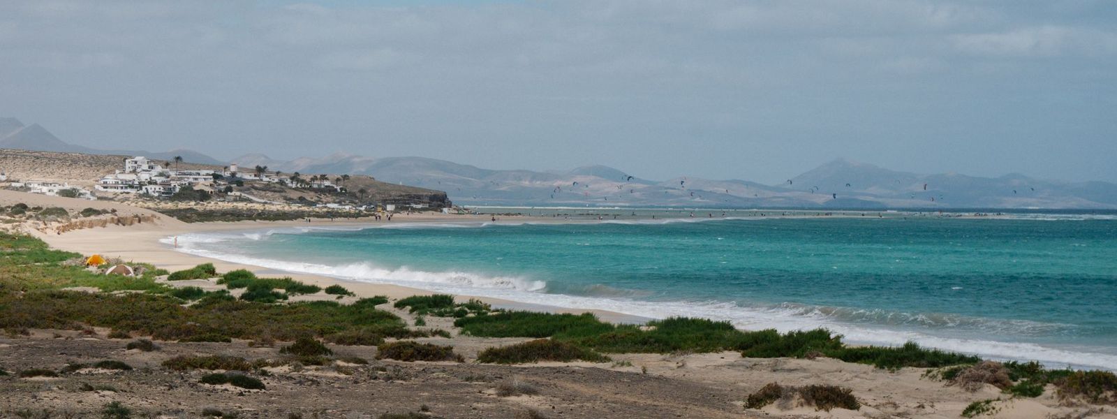
Brown volcanic hills, lava fields and open plains, and a coast of 152 beaches, about 50 km of them white sand. Fuerteventura is the oldest island in the Canaries and one of the windiest, which is why Corralejo, El Cotillo and Playas de Sotavento fill with surfers, windsurfers and kitesurfers. Most people come for the beaches and the water. The dunes east of Corralejo, the wild shore at Cofete and Betancuria, the first settlement, founded in 1404, fill out the trip. UNESCO declared the island a biosphere reserve in 2009.
Fuerteventura
- Currency
- Euro (EUR)
- Language
- Spanish; English, German in resorts
- Power plug
- Type C/F, 230 V
- Visa
- Schengen
- Time zone
- UTC+0 / UTC+1 (WET/WEST)
- Tap water
- Desalinated
- Tipping
- Not expected; 5–10% for great service
- Emergency
- 112
Things to do
All tours in Fuerteventura on GetYourGuide
Paid links: booking through them supports YowJourney.
When to go
High season
Nov – Mar
Winter highs around 22 °C bring the northern European crowd, Atlantic swells build on the north and west coasts, and most of the year's little rain falls now, December wettest.
Shoulder
Apr – Jun
Dry, warm weeks between the winter visitors and the summer holidays, with the trade winds setting in.
High season
Jul – Aug
Highs around 28 °C, steady trade winds for kiting and windsurfing, and Spanish families filling the resorts; the beaches have no shade at midday.
Shoulder
Sep – Oct
The summer crowd thins while the days stay hot, and the island's big fiestas fall now: the Virgen de la Peña in Betancuria in September, then Puerto del Rosario and Tuineje in early October.
How long to stay
Seven to ten days suits a beach holiday with a few day drives. The island is 100 km long, and the FV-1 and FV-2 run its length from Corralejo in the north to Morro Jable on the Jandía peninsula.
With four or five days, pick one end — the dunes and Lobos side around Corralejo, or the long beaches of Jandía in the south — and give one day to the interior and Betancuria.
Getting around
A hire car is the practical way to see the island, and the only easy way to its remote corners. Hire firms have desks at the airport. Two main roads run the length of Fuerteventura: the FV-1 from Corralejo to Puerto del Rosario, part dual carriageway and part single, and the FV-2 from Puerto del Rosario to Morro Jable, dual carriageway between La Lajita and Morro Jable.
Buses run from Puerto del Rosario, via the airport, to Corralejo, Caleta de Fuste, Morro Jable and El Cotillo, and the dune beaches south of Corralejo are easy to reach from town. Bike paths run alongside the main roads. The caveat: the buses link towns and resorts, so the empty beaches and the protected interior need a car or an organised tour.
Destinations in Fuerteventura
Frequently asked questions
Is Fuerteventura windy?
Yes, for most of the year. The summer trade winds and the winter Atlantic swells make it a surfing and windsurfing island year-round. Windsurfing centres on Corralejo and Playas de Sotavento, where the International Windsurfing and Kiteboarding Championship has run since 1985. On the beach, expect blown sand on windy days.Is it safe to swim at Fuerteventura's beaches?
It depends on the coast. Western beaches, such as those around El Cotillo, take strong surf: on the north and west shores, never turn your back on the sea. The calmer water is on the sheltered south-east sands of Playas de Sotavento, between Costa Calma and Morro Jable, and in the calm lagoon beaches just north of El Cotillo.How do you get to Fuerteventura?
Most people fly into Fuerteventura Airport at El Matorral, 5 km south-west of Puerto del Rosario. Ferries also link the island with its neighbours: Corralejo with Playa Blanca on Lanzarote, about 30 minutes across; Gran Tarajal and Puerto del Rosario with Gran Canaria; and Morro Jable with Gran Canaria and Tenerife.What is the calima?
A dust-laden wind off the Sahara. It turns the sky hazy, coats everything in fine red dust and can push temperatures up by around 10 °C while it lasts. Visibility can fall to 100–200 m or lower, so drive with care while it blows.