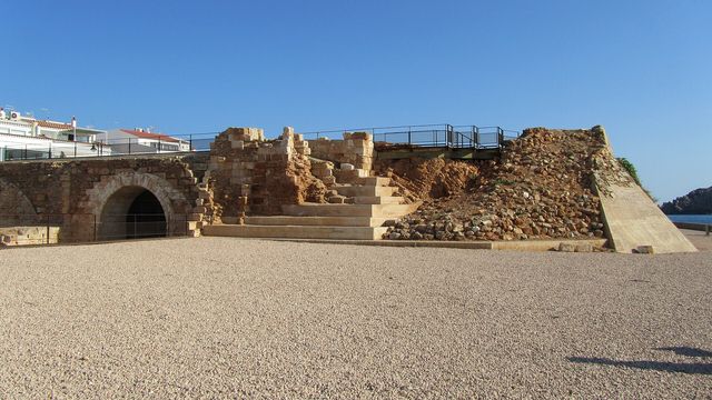
Santa Àgueda Castle stands on an elongated plateau 264 m above sea level in the municipality of Ferreries, the third-highest point on Menorca after Monte Toro and S'Enclusa. Arabs built it over a Roman fort some time before 1232, when the island belonged to the Caliphate of Córdoba. In 1287 it was the last stronghold of Menorca's Arab inhabitants against Alfonso III of Aragon, and Peter IV of Aragon destroyed it around 1343. The Island Council of Menorca bought the ruins from private owners in 2007.
Santa Águeda
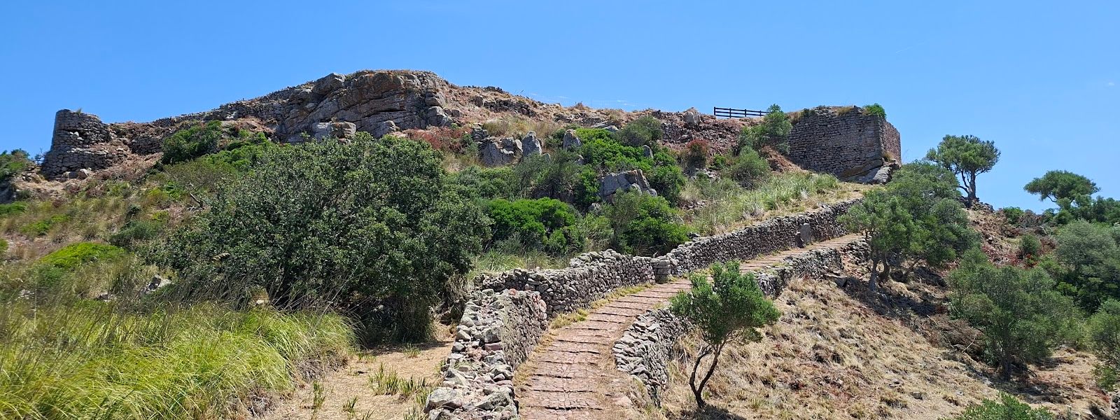
Ruined Moorish castle on Menorca's third-highest hilltop, reached on foot by an old cobbled Roman road.
- Entrance
- Free; there is no ticket.
- Accessibility
- No step-free access: the castle is reached only on foot, up an old cobbled path.
- Parking
- No car park at the start of the path. The nearest public car park is free and about 3 km in a straight line from the castle.
- Difficulty
- Uphill walk of up to 1.5 km on an old cobbled Roman road; hot in summer, with no water nearby.
- Transport
- Nearest bus stop: Ferreries, about 4.7 km in a straight line from the castle.
- Advance booking
- No booking needed; the site is an open ruin.
- Hours
- Open at any time.
- Address
- Camí Santa Àgueda, 07750 Ferreries, Illes Balears, Spain
What makes it special
The view from the top runs all the way round, and to the north it reaches the coast. Getting there is part of it: the way up follows an ancient Roman road, still cobbled, climbing to a long plateau 264 m above sea level, the third-highest ground on Menorca behind Monte Toro and S'Enclusa.
The castle on top is a ruin. Its story carries more weight than its walls. In 1287 Menorca's Arab inhabitants made their last stand here against Alfonso III of Aragon, whose conquest the island marks every 17 January as its National Day. On that same date in 2007 the Island Council of Menorca announced it had bought the castle from its private owners.
Good to know
- There are no toilets and no drinking water at the castle or nearby. Carry water, and more of it in summer.
- The path is old cobbles, uneven underfoot and slippery when wet, so wear shoes with grip.
- There is no car park at the start of the path, so plan for extra walking from wherever you leave the car.
- The castle is an open ruin with no information point nearby. The walk and the view are the reward.
Getting there
There is no car park at the start of the path. The nearest public car park is about 3 km in a straight line from the castle, and the nearest bus stop, in Ferreries, is about 4.7 km away in a straight line. Either way, the day includes a stretch of walking before the climb begins.
The last part is the old Roman road, still cobbled, which climbs for up to 1.5 km to the plateau. The ruins stand at the top, and the view opens out as you reach them.
Best time to visit
Best: winter and spring, on a clear day.
Avoid: summer, especially the middle of the day.
The climb is hot work in summer with no water nearby, and the view in every direction is the reason to go up, so it needs a clear sky.
Sun & daylight
Nearby Places


Similar Places

Santa Águeda on the map
The castle walls are ruined and loose stone lies among them; keep off the masonry and watch your footing. In summer the climb is hot with no water nearby, so carry your own.
Get directions
Your whole travel map in one place
Get inspired by new places around the world and find the ones worth the journey
Frequently asked questions
How long is the walk up to Santa Àgueda Castle?
The path climbs for up to 1.5 km on an old cobbled Roman road to the plateau where the ruins stand.Can I park at the start of the path?
No. There is no car park at the start of the path; the nearest public car park is about 3 km in a straight line from the castle.Are there toilets or drinking water?
No, neither at the castle nor nearby. Bring all the water you need.What is left of the castle?
Ruins. Peter IV of Aragon destroyed the castle around 1343. A chapel dedicated to Saint Agatha stood beside it until recently.Why does Santa Àgueda matter in Menorca's history?
In 1287 it was the last place where Menorca's Arab inhabitants held out against Alfonso III of Aragon, whose conquest the island marks on 17 January as its National Day.