Boca do Risco is a mountain pass at 360 metres in the municipality of Machico, on the north-east coast of Madeira, Portugal. It is reached on foot from the villages below, and it marks the point where the ground gives way to sea cliffs facing the open Atlantic. Two walking routes leave the pass for Porto da Cruz, one along the coast and one over the mountain. Access is open at any hour, and nothing is built here beyond a guidepost.
Boca do Risco
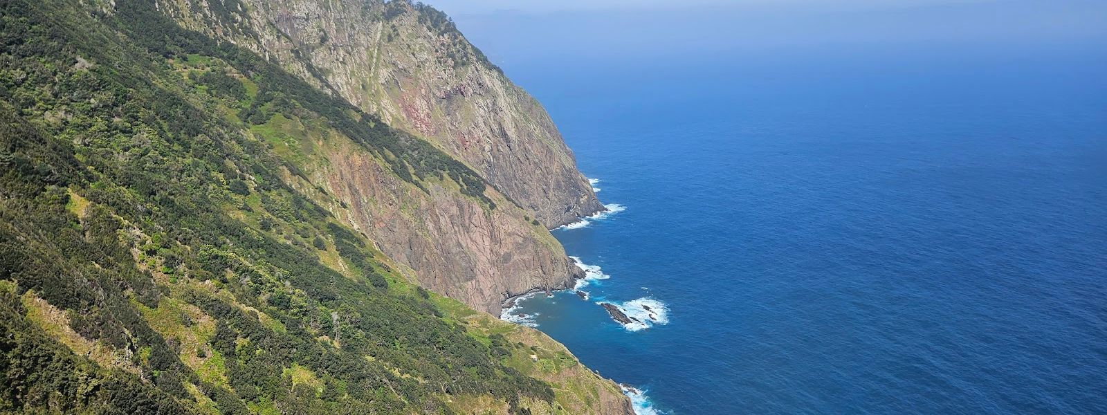
Two trails leave this 360-metre pass for Porto da Cruz — coastal or over the top.
- Entrance
- Free. No ticket and no gate.
- Accessibility
- Not accessible: no wheelchair-accessible entrance or parking, and the pass is reached only by a steep climb on foot.
- Parking
- Free street parking in the village below. The nearest marked car park is about 1.6 km from the pass; nothing to park on was found at the top of the approach road.
- Difficulty
- An hour uphill from the village to the coast at a fit pace, then a cliff path; the final climb to the pass is steep, overgrown and under loose rock.
- Transport
- Nearest bus stop about 1.5 km from the pass.
- Advance booking
- Not needed — no booking, no registration.
- Hours
- Open at any hour, every day.
What makes it special
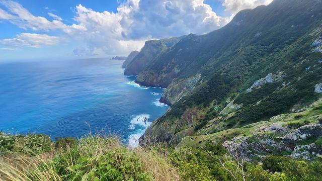
The ridge opens and the ground goes over the edge. From the pass at 360 metres the coastline runs away in cliffs with the Atlantic working at the foot of them, and the walking is what people come here for. Two trails leave for Porto da Cruz — one hugging the coast, one over the mountain — and the coastal side hands out viewpoints with nobody standing on them. One visitor recommended staying for the sunset. Do not push all the way to the highest point of the climb: vegetation closes the view up there, and the drop reads better from a little lower down.
Good to know
- No facilities: there are no toilets and no drinking water anywhere near the pass, so carry what you plan to drink.
- Cover your arms and legs: the climb up to the pass pushes through vegetation that scratches and cuts.
- Nothing is explained on site: a guidepost stands at the pass, but no information boards were found — walkers work the routes out from a trail app.
- The ground keeps climbing past the pass: one party turned back when the right-hand trail got steeper than they wanted.
Getting there
Everyone arrives at the pass on foot. Drivers stop in the village below and start walking there: the last street towards the trailhead is narrow and steep, and one driver gave up on it rather than take the car up, having seen nothing to park on higher. The way in follows the road uphill until it meets the coast — an hour of climbing at a fit pace — and the cliff path carries on to the pass from there. The approach from the Porto da Cruz side is the gentle one, with the coast in view along the way.
Best time to visit
Best: afternoon, and on to sunset if you can wait.
Avoid: setting off with the whole traverse in mind unless the day is long — beyond the pass the ground keeps climbing, and one party gained only 150 metres of height in an hour on the right-hand trail before turning back.
The afternoon walk comes out quiet, with viewpoints empty of people; stay for the sunset and the descent is in the dark, so carry a torch.
Sun & daylight
Nearby Places
Similar Places

Boca do Risco on the map
Falling rocks. A walker who found the trail otherwise easy still warned about rock coming down, and the ground above the path is loose in places. The route runs along the top of sea cliffs, and the climb to the pass is its steepest and most overgrown stretch — keep off the outer edge and do not stop directly under a slope.
Get directions
Your whole travel map in one place
Get inspired by new places around the world and find the ones worth the journey
Frequently asked questions
Is Boca do Risco a marked PR trail?
No. It sits outside Madeira's numbered PR network, which is why nothing has to be booked or registered before you walk it.How long does the walk take?
About an hour from the village up to where the road meets the coast at a fit pace, then the cliff path on to the pass. One party who walked out along the right-hand trail and returned finished with 15 km and three and a half hours behind them.Which trail should you take from the pass?
Two lead to Porto da Cruz: one follows the coast, the other crosses the mountain. The routes off to the left of the pass are graded very difficult, so most walkers turn right.Is it busy?
It stays quiet next to the roadside viewpoints elsewhere on the island. One visitor found the afternoon walk empty of people and had the first viewpoints to themselves.