El Asomadero Viewpoint is an observation point in Los Realejos, on Tenerife in the Canary Islands. It stands at about 1,100 m on the PR-TF 41, the trail that climbs from Socorro beach (Playa del Socorro) on the coast to the summit of Teide, and paths also reach it from Realejo Alto, the La Corona viewpoint (Mirador de La Corona) and the Chanajiga recreation area. It is known for its view over the coast of the Orotava Valley and, on clear days, of Teide.
El Asomadero Viewpoint
Local name: Mirador El Asomadero

Trailside lookout at about 1,100 m above the Orotava Valley, with views down to the coast and up to Teide.
- Entrance
- Free; an open viewpoint with no ticket.
- Accessibility
- No wheelchair-accessible parking or entrance. The approach paths are steep, with uneven steps on the way down to Realejo Alto.
- Parking
- A parking area beside the viewpoint. A free car park lies about 2.1 km away in a straight line. Walkers park near the church in Realejo Alto or at the Chanajiga recreation area.
- Difficulty
- Depends on the route: about 700 m of steep ascent from Realejo Alto; a steep, rough 1.6 to 2 km from La Corona, or a longer, easier track; an easy 4.2 km from Chanajiga. Clay stretches are slippery when damp.
- Transport
- Nearest bus stop: La Madre Juana, about 860 m away in a straight line.
- Advance booking
- Not needed.
- Hours
- Open at all times.
- Address
- 38415 Los Realejos, Santa Cruz de Tenerife, Spain
What makes it special
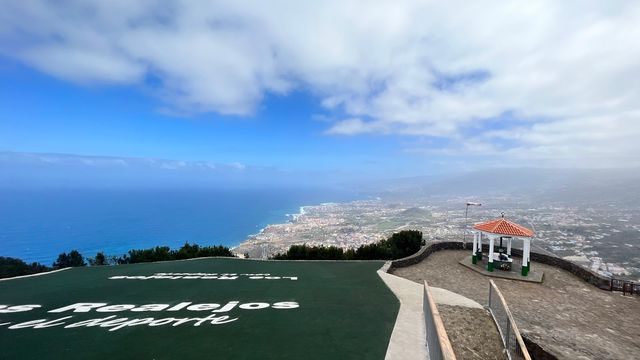
The whole coast of the Orotava Valley lies spread below the viewpoint, and on a clear day Teide rises behind it, often white with snow in winter.
The walk up is half the reason to come. The PR-TF 41 runs from sea level at Socorro beach to the summit of Teide and is billed as the longest ascent in Spain. On the way to El Asomadero it passes the El Lance viewpoint (Mirador de El Lance) and the La Corona viewpoint, where paragliders take off, and it gains height fast enough that you feel the air and the vegetation change within a few kilometres. The way down to Realejo Alto runs through laurel forest and tree-heath woodland.
The hum of traffic from the valley still carries up here. It is a reminder of how close the coast stays, even this high.
Good to know
- The paths up from Realejo Alto and La Corona are steep and demand real fitness. The longer trail from the Chanajiga recreation area is the easy one.
- Long stretches of path are compact clay that turns slippery in damp air. Wear hiking boots with a good grip.
- There are no toilets and no drinking water at the viewpoint or nearby. Carry what you need.
- Fog can settle over the slope and hide the view completely.
- The descent to Realejo Alto is steep, with uneven steps that are hard on the knees. Leave time to take it slowly.
Getting there
There is a parking area beside the viewpoint, but most people come up on foot, and three trails lead here.
From Realejo Alto. Park near the church and climb. The signpost at the viewpoint puts Realejo Alto at 3.5 km, and the path gains about 700 m on the way. It is the hardest way up.
From the La Corona viewpoint. A steep path in poor condition climbs 1.6 to 2 km. The track is longer and winds more, and it is much easier going.
From the Chanajiga recreation area. Park at the recreation area, follow the trail along the hillside to Pino Llorón, then drop down to the viewpoint. The signpost gives 4.2 km. It is the longest approach and the easiest.
Walking the PR-TF 41 from Socorro beach, you pass El Lance and La Corona before the final climb.
Best time to visit
Best: a clear, dry day, starting early.
Avoid: foggy days and the days after rain.
Cloud tends to build on Tenerife's north slopes as the day goes on and can hide both the coast and Teide, while wet clay makes the steep paths slippery.
Sun & daylight
Nearby Places
Similar Places


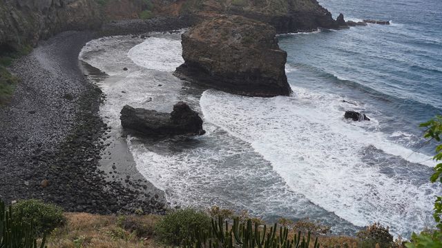
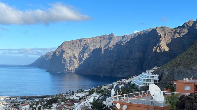
El Asomadero Viewpoint on the map
The steep clay paths turn slippery in damp weather and fog, and the descent to Realejo Alto has uneven steps. Wear boots with a good grip and take the downhill slowly.
Get directions

Your whole travel map in one place
Get inspired by new places around the world and find the ones worth the journey
Frequently asked questions
How do you walk to El Asomadero Viewpoint?
Three trails lead here: a steep climb from Realejo Alto, a steep path or a longer track from the La Corona viewpoint, and a longer, easy trail from the Chanajiga recreation area. The PR-TF 41 from Socorro beach also passes through.Which is the easiest route?
The trail from the Chanajiga recreation area. It runs along the hillside to Pino Llorón and then drops to the viewpoint, 4.2 km by the signpost.How hard is the climb from Realejo Alto?
It is the hardest approach: about 700 m of ascent, with the signpost at the top giving 3.5 km. Coming down the same way, the steep, uneven steps are tough on the knees.Are there toilets or water at the viewpoint?
No. There are no toilets and no drinking water at the viewpoint or nearby, so bring water with you.How high is El Asomadero Viewpoint?
About 1,100 m above sea level, looking down over the Orotava Valley to the coast.