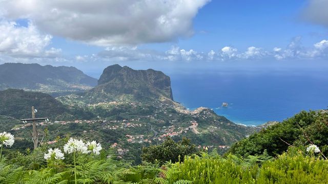
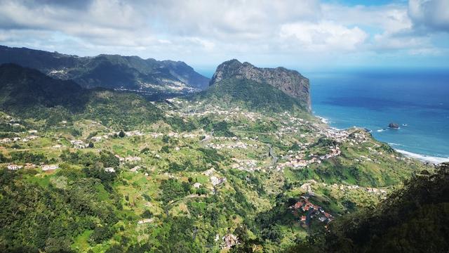
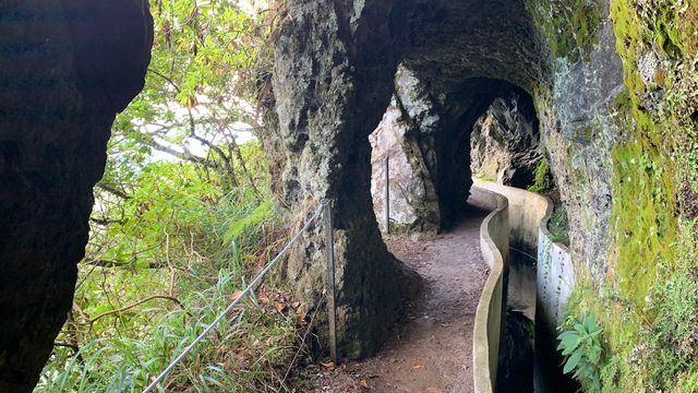
Levada do Castelejo is a levada, one of the island's irrigation channels, in Machico on Madeira, within the parish of Porto da Cruz, and it is recorded as cultural heritage. The path beside the channel is flat and makes an easy walk of 8 to 10 km there and back, through green forest and past houses, with a huge rock across the way and a suspended bridge further on. The trail is not classified, so no fee or booking applies.
Levada do Castelejo
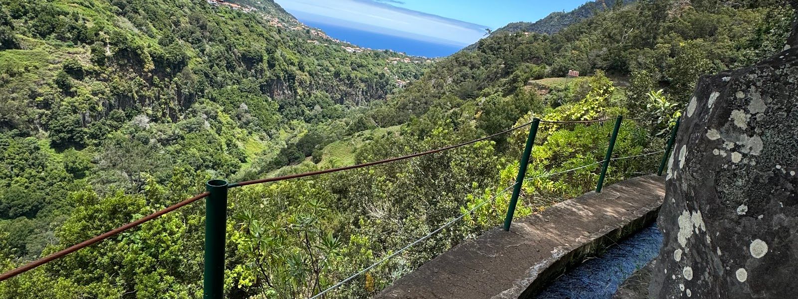
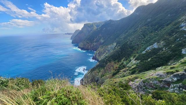
Flat levada in Machico, Madeira, running through greenery and past houses with flowers to a suspended bridge.
Levada do Castelejo on the map
- Entrance
- Free: the IFCN trail fee covers only classified trails, and this one is not classified.
- Walking time
- Two hours to half a day, there and back.
- Difficulty
- Easy. Flat path along the channel, with a huge rock to walk around and a suspended bridge to cross.
- Parking
- Parking at the access point beyond the Google Maps pin. Of two car parks about 1.4 km away, one is free but marked permit-only.
- Transport
- Two public transport stops, about 45 m and 61 m away in a straight line.
- Accessibility
- Flat and open to most walkers, but no wheelchair-accessible entrance or parking, and a rock on the path to get around.
- Advance booking
- No booking: the trail is outside the IFCN booking system and does not appear on the SIMplifica Portal.
What makes it special
A huge rock cuts straight across the levada, and the way on is simply around it. Further along, a suspended bridge crosses to the other side, where a small table waits for whatever snacks you carried in.
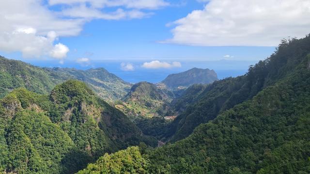
The rest is quiet. The going stays flat, which leaves your attention free for the birdsong and the jungle-thick green on either hand. Here and there the path passes houses with flowers and a table of fruit for sale, and the views open up along the way. It is one of the lesser-known levadas on Madeira, and an easy one.
The route
At the start, you join the levada at the access point with parking, which lies further ahead than the Google Maps pin.
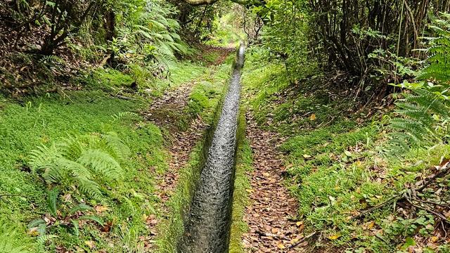
Along the channel the path runs flat through the greenery, passing houses here and there, some with a table of fruit for sale.
At the huge rock that cuts the levada, go around it and carry on along the channel until the suspended bridge.
At the bridge, cross to the other side, where there is a small table for a snack.
In its last part the walk goes through a village where you can stop for a drink. There is no loop: the way back to the start is the way you came.
Good to know
- Start: The Google Maps pin is in the wrong place. Begin there and the outing runs to 18 km; from the access point with parking it is 8 to 10 km.
- Water and toilets: None nearby, so fill up and plan ahead before you come.
- Food: Carry your own snacks for the table past the bridge, and some coins for the fruit tables beside the houses.
- Status: The trail is unclassified, so IFCN, Madeira's forest and nature conservation institute, neither recommends it nor takes responsibility for it.
Getting there
Most of the work is finding the right start. The Google Maps pin is in the wrong place: follow the line of the levada on the map, and the access point with parking comes further ahead. Start from the pin and the outing runs to 18 km; from the access point it is 8 to 10 km there and back.
Parking at the access point comes without much trouble. The walk ends where it began, so there is no return transfer to arrange.
Best time to visit
Best: a dry morning, when the birds in the greenery are at their loudest.
Avoid: the hours after heavy rain.
Rain leaves rock and soil slick beside an open channel, and sure footing is what keeps a flat levada easy.
Things to do nearby
All tours in Machico on GetYourGuide
Paid links: booking through them supports YowJourney.
Sun & daylight
Along the route
Similar Places

Levada do Castelejo on the map
The path follows an open water channel along a hillside, and its outer edge is not fenced everywhere. Watch your footing where the ground is wet, above all on the way around the huge rock that blocks the levada.
Get directions
Your whole travel map in one place
Get inspired by new places around the world and find the ones worth the journey
Frequently asked questions
Where does the Levada do Castelejo walk start?
Further ahead than the Google Maps pin. Follow the line of the levada on the map to the access point with parking.How long is the walk?
From the access point it is 8 to 10 km there and back, and takes two hours to half a day. Starting from the Google Maps pin stretches it to 18 km.Is it hard?
No. The path is flat and easy, and the main obstacle is a huge rock you walk around. It suits almost everybody, though there is no wheelchair-accessible entrance or parking.Do I need to pay or book?
No. The trail is not classified, so the IFCN fee and booking system do not cover it, and it does not appear on the SIMplifica Portal.Can I buy food or drink on the way?
Fruit is sold from tables beside some of the houses, and you can get a drink in the village on the last part of the walk. Bring your own snacks for the table past the bridge.