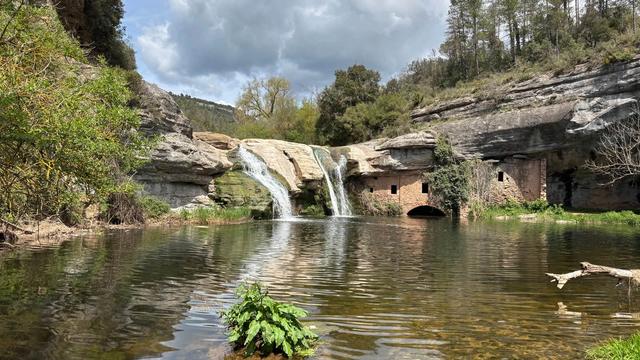
Water falls spectacularly among rocks into a crystal-clear turquoise pool. The cascade lies in the Ter river gorge, surrounded by forest and stone. Most visitors start from the Sadernes car park and follow the marked trail towards Sant Aniol d'Aguja. The walk is long — about 16 kilometres round trip — but straightforward. Water flow drops significantly in drought seasons. The area is clean and well-maintained by volunteers.
Brull Waterfall
Local name: Salt del Brull
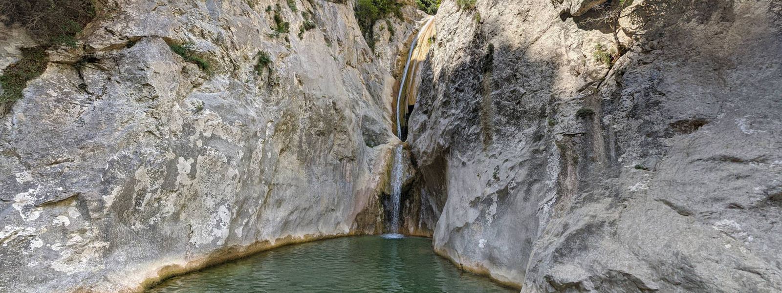
Turquoise pool cradled between high rock walls.
- Parking
- Parking available at Sadernes, the trailhead for this hike.
- Difficulty
- The main trail from Sadernes to Sant Aniol is easy and well-marked (about 4 hours). The final section to Brull is often unmarked, requiring navigation over rocky terrain with possible water crossings. Total distance is roughly 16 kilometres. Elevation gain is moderate. Not suitable for very young children; experienced walkers manage comfortably.
What makes it special
The waterfall cascades through a narrow gorge between tall rock faces, forming a deep pool where the water runs bright turquoise. The surrounding forest is dense and largely untouched, with stone shelters and volunteer-run buildings marking the trek. The route passes through woodland the entire way, rarely climbing above the valley floor.
Good to know
- Water flow can be very low in July and August. The cascade may be reduced to a trickle in drought years.
- The trail is easy to walk, but you climb and descend over uneven stone. Sections near Gorg Blau lack clear waymarks; here you may need to pick your way over rocks in the stream bed.
- From Sadernes car park to the falls is a full day commitment. The round trip is roughly 16 kilometres; allow 5–6 hours with breaks.
- Volunteers maintain a shelter near the chapel, and locals appreciate visitors who help carry supplies uphill if you pass by. This is voluntary but valued.
Getting there
Drive to the Sadernes car park and walk uphill on the marked trail towards Sant Aniol d'Aguja (about 4 hours). From Sant Aniol, the final 15–20 minutes to Brull is a trail through woodland, sometimes unmarked; you may need to pick your way over rocks in the stream bed or step through shallow water.
Sun & daylight
Nearby Places
Similar Places
Featured in our guides

Your whole travel map in one place
Get inspired by new places around the world and find the ones worth the journey
Frequently asked questions
How long does the hike take?
From Sadernes car park to Brull Waterfall and back is roughly 16 kilometres, taking 5–6 hours with breaks. The final 15–20 minutes from Sant Aniol d'Aguja is the steepest section.Is the trail easy?
The main route from Sadernes is well-marked and easy to follow. However, the final section towards Brull lacks clear waymarks and requires picking through rocks and possible water crossings.How much water is in the waterfall?
Water flow is high in winter and spring. In July and August, especially during drought, the cascade may reduce to a thin stream or trickle.Can small children go?
The long distance (16 km) and unmarked final section make this unsuitable for very young children. Children aged 8–10 and up may manage with strong adult support and plenty of breaks.