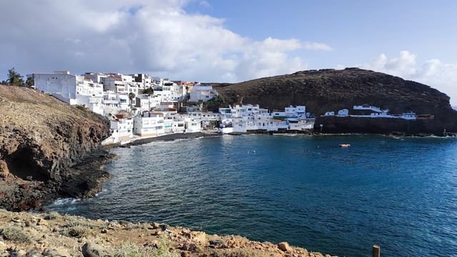
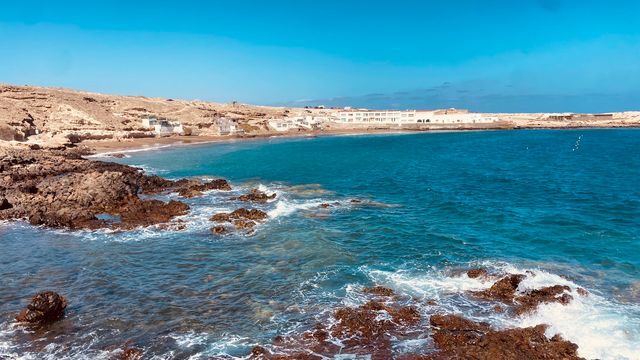
El Risco Beach is a black-sand and shingle beach in the municipality of Agaete, on the west coast of Gran Canaria in the Canary Islands. It fills an undeveloped, rocky bay below the hamlet of El Risco, with a headland at one end. There are no facilities. The beach is known for heavy Atlantic surf, a tide that covers much of the sand at high water, and sunsets over the sea.
El Risco Beach
Local name: Playa del Risco
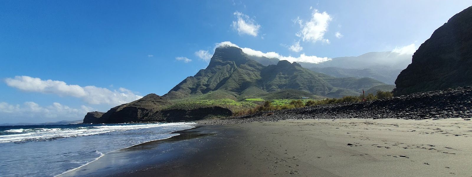
Wild black-sand and shingle beach on Gran Canaria's west coast, reached by an unpaved track and a walk.
- Entrance
- Free; it is a public beach with no ticket.
- Accessibility
- No step-free access and unsuitable for wheelchairs: an unpaved track, a walk on foot, and a rocky shore of black sand and shingle.
- Parking
- Two mapped parking areas, about 100 m and about 1.1 km away in a straight line, reached by an unpaved track.
- Difficulty
- A rough unpaved access track, then a walk of about ten minutes to a rocky beach of sand and shingle.
- Transport
- Bus stop Ceip El Risco, about 800 m away in a straight line.
- Advance booking
- No booking needed.
- Hours
- Open at any time.
- Address
- Playa del Risco, 35489, Spain
What makes it special
At low tide the black sand comes out from under the water and the waves run in across it in long white lines. El Risco Beach is a wild bay of dark sand and rounded stones with nothing built on it, and the only sound is the surf working the shingle.
Stay into the evening. The sun goes down behind the headland, and the wet sand holds the last of the light. The rough track and the walk at the end keep it a place you have to want to reach.
Good to know
- The access track is unpaved and has been washed out with no warning signs. A car without high clearance struggles; be ready to park early and walk.
- Come at low tide. At high water the sea covers most of the sand and leaves the stones.
- There are no toilets and no drinking water at the beach or nearby. Bring what you need.
- The red flag is usually up and the waves run big. Treat it as a beach for walking and watching the sea.
Getting there
The approach ends on an unpaved track down towards the bay. It is hard going for an ordinary car, and it has been washed out before with no warning signs, so drive slowly and turn back if the surface looks broken. At some point the car stays behind and you walk; the beach is about ten minutes on foot from there.
There is one mapped parking area about 100 m away in a straight line and another about 1.1 km away. The nearest bus stop, Ceip El Risco, is about 800 m away in a straight line.
Best time to visit
Best: at low tide, towards sunset. Avoid: high tide and days of big swell.
Low water uncovers the black sand and makes the sea easier to reach, and in the evening the sun sets behind the headland, while at high tide little sand is left and the waves break straight onto the stones.
Sun & daylight
Nearby Places


Similar Places
El Risco Beach on the map
Big waves break on this open shore and the red flag is usually flying. Stay out of the water when it is up, and never turn your back on the sea at the waterline.
Get directions

Your whole travel map in one place
Get inspired by new places around the world and find the ones worth the journey
Frequently asked questions
Can you swim at El Risco Beach?
Rarely. The waves run big and the red flag is usually up. At low tide the water is easier to reach, but stay out whenever the flag is flying.Can you drive all the way to El Risco Beach?
No. The access track is unpaved, hard on a car without high clearance, and has been washed out with no warning signs. The last stretch is on foot, about ten minutes.Is El Risco Beach sand or stones?
Both: black sand and shingle in a rocky bay. How much sand there is depends on the tide, and low water uncovers far more of it.Are there toilets or drinking water?
No. There are no toilets and no drinking water at the beach or nearby, so bring your own.Can you get to El Risco Beach by bus?
The nearest bus stop is Ceip El Risco, about 800 m away in a straight line; the rest is on foot.