Rebecos Bridge is a pedestrian suspension bridge that spans a narrow section of the Cares River gorge in Picos de Europa National Park. The bridge is part of the Cares Route, a famous hiking trail that connects Asturias and León. Built in the early 20th century as part of the infrastructure for maintaining a hydroelectric canal, the bridge and its surrounding path were carved into the rock face by workers suspended from ropes—an extraordinary engineering feat for its time. The bridge takes its name from the rebeco, or chamois, the agile mountain animals that inhabit the high peaks of the Cantabrian range. The structure offers hikers dramatic views of vertical canyon walls and the rushing river far below.
Rebecos Bridge
Local name: Puente de Los Rebecos
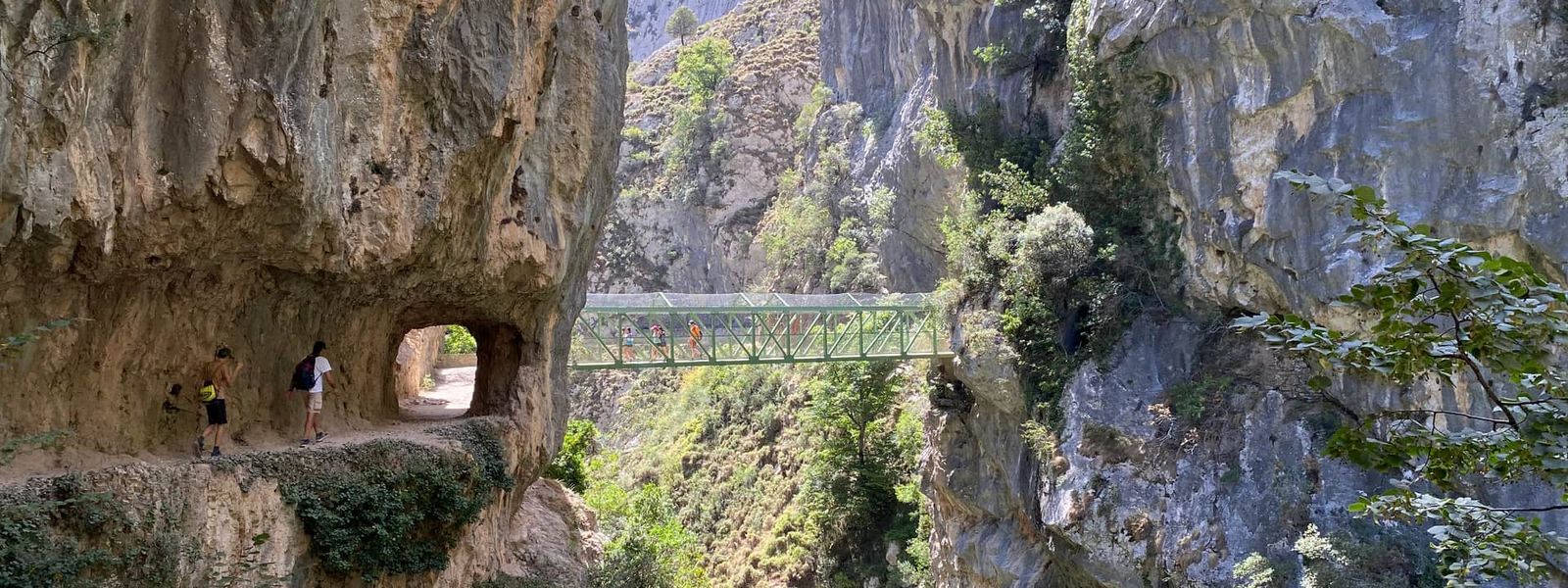
Built in the 1920s by workers suspended from ropes over a 300-metre void.
- Difficulty
- Moderate to challenging. Significant elevation gain from Poncebos, with exposed sections alongside the canyon. The paths are wide but narrow in places. Decent fitness is required for the full route.
- Hours
- Open 24 hours.
What makes it special
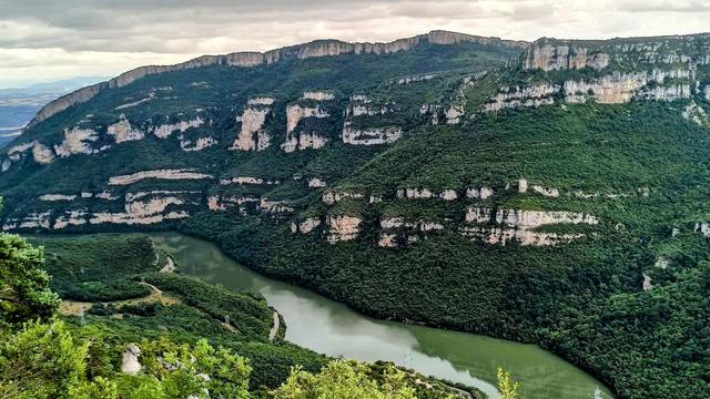
What makes this bridge memorable is the combination of engineering and landscape. Built in the 1920s, the structure and path represent a remarkable feat: workers hammered it into the rock face while suspended from ropes over a rushing void. The bridge's name honours the rebeco, mountain animals that leap across these vertical cliffs with ease—a reminder that the walkway humans use was carved into terrain that belonged first to them. The views are severe: vertical rock walls rising hundreds of metres, the river far below, and a sense of being inside the mountain rather than merely crossing it.
Good to know
- Not suitable for those with fear of heights or claustrophobia. The bridge is suspended high above the river, and some path sections are narrow with sheer drops.
- Significant elevation gain from the start. Decent physical fitness is required; the full Cares Route is not a leisurely walk.
- Start early to avoid midday heat. Water sources are available roughly every 3 km along the route.
- Paths are wide and well-maintained overall, but there are no toilets along this section.
Getting there
The bridge is accessed on foot via the Cares Route, a well-trodden path that follows the river gorge. The full route runs between Poncebos (in Asturias) and Caín (in León), and the bridge crosses one of the narrowest sections of the canyon. Most visitors approach from one end and either turn back at the bridge or continue to the other terminus. The path is wide in most places, though exposure is constant.
Best time to visit
Best: Early morning, from sunrise to mid-morning. The bridge and gorge are less crowded then, and you avoid the midday heat that can make the exposed sections uncomfortable.
Avoid: Midday and early afternoon. The sun hits the exposed sections of the path directly, and afternoon heat can make the elevation gain feel more taxing than it needs to be.
Sun & daylight
Nearby Places
Similar Places

Your whole travel map in one place
Get inspired by new places around the world and find the ones worth the journey
Frequently asked questions
How long is the full Cares Route?
The full route between Poncebos and Caín covers approximately 12 km and takes 4–5 hours depending on fitness. Many visitors hike only the first few kilometres to the bridge and back.Can you bring dogs?
Yes, dogs can walk the route. Bring water and food for them, and consider starting early to avoid overheating on exposed sections.Why is the bridge named Rebecos?
Rebecos are chamois, agile mountain animals native to the Cantabrian peaks. Workers named the bridge in honour of these animals, whose ease across the vertical cliffs contrasts with the difficulty humans face crossing the same terrain.Is this suitable for someone new to hiking?
The bridge itself is walkable by most people comfortable with heights, but the full route requires decent fitness due to significant elevation gain. Many visitors walk only the first section to the bridge and back, which is more manageable.