Levada da Ribeira da Janela is a there-and-back walk on the island of Madeira, near Porto Moniz, following an irrigation channel from Lamaçeiros to Origem. It is known for its tunnels, one of them about 1.5 km long with waterfalls inside, and for its views over green valleys. The path is mostly flat, but landslides have damaged it further in. It is not one of Madeira's classified trails.
Levada da Ribeira da Janela
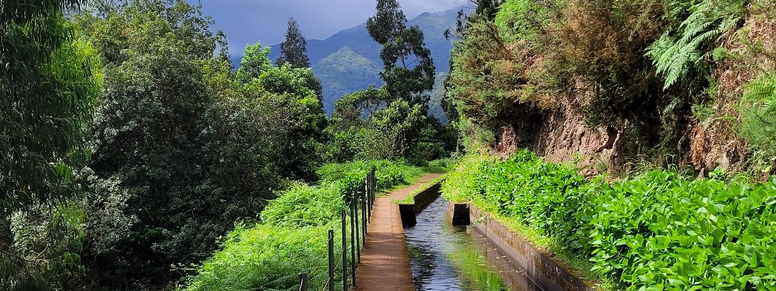
Levada walk near Porto Moniz through dark tunnels, one about 1.5 km long with waterfalls inside.
Levada da Ribeira da Janela on the map
- Route length
- 13.1 km · one way
- Entrance
- Free: the trail is outside Madeira's fee and booking system.
- Walking time
- 3–4 hours there and back, turning at the third tunnel or just before the fourth, about 7 km in.
- Difficulty
- Moderate. Mostly flat, with dark tunnels, slippery ground, rolling stones and landslide damage further in.
- Parking
- Free asphalt car park, with free street parking as well.
- Transport
- Nearest stops are about 1 km and 1.2 km away in a straight line.
- Accessibility
- No wheelchair access; the path is wet and muddy, with dark tunnels and landslide damage further in.
- Advance booking
- None needed: the trail is outside Madeira's booking system.
What makes it special
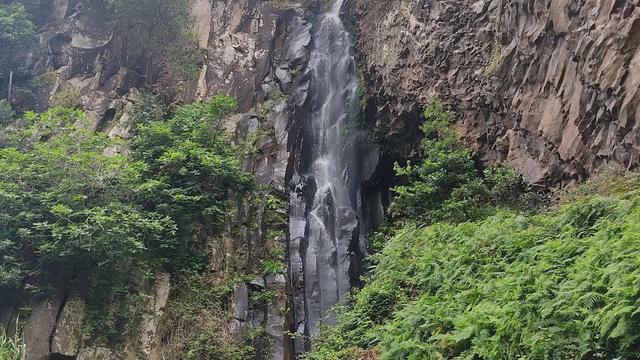
Waterfalls come down inside the tunnels on this levada. The first tunnel has one, and one of the tunnels runs for about 1.5 km with water falling through it, so a walker without a jacket comes out soaked. Between them the path opens onto lush green valleys and rock faces, and it stays quiet.
After the last tunnel, a house stands to the right of the path, and you can leave your name and the date on the wall inside.
The path is mostly flat, which makes the first stretch easy going. Deeper in, the effort moves to your footing: past the first tunnel the landslides begin, and how far you get depends on the ground that day.
The route
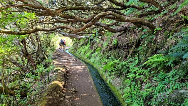
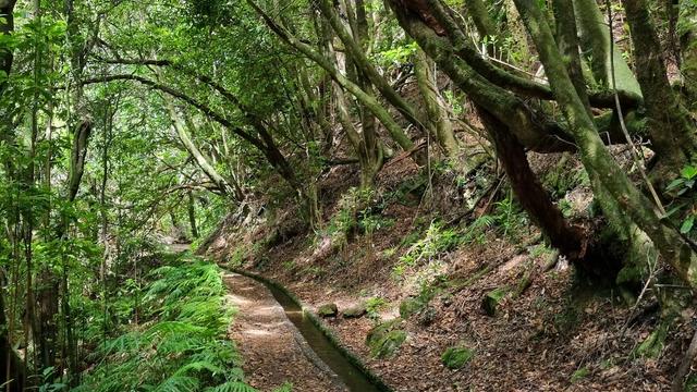
From Lamaçeiros the path runs mostly flat beside the levada, with green valleys alongside, as far as the first tunnel and its waterfall. Turning back here skips the worst of the ground.
Past the first tunnel the path deteriorates and landslides cut across it. After the third tunnel the ground can become too dangerous to continue, and around 7 km in, just before the fourth tunnel, a single night of rain can be enough to stop you.
Beyond the last tunnel a house stands on your right. Shortly after it, about 10 km in, a dirt path on the left drops to the river and climbs back to the line on the far side; it is very steep. The main path around the mountain crosses a dam with waterfalls, then ends where a landslide has destroyed it.
The far end of the line is Origem. The walk is there and back, so you return the way you came from wherever you turn.
Good to know
- Torch: carry one, because the tunnels are dark enough to need it.
- Clothing: water falls inside the long tunnel, so pack a waterproof jacket. Your shoes will get wet and dirty regardless.
- Turning back: landslides and a very steep river detour lie on the way to the far end, so choose a turning point before you set out.
- Facilities: toilets and a water point are under 100 m from the car park. The picnic spots are poorly kept.
Getting there
The walk starts at Lamaçeiros, near Porto Moniz, and you can drive there: an asphalt car park serves it, with street parking as well.
Two stops lie about 1 km and 1.2 km away in a straight line, so coming by public transport leaves a walk at both ends of the day, and the distance on the ground will be longer than those figures.
The line is walked there and back, so you finish where you parked.
Best time to visit
Best: after a couple of dry days in a row, starting early. The tunnels further in have a better chance of being passable then, and an early start keeps you ahead of other walkers.
Avoid: rain and the day after it. The path turns very slippery, stones roll down, and one night of rain can be enough to stop you before the fourth tunnel. Keep out of the tunnels in flood season, and expect fog to take the view when it closes in.
Access & restrictions
Levada da Ribeira da Janela is not a classified trail, so Madeira's fee and booking system does not cover it. The same status means IFCN, which runs that system, cannot recommend the walk or take responsibility for it.
Where a sign on the line tells you not to go further, turn back: landslides have damaged the path further in.
Things to do nearby
All tours in Porto Moniz on GetYourGuide
Paid links: booking through them supports YowJourney.
Sun & daylight
Along the route


Similar Places

Levada da Ribeira da Janela on the map
Past the first tunnel, landslides have broken the path and stones roll down onto it, more so in rain, and the levada edge is unfenced in places. Turn back when the ground ahead looks unsafe, and do not enter a tunnel that is flooding.
Get directions
Your whole travel map in one place
Get inspired by new places around the world and find the ones worth the journey
Frequently asked questions
Can you walk the whole levada?
The ground decides. The third tunnel, or the approach to the fourth around 7 km in, can be too dangerous to pass. Beyond the tunnels, the main path past the dam is destroyed by a landslide, and the only way on is a very steep dirt path down to the river and up the other side, about 10 km in.Is it suitable for beginners?
As far as the first tunnel, yes: the path is easy and mostly flat. Past it, landslides and rolling stones make it a different walk, and rain makes the ground very slippery.Do I need a torch?
Yes. The tunnels are dark enough to need one, and one of them runs for about 1.5 km.Will I get wet?
Yes. Water falls inside the long tunnel, so wear a waterproof jacket. Your shoes will get wet and dirty too.How long does it take?
Three to four hours there and back, turning at the third tunnel or just before the fourth, about 7 km in. Going further along the line takes longer.