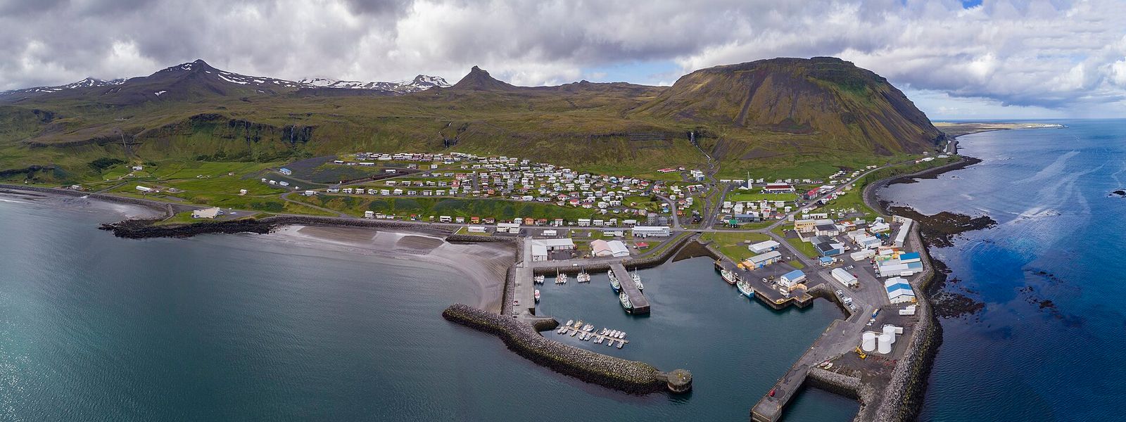
Ólafsvík stands on the north coast of the Snæfellsnes Peninsula, on Route 54 between Grundarfjörður and Hellissandur. Around 970 people live here. The town was certified as a trading place by the Danish king in 1687 and became one of the larger trading ports in Iceland; fishing and commerce still carry the economy. Snæfellsjökull is 10 km away, and the area around the town offers hiking trails, birdwatching and long sandy beaches.
Ólafsvík
- Currency
- Icelandic króna (ISK), written kr. Cards work almost everywhere, including taxis, petrol stations, souvenir stands and remote guesthouses, so large amounts of cash are unnecessary. Exchange rates are better inside Iceland, and banks in Reykjavík give the best of them.
- Language
- Icelandic. English is widely spoken, and apart from the elderly and young children almost everyone is fluent.
- Power plug
- Europlug and Schuko sockets, 230 V
- Visa
- Schengen area, with no immigration checks on arrivals from other Schengen countries. Iceland is outside the EU, so every traveller, including those from EU countries, goes through customs on entry.
- Time zone
- UTC±00:00 (Atlantic/Reykjavik)
- Tap water
- Safe everywhere and among the cleanest in the world. Hot tap water smells of sulphur because geothermal energy heats it; it is still safe to drink.
- Tipping
- Not practised. An attempt to tip can occasionally be taken as an insult, so praise the service instead. Tip jars by the till are generally ignored.
- Emergency
- 112
When to go
High season
Jun – Aug
At almost 65 degrees north the nights barely darken. Hiking trails and the sandy beaches are open, and this is the stretch when snowmobile tours on Snæfellsjökull run.
Shoulder
Sep – Oct
Daylight shortens fast after the equinox and visitor numbers fall away. Clear nights bring the aurora back to this latitude.
Low season
Nov – Mar
Days are short and the road up to Snæfellsjökull is shut. Route 54 along the coast is the link to the rest of the peninsula.
Shoulder
Apr – May
Daylight returns quickly and the coast road is quiet before the summer traffic. The glacier road is closed for much of the year, so do not count on it in spring.
How long to stay
One night covers the town itself. Two make sense if you are working through Snæfellsbær: Rif, Hellissandur, Arnarstapi and Hellnar are all a short drive away, and a snowmobile trip on Snæfellsjökull takes most of a day. As the administrative centre of the municipality, Ólafsvík carries the shops and services the smaller villages do not, which makes it a workable base for the north side of the peninsula.
Getting around
Route 54 runs along the north coast and through the town, with Grundarfjörður to the east and Hellissandur to the west. A car is the practical way in, and the practical way to move between the villages of Snæfellsbær: Rif, Hellissandur, Arnarstapi and Hellnar. Ólafsvík itself has under a thousand inhabitants and is crossed on foot in minutes. Snæfellsjökull lies 10 km away and snowmobile tours run on the glacier. The road up to it is closed for much of the year, so check its status before driving that way.
Destinations in Ólafsvík
Frequently asked questions
Where is Ólafsvík?
On the north coast of the Snæfellsnes Peninsula in western Iceland, on Route 54 between Grundarfjörður and Hellissandur. At 23 degrees 42 minutes West it is the westernmost settlement of its size in Europe.How far is Snæfellsjökull glacier?
About 10 km. Snowmobiling on the glacier is run from the area, but the road up is closed for much of the year.Is Ólafsvík a good base for the peninsula?
It is the administrative centre of Snæfellsbær, the municipality that also covers Arnarstapi, Hellnar, Rif and Hellissandur, so it holds more services than the villages around it.What is there to do?
Birdwatching, hiking trails, long sandy beaches and snowmobiling on Snæfellsjökull.What is the tall mast west of the town?
The Gufuskálar radio mast at Hellissandur. At 412 metres it is the tallest structure in Western Europe.