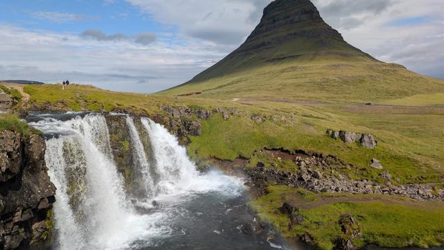
Grundarfjörður is a town of about 860 people on the north coast of the Snæfellsnes peninsula in western Iceland, set between a mountain range and the sea. Mount Kirkjufell lies just west of the town and forms a small peninsula. The Kirkjufellsfoss and Grundarfoss waterfalls are close by. The harbour is one of the ten largest quota-fishery harbours in the country and lands the biggest demersal catch in West Iceland. The town won the right to trade in 1786 and grew wealthy on fishing.
Grundarfjörður

- Currency
- Icelandic króna (ISK)
- Language
- Icelandic; nearly all speak English
- Power plug
- Europlug and Schuko sockets, 230 V
- Visa
- Schengen; outside the EU
- Time zone
- UTC±00:00 (Atlantic/Reykjavik)
- Tap water
- Safe; hot water smells of sulphur
- Tipping
- Not customary
- Emergency
- 112
Things to do
All tours in Grundarfjörður on GetYourGuide
Paid links: booking through them supports YowJourney.
When to go
High season
Jun – Aug
The sun barely sets at this latitude. Kirkjufell and the mountain range behind the town stay lit late into the night.
Shoulder
Sep – Oct
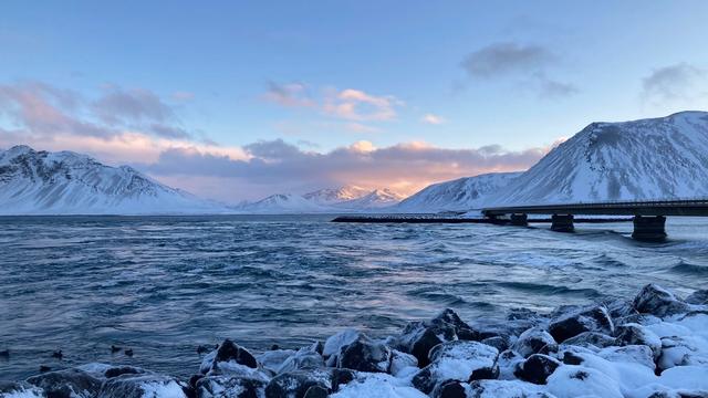
Daylight shortens fast and the first snow settles on the mountain range behind the town.
Low season
Nov – Mar
Only a few hours of daylight, and the coast road takes the brunt of the weather between the mountains and the sea. On clear nights the aurora is visible.
Shoulder
Apr – May
Snow leaves the lowland and holds on the tops. Days lengthen quickly and the waterfalls run full with meltwater.
How long to stay
Half a day covers the town itself — the harbour, the Saga Center, the church and the sculpture scattered through the streets. One night is the usual choice, with Grundarfjörður used as a base for the north side of Snæfellsnes and for Kirkjufell, Kirkjufellsfoss and Grundarfoss. Give it two nights in winter, when short daylight cuts what fits into a day.
Getting around
A car is the practical way in and out. The town sits on the road that runs along the north coast of Snæfellsnes, and that road carries on east to Stykkishólmur across the Berserkjahraun lava field. Mount Kirkjufell and Kirkjufellsfoss are west of the town on the same road. Grundarfjörður itself is small, a few streets between the mountains and the water, so the harbour, the church and the outdoor sculpture are all within walking distance. One caveat: the road hugs the coast between the mountain range and the sea, and there is no inland alternative on this side of the peninsula.
What to see



Destinations in Grundarfjörður
Frequently asked questions
What is Grundarfjörður known for?
Mount Kirkjufell, which lies just west of the town and forms a small peninsula, and the Kirkjufellsfoss and Grundarfoss waterfalls. It is also a serious fishing port: the harbour is one of the ten largest quota-fishery harbours in Iceland and lands the biggest demersal catch in West Iceland.Can orcas be seen here?
Snæfellsnes is the only part of Iceland where orcas are seen regularly, because of the large herring population in the region. The Orca Statue in the town marks this.What is there to do in bad weather?
The Saga Center Grundarfjörður documents the history of the town and shows photographs by Bæring Cecilsson. The church to the south, built in 1966, holds one of the 500 original lithographs of the Guðbrandsbiblía, the first book printed in Iceland.Why does the town have a Breton connection?
Sailors from Paimpol in Brittany came to fish cod off Iceland between 1852 and 1935, and merchants from Paimpol traded at Grundarkampur, west of the town. The Paimpol Cross stands there in memory of the Breton sailors who drowned. The two towns have been twinned since 2004. Around 1800 French merchants also lived here and built a church and a hospital of their own.What is the lava field on the road to Stykkishólmur?
Berserkjahraun. The name comes from the Eyrbyggja saga: two berserkers were killed here by their master because one of them had fallen in love with his master's daughter.