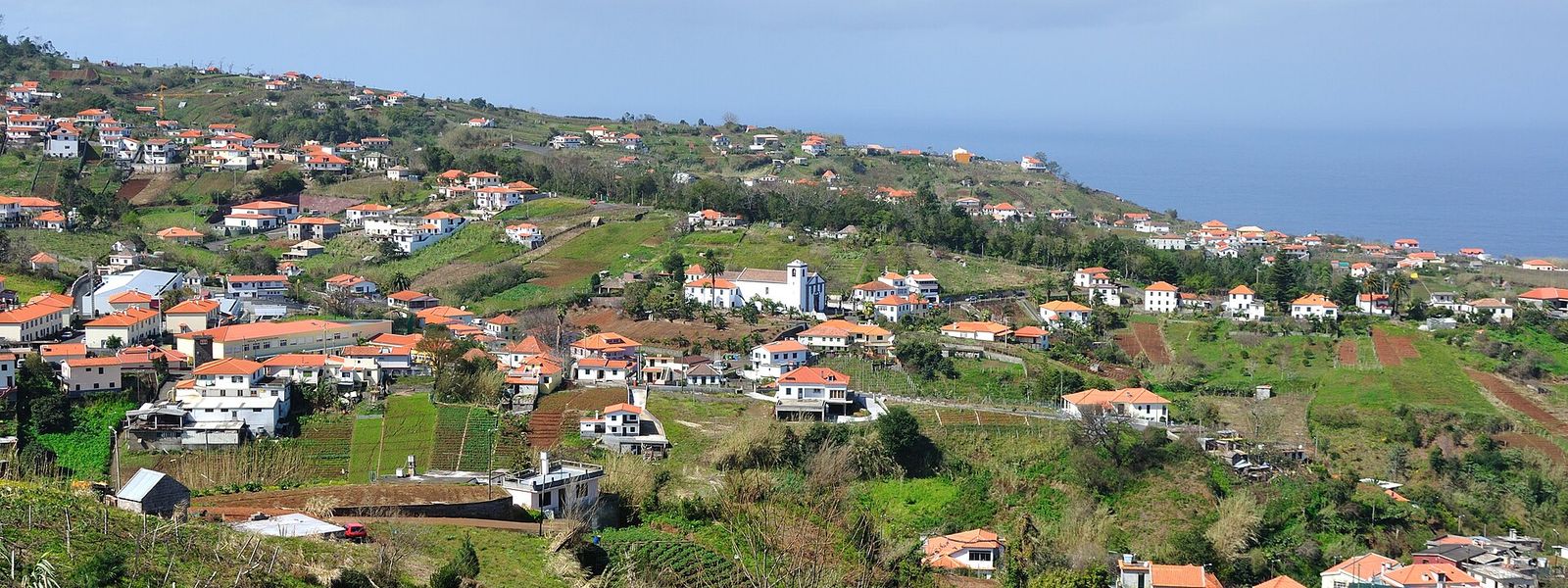
São Jorge is a civil parish on the north coast of Madeira, in the municipality of Santana, 50 kilometres from the regional capital. It sits 240 metres above sea level between the Atlantic and the interior mountain range, where Pico Canário reaches 1,592 metres. Created in 1515 under the patronage of King Manuel I, it is spread across dozens of named sítios rather than gathered into one centre. Its Baroque parish church was completed in 1761, and roughly half of the 19.34 square kilometres is Laurissilva, the laurel forest listed by UNESCO.
São Jorge
- Currency
- Euro, in place of the escudo since 2002. Multibanco and ATM Express cash machines take international cards almost everywhere and mostly charge nothing of their own, while the Euronet machines clustered in tourist streets take high fees and give poor rates. VAT is already inside every price in shops and restaurants: 23% standard on the mainland, 22% in Madeira and 18% in the Azores.
- Language
- Portuguese, spoken here with a heavy accent even by mainland standards. English gets you about as far as it does on the mainland, and an attempt at a few Portuguese words is always taken well.
- Power plug
- Type C / F, 230 V, 50 Hz
- Visa
- Schengen: entry and short-stay limits follow the common Schengen rules.
- Time zone
- UTC+0 (UTC+1 in summer)
- Tap water
- Safe to drink across the country. Bottled spring water (água mineral) is sold everywhere for those who prefer it.
- Tipping
- Not expected, appreciated for good service. Around 8–10% in a restaurant if the service was exemplary, and it is perfectly acceptable to leave nothing if it was not. No tip for a coffee or a cake; €1–2 if you eat a full meal in a café. Nothing in pubs and bars. In a taxi, round the fare up and add €1–2.
- Emergency
- 112
When to go
High season
Jun – Sep
The clearest stretch on this coast, though the north side of the island still collects cloud on days when the south is open; the laurel forest above the parish stays damp through it.
Shoulder
Oct – Nov
Autumn brings the greenest slopes and the heaviest run-off in the ravines; cloud settles on the ridge above the sítios and clears through the day.
Low season
Dec – Mar
Winter is the wet season on Madeira's north coast, with Atlantic swell breaking below the parish and rain on the high ground; the peaks inland, Pico Canário at 1,592 metres among them, can sit under cloud for days.
Shoulder
Apr – May
Rain eases and the light lengthens; the terraces below the road are at their greenest before the summer traffic reaches this side of the island.
How long to stay
Two hours covers what most people come for: the parish church, a chapel or two and the drop from the road to the north coast, taken on a drive along this side of Madeira. Give it a full day, or a night on this coast, if the Laurissilva is the point — roughly half the parish is laurel forest, and basing yourself here saves the 50-kilometre run back over the mountains to Funchal twice in a day.
Getting around
A car does the work here. São Jorge is not a single street but a scatter of sítios — Achada do Pico, Fajã Alta, Ribeira Funda, Pé do Pico and a dozen more — spread across the slopes between the Atlantic and the interior range, and the roads that link them climb and turn the whole way. The parish sits 240 metres above sea level, with Arco de São Jorge to the west and Ilha and Santana to the east. Funchal, the regional capital, is 50 kilometres off, on the far side of the island's mountain spine, so a day trip from there gives up a good part of itself to driving.
What to see


Destinations in São Jorge
Frequently asked questions
Where is São Jorge?
On the north coast of Madeira, in the municipality of Santana, 50 kilometres from the regional capital. The parish lies 240 metres above sea level, bounded by the Atlantic to the north and the interior mountain range to the south, with Arco de São Jorge to the west and the parishes of Ilha and Santana to the east.What is there to see in the parish?
The Church of São Jorge (Igreja de São Jorge), completed in 1761, is Baroque, with a presbytery of gilded wood and an ornate pulpit. The Chapel of São Pedro (Capela de São Pedro) dates to the end of the 15th century, and the Chapel of the Sacred Heart of Jesus (Capela do Sagrado Coração de Jesus), at Ribeira Funda, was completed in 2000.How old is São Jorge?
The parish was created in 1515 and held the patronage of King Manuel I of Portugal, who donated religious pieces and artefacts to the first church; the record survives in the archives of the Torre do Tombo. The first settlers took the area of Sítio do Calhau. Territory was pared away over the centuries: Santana became a parish in 1564 and municipal seat after 1835, Arco de São Jorge split off in 1676 and Ilha in 1989.Is there laurel forest here?
About half the parish is covered by Laurissilva, the laurel forest recognised by UNESCO as Natural Heritage. It runs up the southern side of the parish towards the interior range, where Pico Canário reaches 1,592 metres and Pico dos Assumadouros 1,184 metres.How large is São Jorge?
The population was 1,473 at the 2011 census, in an area of 19.34 square kilometres. Rather than one settlement, that population is spread across named sítios — among them Achada Grande, Fajã Alta, Lombo do Pico, Poço e Vale, Ribeira Funda and São Pedro.