Aguas Negras Reservoir is an artificial reservoir in the municipality of Cazorla, Jaén province, in the Sierras de Cazorla, Segura y Las Villas Natural Park. A small dam holds back water gathered from the Borosa River (Río Borosa) and the Valdeazores Lagoon (Laguna de Valdeazores). It sits on a mountain pass around 1,300 metres up and is known as the goal of the Borosa River trail, a 25 km round trip through gorges and a tunnel cut by hydroelectric workers.
Aguas Negras Reservoir
Local name: Embalse de Aguas Negras
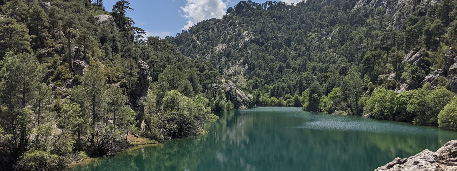
Mountain reservoir behind a small dam, reached by a 12 km hike up the Borosa River gorge and through a rock-cut tunnel
- Accessibility
- Reached only on foot by a steep, rocky mountain trail that passes through a tunnel; there is no wheelchair access.
- Difficulty
- Hard: 25 km there and back with 700 m of ascent and about 6 hours of walking. The upper section is steep and rocky and the descent is demanding; for hikers used to mountain terrain.
- Hours
- Open at all hours.
- Address
- 23470 Cazorla, Province of Jaén, Spain
What makes it special
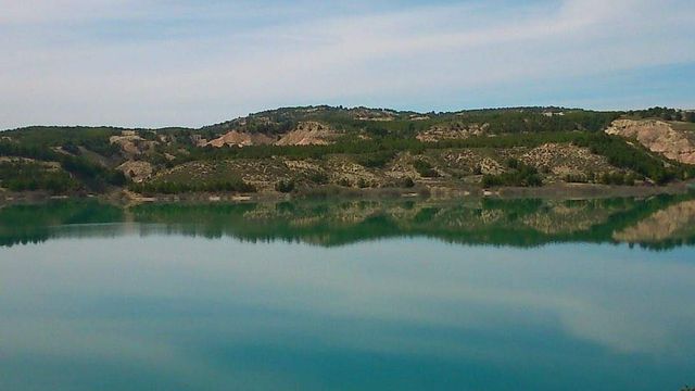
The last stretch runs through a tunnel cut into the rock by hydroelectric workers, and beyond it lies still water that holds the mountains, cliffs and woods upside down on its surface. Behind the small dam the reservoir sits on a mountain pass around 1,300 metres up, fed by the Borosa River and the Valdeazores Lagoon. The woods around it stay green through summer and turn colour in autumn, and quiet spots along the shore make a place to rest before the walk back.
The walk is half the reason to come. Below the reservoir the trail threads the narrow gorges of the Borosa River on wooden walkways fixed to the rock face and laid over the water, past waterfalls, pools, karst formations and caves. Beside the reservoir a 300-metre path leads to the source of the Borosa River, and from here trails carry on deeper into the park for anyone planning a multi-day route.
Good to know
- It is a full day: 25 km there and back, 700 m of ascent and about 6 hours of walking before stops. Carry water and food for all of it.
- The upper section is steep and covered in rocks, and the descent is the hardest part. Proper mountain footwear is essential.
- Carry a torch: the tunnel cut through the rock on the final stretch is dark inside.
- Snow falls at the reservoir in winter, and the high section of the trail becomes a winter mountain route.
- Guided walks to the reservoir are an option for anyone less sure of mountain trails.
Getting there
Aguas Negras is reached on foot along the Borosa River trail, about 12 km each way and 25 km for the round trip. The route follows the river upstream through narrow gorges, on wooden walkways fixed to the rock face and over the water, past waterfalls, pools and caves.
The climb adds up to 700 m. The highest section is steep and strewn with rocks, and near the top the trail passes through a pedestrian tunnel that hydroelectric workers cut into the mountain. The reservoir lies beyond it, behind its small dam. Allow about 6 hours of walking for the whole round trip, plus whatever time you spend at the water.
Best time to visit
Best: autumn, when the woods around the water turn colour, and spring. Start early in any season.
Avoid: winter, when snow falls at the reservoir, and the heat of a summer afternoon on the climb.
Six hours of walking on a steep, rocky mountain trail needs mild weather and daylight to spare.
Sun & daylight
Nearby Places
Similar Places
Featured in our guides

Aguas Negras Reservoir on the map
The upper trail is steep and rock-strewn, and in winter snow and ice can cover it. Wear mountain boots, take the descent slowly and turn back if the path is icy.
Get directions

Your whole travel map in one place
Get inspired by new places around the world and find the ones worth the journey
Frequently asked questions
How long is the hike to Aguas Negras Reservoir?
About 12 km each way along the Borosa River trail, 25 km for the round trip, with 700 m of ascent and about 6 hours of walking.How hard is the walk?
The upper section is steep and rocky, and the descent is demanding. It suits people used to mountain hiking who walk at a steady pace with stops; proper footwear is essential.Can you visit in winter?
Snow falls at the reservoir in winter, which turns the high section of the trail into a winter mountain route.Is there anything beyond the reservoir?
A 300-metre path beside the reservoir leads to the source of the Borosa River, and trails continue from here into the park for multi-day routes.