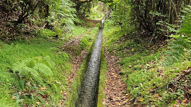
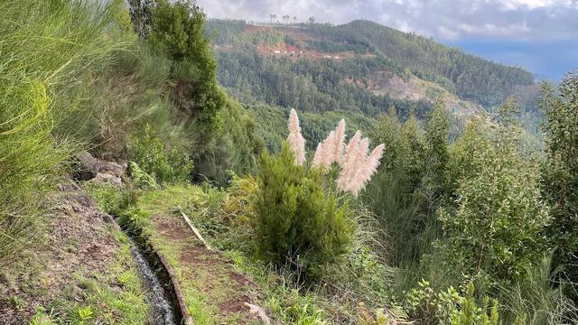
Levada da Ponta do Pargo follows an irrigation channel across the western end of Madeira, above the village of Ponta do Pargo. The walking is level and undemanding, through eucalyptus woodland that is regenerating after fire, with birdlife along the way. The path alternates between valley views and open Atlantic, and can be finished near the lighthouse. It is one of the island's quieter levadas, walked by far fewer people than the well-known routes.
Levada da Ponta do Pargo

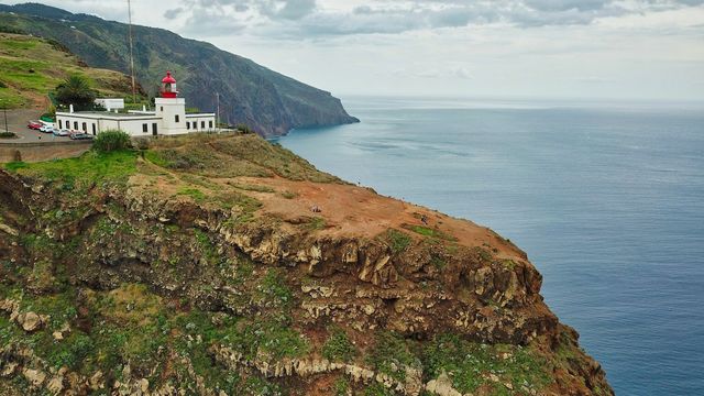
The walk can be finished at the Ponta do Pargo lighthouse, on the westernmost point of Madeira, with the open Atlantic in front of you.
- Accessibility
- Not wheelchair accessible: no step-free entrance and no accessible parking.
- Parking
- Two car parks about 800 m from the trail.
- Difficulty
- Flat and easy; trainers are enough. The climb from Ponta do Pargo village up to the start of the levada is long.
- Transport
- Nearest bus stop: Ponta do Pargo, about 1.2 km from the trail.
- Hours
- Open 24 hours, all week.
What makes it special
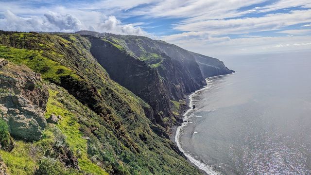
Fire has been through this part of the west coast, and the forest is coming back. Eucalyptus is sprouting again beside the channel, and there is plenty of birdlife along the way. The path zigzags, trading valley views for open Atlantic and back again. The vegetation and the wildlife here look different from the rest of Madeira.
It is also quiet. Few people walk this levada, so long stretches are yours alone. The channel can be done out and back, or as a loop through Ponta do Pargo, and the village is worth walking through in its own right. Ending near the lighthouse puts the Atlantic straight ahead.
Good to know
- No toilets. None are mapped on the trail or within 5 km of it, so plan ahead.
- Check the route before you set out. The round trip from Ponta do Pargo is easy to walk the wrong way.
- Food and drink on the way: the Carreta restaurant and bar is about two hours' walk along the trail.
- A water point is mapped about 270 m from the trail. Carry your own water anyway.
- Information boards stand at Lombadinha and Pedregal, within about 700 m of the route.
Getting there
The nearest mapped car parks are about 800 m from the trail, and the bus stop in Ponta do Pargo about 1.2 km. Walking up from the village to the start of the levada is a long climb, so it works better as the way back than the way out. Once you are on the channel itself, the path is level.
Best time to visit
Best: dry days, any day of the week.
Avoid: the days right after heavy, prolonged rain.
Rain raises the small stream that crosses the route, and an easy walk turns into a wet one. Crowding is not a factor here at any time.
Sun & daylight
Nearby Places

Similar Places

Levada da Ponta do Pargo on the map
After heavy and prolonged rain a small stream crosses the trail and has to be forded. If it is running high, turn back.
Get directions
Your whole travel map in one place
Get inspired by new places around the world and find the ones worth the journey
Frequently asked questions
Is Levada da Ponta do Pargo a hard walk?
No. The levada is flat and easy going, and trainers are enough. The only real climb is the stretch from Ponta do Pargo village up to the start of the channel.Is the trail busy?
Rarely. This is not one of the popular levadas, and quiet, empty stretches are the norm.Is there anywhere to eat on the way?
Yes. The Carreta restaurant and bar is about two hours' walk along the trail.Are there toilets?
No. Nothing is mapped on the trail or within 5 km of it.Can it be done as a round trip?
Yes, as a loop from Ponta do Pargo, returning through the village. Check the route in advance — it is easy to take the wrong path.