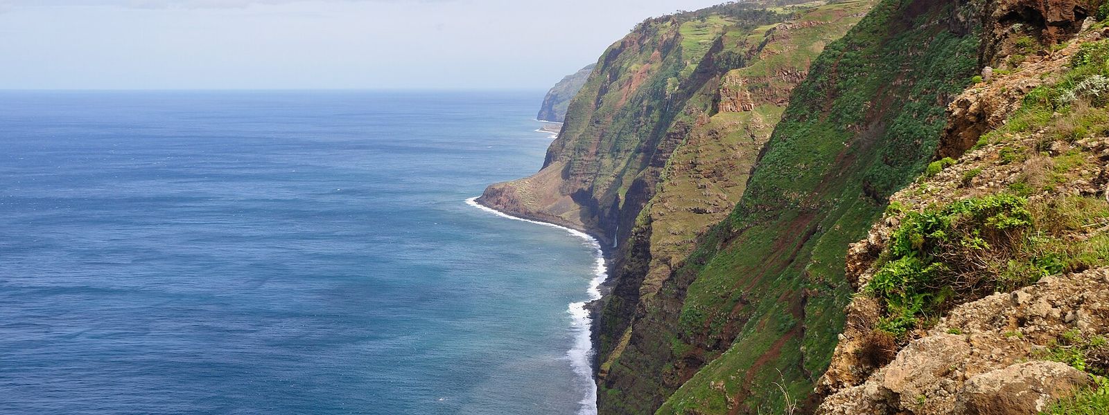
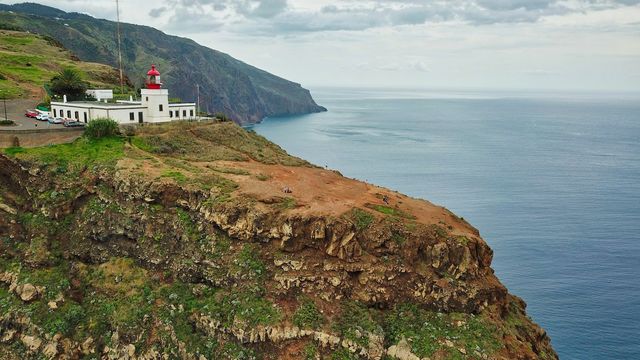
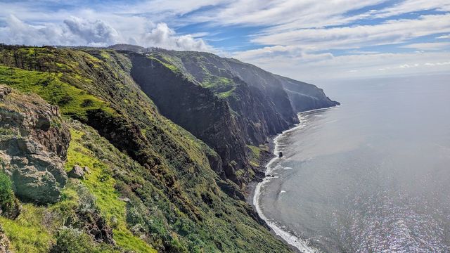
Ponta do Pargo is a civil parish at the western end of Madeira, in the municipality of Calheta and south-west of Porto Moniz. The name comes from a porgy — pargo — caught off the point by the island's first explorers. The land is farmed: dairy herds and butter, sweet potato, carrots, wheat, grapes and apples, worked from a dozen localities strung along the regional road. What draws visitors is the western edge itself, where the cliff-top bluffs reach 392 metres and a lighthouse, working since 1922, stands above the ocean.
Ponta do Pargo
- Currency
- Euro, in place of the escudo since 2002. Multibanco and ATM Express cash machines take international cards almost everywhere and mostly charge nothing of their own, while the Euronet machines clustered in tourist streets take high fees and give poor rates. VAT is already inside every price in shops and restaurants: 23% standard on the mainland, 22% in Madeira and 18% in the Azores.
- Language
- Portuguese, spoken here with a heavy accent even by mainland standards. English gets you about as far as it does on the mainland, and an attempt at a few Portuguese words is always taken well.
- Power plug
- Type C / F, 230 V, 50 Hz
- Visa
- Schengen: entry and short-stay limits follow the common Schengen rules.
- Time zone
- UTC+0 (UTC+1 in summer)
- Tap water
- Safe to drink across the country. Bottled spring water (água mineral) is sold everywhere for those who prefer it.
- Tipping
- Not expected, appreciated for good service. Around 8–10% in a restaurant if the service was exemplary, and it is perfectly acceptable to leave nothing if it was not. No tip for a coffee or a cake; €1–2 if you eat a full meal in a café. Nothing in pubs and bars. In a taxi, round the fare up and add €1–2.
- Emergency
- 112
When to go
Low season
Dec – Mar
Atlantic weather comes straight at this western tip, and cloud sits on the clifftops for days at a time; the lighthouse is often inside the fog rather than above it.
Shoulder
Apr – Jun
The farmed terraces are at their greenest and visitor numbers stay modest until the patron saint's festival on 29 June brings the parish out to the Church of São Pedro.
High season
Jul – Sep
The busiest stretch, and the one with the calendar behind it: Nossa Senhora da Boa Morte at Cabo in July, Nossa Senhora da Boa Viagem at Amparo in August, and the Festival of the Pêro, an apple festival, at Salão in September.
Shoulder
Oct – Nov
Traffic along the western road thins out after the summer festivals, and clear afternoons at the point become worth planning a drive around.
How long to stay
Ponta do Pargo works as a stop on a day spent along the west of Madeira. The lighthouse at Ponta da Vigia and the Church of São Pedro fill an hour or two, and the rest of the parish is farmland and hamlets you pass through. Stay overnight if you want the western point at first or last light, or if one of the festival dates brings you here — Saint Peter on 29 June, the apple festival at Salão in September.
Getting around
A car is what this corner of Madeira is built around. Ponta do Pargo is not one village but a string of hamlets — Cabo, Lombada Velha, Ribeira da Vaca, Salão, Corujeira de Dentro and de Fora, Lombadinha, Amparo, Lombo — spread along the central band of the regional road, and moving between them means driving. The lighthouse stands apart from all of it, out on the Ponta da Vigia promontory at the western edge of the parish. Inland the ground climbs hard: cliff-top bluffs at 392 metres, and over 1,321 metres where the parish reaches the Serra do Paul. One honest caveat about the lighthouse: it sits high enough that fog swallows it, and a clear view from the point is never a given.
What to see
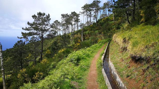

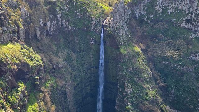
Destinations in Ponta do Pargo
Frequently asked questions
Where is Ponta do Pargo?
At the western end of Madeira. It is a civil parish of the municipality of Calheta, west of the municipal seat and south-west of Porto Moniz, taking in a diamond of land that runs from the ocean cliffs inland to the Serra do Paul.What is there to see?
The lighthouse on the Ponta da Vigia, inaugurated on 5 June 1922 on a cliff 290 metres above the sea, with its light at 312 metres. In the settled band inland there is the Church of São Pedro, rebuilt from 1620 and completed in 1690, and opposite it the Civic Centre of 2006, which holds the health centre, the Junta de Freguesia and the Casa do Povo.Where does the name come from?
From a fish. The historian Gaspar Frutuoso recorded that the first explorers to reach the island's western point caught a porgy — pargo in Portuguese — of remarkable size in the water below, and the point took its name from the catch.Is Ponta do Pargo a single village?
It covers 24.71 km² and its people live in separate localities along the central band of the regional road: Cabo, Lombada Velha, Ribeira da Vaca, Serrado, Salão, Corujeira de Dentro, Corujeira de Fora, Lombadinha, Amparo and Lombo. The 2011 census counted 909 residents.What do people here do for a living?
Farming above all — dairy herds feeding the butter trade, along with sweet potato, carrots, wheat, grapes and apples. Civil construction employs a large share of the working population, and the shops and services cluster in Ponta do Pargo itself, Ribeira da Vaca and Lombada Velha.