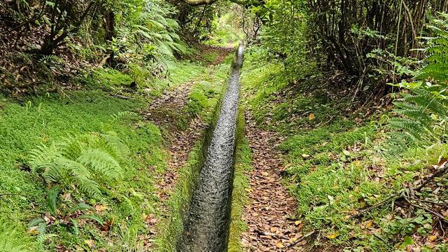
Levada dos Cardais is a walking trail beside an irrigation channel in the São Vicente valley, on the north side of Madeira. The first section is overgrown and unmaintained, and the route is not signposted. Past the road it crosses, the path is in much better condition and the views over the valley open up. The trail sees few walkers. It suits people happy to find their own way rather than follow a marked route.
Levada dos Cardais
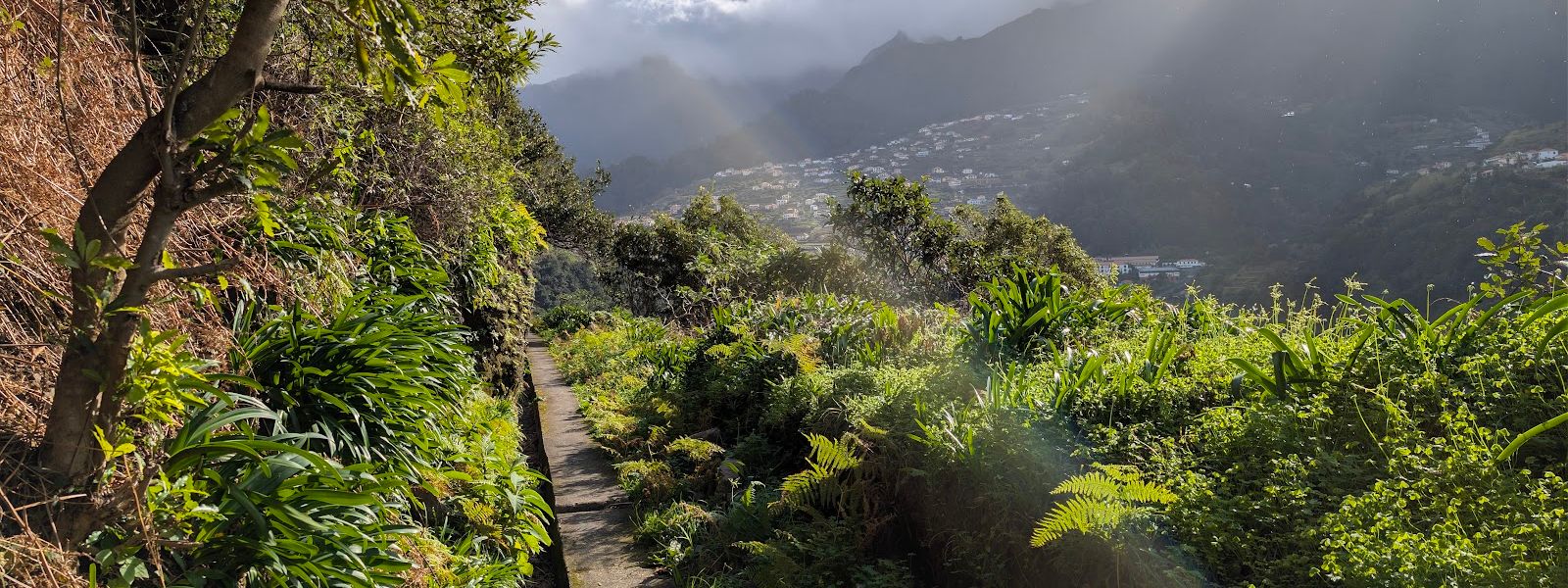
An unsignposted levada in the São Vicente valley where walkers have had the whole path to themselves.
- Accessibility
- Not wheelchair accessible: no accessible entrance and no accessible parking. The first section of the path is overgrown and unmaintained.
- Parking
- Two parking areas about 550 m from the trail, neither named. No wheelchair-accessible bays.
- Difficulty
- Easy walking along the channel. The first section is overgrown and unmaintained; conditions improve where the path meets a road.
- Transport
- The nearest bus stops are about 420 m and 500 m from the trail.
What makes it special
Levada dos Cardais runs above the São Vicente valley, on the north side of Madeira. The first stretch is overgrown and plainly unmaintained. Vegetation closes over the channel, and some walkers give up there and turn back. Past the point where the levada meets a road, the path is in much better condition and the walking is easy. The valley opens out below, with cultivated ground and scattered houses. What the trail lacks is company: people have walked the whole of it without meeting anyone.
Good to know
- No signposting. The walk is not signposted, and the location shown on maps is not the start. Finding it takes some searching.
- Overgrown start. The first section is overgrown and unmaintained. Past the road crossing the levada is in much better condition.
- Private land. The dirt road at the mapped point crosses private farmland. Do not walk up it; it serves residents only.
- No facilities. There are no toilets and no information point nearby. The nearest public drinking water is about 600 m away.
- A fallback. If the levada is too overgrown, footpaths climb to Bica and the road at the top loops back to the car park.
Getting there
Most people arrive by car. The nearest parking is about 550 m from the levada, off the ER104 through the São Vicente valley, and the rest of the approach is on foot. Bus stops are a little closer, roughly 420 to 500 m away. The start is not signposted and the point marked on maps is wrong, so allow time to find it. The dirt road at that mapped point is private farmland for residents. It is not the way in.
Sun & daylight
Nearby Places


Similar Places


Your whole travel map in one place
Get inspired by new places around the world and find the ones worth the journey
Frequently asked questions
Is Levada dos Cardais signposted?
No. The walk is not signposted, and the location shown on maps is not the start. Finding the beginning takes some searching.What condition is the path in?
The first section is overgrown and unmaintained. After the levada meets a road, the path is in much better condition and the walking is easy.Where do you park?
There are two parking areas about 550 m from the trail. The dirt road at the point marked on maps is private farmland and is not a way in.What is the alternative if the levada is too overgrown?
Footpaths climb to Bica, and the road at the top loops back to the car park in about an hour and a half. Two bars or shops sit along that road.Are there toilets at the trail?
No. There are no toilets and no information point nearby. The nearest public drinking water is about 600 m away and free to use.