Levada dos Tornos is a hiking route above the village of Boaventura, on the north coast of Madeira, Portugal, reached by the PR2 path. From the car park at the top of the village a steep stair climb of 15 to 20 minutes leads up to the water channel, where the path levels out at a signed junction and runs in both directions. The right-hand branch goes upstream past several stream crossings to a waterfall, 4 to 5 km from the car park in all. There are no facilities at the start.
Levada dos Tornos

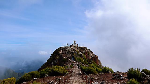
Instead of turning at the junction you can keep climbing: another hour of steep path reaches a pass at around 1,000 metres, with a secluded valley full of birds on the far side.
- Accessibility
- Not accessible: no wheelchair-accessible parking or entrance, and the only way up to the levada is a steep stair climb.
- Parking
- Free. Room for four or five cars at the end of the road above the village, with further space by the PR2 sign lower down.
- Difficulty
- Steep climb of 15–20 minutes on stairs from the car park, then level walking along the channel; 4–5 km to the end of the right-hand branch, with several stream crossings.
- Transport
- No bus stop at the trailhead; the nearest mapped stops are about 3.5 km away.
- Hours
- Open 24 hours.
What makes it special
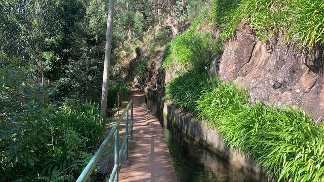
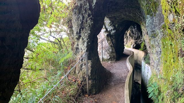
The hard part comes first. From the car park above the village a steep stair climb of 15 to 20 minutes takes you up to the water channel, and at a signed junction the gradient simply stops. From there the levada runs level along the hillside, through trees and ferns, with the river below and the valley opening out to the side. Turn right and the channel goes upstream, over several stream crossings, to a waterfall roughly 2.5 km along; in December it comes down heavy. The whole of that branch is 4 to 5 km from the car park. It stays empty, too — one walker covered 15 km here and met two other couples all day.
Good to know
- Left branch closed — in April 2026 the left-hand levada was shut off, and PR2 itself was blocked about 6 km along.
- The climb is front-loaded — 15 to 20 minutes of steep stairs from the car park, and then the levada runs flat.
- Stream crossings — the upstream branch crosses several streams; they are easy enough to step across.
- Nothing at the trailhead — no toilets, no drinking water and no information board within 800 m of the start.
Getting there
Drive up through Boaventura to the end of the road above the village, or stop lower down at the PR2 sign; from either, the way in is a steep flight of stairs, 15 to 20 minutes of climbing, before the path reaches the levada and levels out. An offline map app is worth having on the way up — the junction at the top is signed at the source of the levada.
Best time to visit
Better: clear days in December and through the winter, when the waterfall on the upstream branch carries the most water.
Avoid: grey, low-cloud days. What the level section gives you is the view down the valley and the sound of the water, and cloud takes the first of those away.
Sun & daylight
Nearby Places



Similar Places


Featured in our guides
Levada dos Tornos on the map
A landslide has brought fallen trees down across the upstream (right-hand) branch roughly halfway to the waterfall. One walker climbed over it; another turned back rather than try. Treat it as the end of the walk unless the way across is plainly clear, and do not attempt it in rain or poor visibility.
Get directions

Your whole travel map in one place
Get inspired by new places around the world and find the ones worth the journey
Frequently asked questions
How long is the climb up to the levada?
15 to 20 minutes of steep stairs from the car park above the village. Once you reach the water channel the walking is flat.Is there a waterfall on the route?
Yes, on the upstream branch — turn right at the junction and it is roughly 2.5 km along. That branch runs 4 to 5 km in total from the car park.Can both directions be walked?
Not as things stand. In April 2026 the left-hand branch was closed off, and the right-hand one carries a landslide with fallen trees roughly halfway to the waterfall.How busy does it get?
Quiet. One walker covered 15 km here and passed two other couples; another spent a day on the higher path above the levada without meeting anyone.