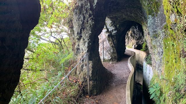
Levada of Ribeira da Janela follows an irrigation channel through the Ribeira da Janela valley in the north-west of Madeira. The going is level and asks little, and the interest lies in the tunnels: several are cut through the rock, all unlit, and one runs about 1.5 km with waterfalls coming down inside it. Past the tunnels the path reaches a dam with waterfalls below. Beyond it a landslide has destroyed the trail, so the full length can no longer be walked and most people turn back.
Levada of Ribeira da Janela
Local name: Levada da Ribeira da Janela

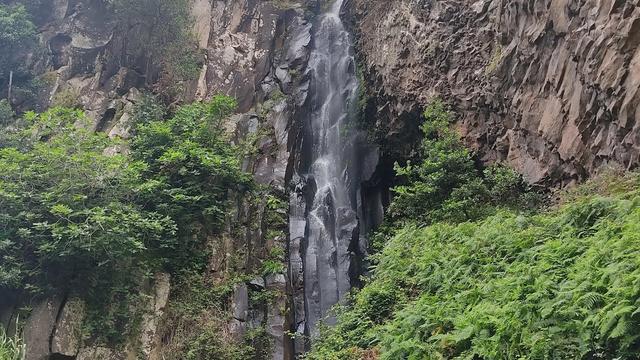
One of the tunnels runs about 1.5 km through the rock, with waterfalls falling inside it.
- Accessibility
- No wheelchair-accessible entrance.
- Parking
- Free car park 28 m from the trailhead, asphalt surface; a second one 56 m away. Free street parking as well.
- Difficulty
- Mostly flat and easy underfoot along the channel; the unlit tunnels are the only demanding part and need a torch. Allow 3–4 hours. Very slippery after rain.
- Transport
- Nearest bus stop about 960 m from the trailhead.
- Hours
- Open 24 hours, every day.
What makes it special
The walk follows the water channel with the valley falling away on one side, and it is the tunnels people come back talking about. Several are cut straight through the rock and none of them are lit. One runs about 1.5 km, with waterfalls coming down inside it, so you cross it in the dark and come out soaked. The first tunnel has a waterfall of its own and is the easiest of them.
Past the tunnels the path reaches a house on the right, where walkers write their name and the date on the wall inside. Further on the main path crosses a dam with waterfalls below it. Beyond that a landslide has taken the trail out. Anyone set on continuing has to take the dirt path that drops to the river and climbs back up to the far side, and that stretch is very steep.
Good to know
- Torch: the tunnels are unlit, and one of them runs about 1.5 km.
- Waterproof jacket: water falls from the roof inside the long tunnel and soaks you through.
- After rain: the path turns very wet and slippery, and stones come loose off the slope above.
- The far end is broken: a landslide has destroyed the path beyond the dam, and a sign marks where walkers are told to stop.
- Facilities: toilets sit close to the start; the picnic spots along the trail are there but not kept up.
Getting there
Nearly everyone drives. The asphalt car park sits 28 m from where the path starts, with a second one 56 m along, so there is no approach walk to speak of — you step out of the car and onto the levada. From there the path runs level beside the channel, and the tunnels come later, so keep the torch where you can reach it rather than buried in the pack.
Best time to visit
Better: early in the morning, after several dry days in a row.
Avoid: rain, and the day straight after it.
The trail is a quiet one — start at half past eight and you can have the first few kilometres to yourself, with other walkers appearing only later in the morning. Rain changes the walk completely: the surface goes slick, loose stones come off the slope, and fog can close the valley so there is nothing to look at. The fourth tunnel needs a couple of dry days behind it; one night of rain is enough to rule it out.
Sun & daylight
Nearby Places


Similar Places



Levada of Ribeira da Janela on the map
A landslide has destroyed the path beyond the dam, and a sign marks the point where walkers are told not to continue. In rain the path is very slippery and stones come loose from the slope above; the fourth tunnel is not passable when the ground is wet. The dirt path down to the river and back up to the far side is very steep.
Get directions

Your whole travel map in one place
Get inspired by new places around the world and find the ones worth the journey
Frequently asked questions
Do you need a torch?
Yes. The tunnels are unlit, and one of them is about 1.5 km long. A waterproof jacket matters just as much — waterfalls come down inside that tunnel.How long does the walk take?
Allow 3–4 hours. Turning back at the 7 km mark, just before the fourth tunnel, works out at about 3.5 hours there and back.Can the whole trail be walked?
No. A landslide has destroyed the path beyond the dam. The alternative is a very steep dirt path down to the river and up the other side, and a sign warns against carrying on.Is it suitable for beginners?
The path is mostly flat and takes little effort. The tunnels are the only demanding part, and shoes will end up wet and dirty either way.Are there toilets at the trailhead?
Yes, free toilets stand 45 m from the start, with more 380 m away.