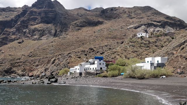
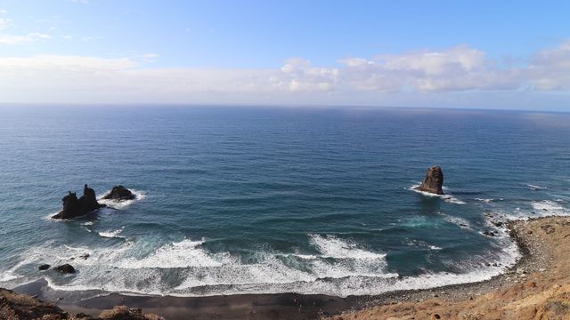
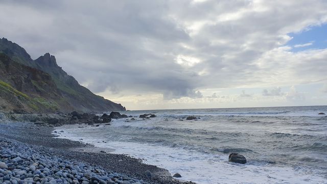
Playa de Antequera is a black-sand beach on the Anaga coast of north-eastern Tenerife, within Santa Cruz de Tenerife. It lies at the mouth of the Barranco de Antequera, enclosed by steep cliffs, and no road reaches it. Visitors arrive by water taxi or on foot, descending from about 690 m near Chamorga on the PR-TF 5 trail and then down the ravine. Its isolation keeps it quiet. There are no toilets and no drinking water.
Antequera Beach
Local name: Playa de Antequera

Black-sand beach under the cliffs of Anaga, reached by water taxi or a long mountain trail down a barranco.
- Entrance
- Free; there is no ticket for the beach. The water taxi is paid.
- Accessibility
- No step-free route. The only way in by land is a steep mountain trail of 5.7 to 7.5 km each way; the other is by water taxi.
- Parking
- No parking at the beach. Walkers leave the car at the cemetery at Punta de Anaga near Chamorga, where the trail starts.
- Difficulty
- Hard. A mountain trail of 5.7 to 7.5 km each way, descending from about 690 m to sea level and climbing all of it back; four to six hours of walking for the round trip. Proper hiking shoes needed.
- Transport
- No bus reaches the beach; the nearest stop, El Cascajo, is about 2,350 m away in a straight line. The walking route starts at the Punta de Anaga cemetery; a water taxi serves the beach.
- Hours
- Open at all times.
What makes it special
The path ends on the sand. The Barranco de Antequera closes in on both sides and delivers you straight onto a black beach walled by cliffs, with nothing behind it but the ravine you came down.
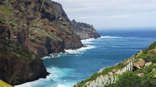
No road comes here, so the beach stays uncrowded; everyone on it arrived by boat or on foot. The walk in is half the reason to make the trip. It runs along the side of the Barranco de Ijuana with the sea below, then passes through Las Casillas, a hamlet of five or six houses that is still lived in and can only be reached on foot. From there the route crosses to the rim of the Barranco de Igueste before dropping down to the shore.
Good to know
- There is no mobile signal or internet along the trail. Download the route before you set off and expect to rely on yourself.
- No toilets and no drinking water at the beach or nearby. Carry 2–3 litres of water per person, plus food and sun cream.
- The return climbs about 690 m at the end of the day. If you do not hike regularly, take the water taxi instead.
- Wear proper hiking shoes, and carry out everything you bring in.
Getting there
There are two ways in. The water taxi takes about 15 minutes.
On foot, leave the car at the cemetery at Punta de Anaga (Cementerio de Punta de Anaga) near Chamorga and take the PR-TF 5 towards the Barranco de Igueste. The path first runs along the side of the Barranco de Ijuana to the hamlet of Las Casillas, then crosses to the rim of the Barranco de Igueste, where a signpost reads 'Antequera'. Leave the PR-TF 5 there and follow the Barranco de Antequera down; the path ends on the beach.
Each way is 5.7 to 7.5 km, dropping from about 690 m to sea level. That means a climb back roughly the height of two Eiffel Towers stacked. Allow four to six hours of walking for the round trip.
Best time to visit
Best: an early start on a dry, mild day.
Avoid: hot summer middays and the days after heavy rain.
The return is a long climb from the sea on an exposed mountain path, heat makes it far harder, and ravine paths turn slippery and loose after rain.
Sun & daylight
Nearby Places
Similar Places
Antequera Beach on the map
The trail has no mobile signal and no water on the way or at the beach, and the return climbs about 690 m. Carry plenty of water and food, and turn back early if the heat or the pace gets to you.
Get directions

Your whole travel map in one place
Get inspired by new places around the world and find the ones worth the journey
Frequently asked questions
Can you drive to Playa de Antequera?
No road reaches the beach. Walkers park at the cemetery at Punta de Anaga near Chamorga and hike down; the other way in is by water taxi.How long is the hike to Playa de Antequera?
Each way is 5.7 to 7.5 km, descending from about 690 m to sea level. Allow four to six hours of walking for the round trip, most of the return uphill.Is there a boat to the beach?
Yes, a water taxi serves the beach, and the ride takes about 15 minutes.Are there any facilities at the beach?
No. There are no toilets and no drinking water at the beach or nearby, and no mobile signal on the trail. Bring everything you need.