Puig de Massanella rises to 1,364 m in the Serra de Tramuntana, in the municipality of Escorca in northern Mallorca. It is the second-highest peak on the island and the highest with a summit open to walkers, since Puig Major, its higher neighbour, carries a military antenna complex. A walking route climbs from the south, and scrambling routes marked with cairns and red dots rise from a col to the north. The summit holds a deep karst pit, and ruined snow houses stand on a col nearby.
Puig de Massanella
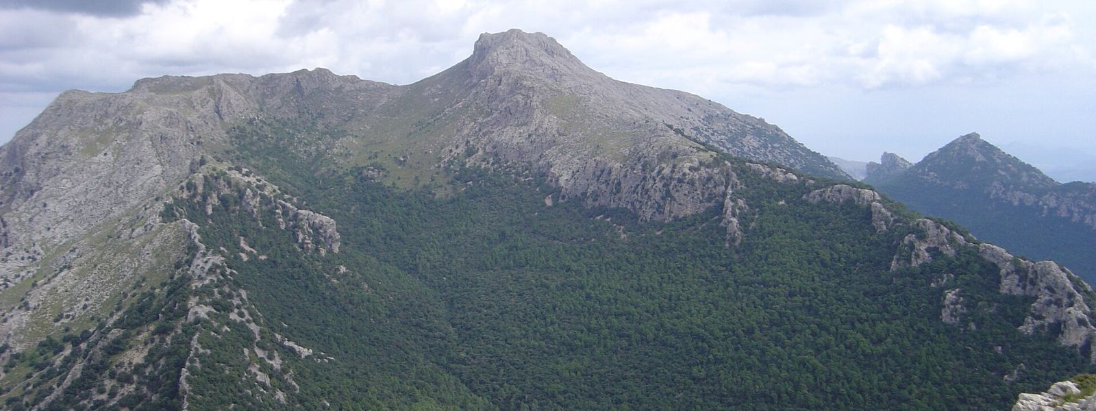
Tramuntana limestone peak of 1,364 m, with an old snow pit on its summit and a scramble over sharp rock to reach it
- Entrance
- Paid: a per-person fee for crossing private land, collected in cash at a booth on the lower track.
- Accessibility
- Not accessible for wheelchairs or anyone with limited mobility: the route climbs over loose, sharp rock and needs scrambling near the top.
- Parking
- Roadside parallel spaces near Restaurant Ca'n Galleta, just past the Repsol petrol station at the start of the trail.
- Difficulty
- Strenuous. A track through shaded forest leads to open limestone above the tree line, where the path turns to loose, sharp rock and scrambling and is easy to lose. Summit at 1,364 m; 3.5–5.5 hours round trip.
- Transport
- Bus towards Lluc; get off at the Repsol petrol station, before the monastery, for the start of the trail.
- Address
- Puig de Massanella, 07315, Balearic Islands, Spain
What makes it special
At the very top the ground opens into a deep pit, dissolved out of the limestone by water. Tradition has it that the pit was used to store snow, and on a col just below the summit stand the ruins of the snow houses that went with it.
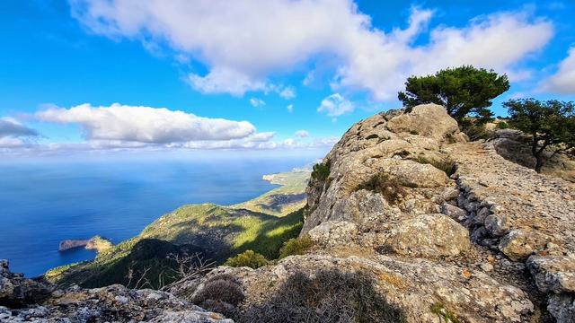
Puig de Massanella is the second-highest peak on Mallorca and the highest whose summit anyone can stand on: Puig Major next door is taken up by a military antenna complex. That makes it the island's big climb, and plenty of walkers come for it. The route earns the top. Shaded woods cover the lower slopes, then the trees give out and the path crosses bare, broken grey rock. From the summit the ridges of the Serra de Tramuntana fall away on every side, and the view holds up even on a cloudy evening.
Good to know
- Bring cash: the fee for crossing private land is taken at a booth on the lower track, and cards are not accepted.
- Wear hiking boots and long trousers. Loose, sharp rock runs from start to finish, and thorny scrub lines the path.
- Download an offline map before you set out. Above the tree line the route is poorly marked and easy to lose.
- There is no drinking water on the mountain and no toilets. Carry plenty of water; the café at the petrol station by the trail start sells food.
Getting there
The trail starts by the Repsol petrol station on the road to Lluc, 4 km short of the monastery. Drivers use the roadside parallel spaces near Restaurant Ca'n Galleta, just past the station.
By bus, get off at the petrol station, before Lluc. Stay on to the monastery and you add 4 km of walking each way, which on a day trip can mean turning round short of the summit to catch the last bus back towards Alcúdia. Check that time before you start.
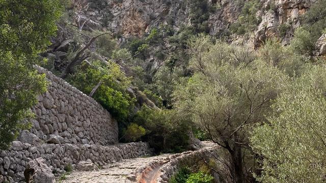
From the road a broad track makes easy going for the first stretch. Then comes a stile with the pay booth beside it, and the path climbs through shaded forest before it breaks out onto open rock above the trees.
Best time to visit
Best: spring and autumn, on a clear day, with an early start.
Above the tree line there is no shade, and the long climb over bare rock goes better in cool air; the summit is already chilly by early October, so carry a warm layer.
Avoid: summer middays, rain, and winter days when ice may lie on the upper slopes.
Wet or icy limestone turns the loose, sharp rock of the upper route into a real hazard, and midday heat on bare rock drains you fast.
Access & restrictions
The route up Puig de Massanella crosses private land, and the owners charge each walker for using the trail. The fee is collected at a booth beside a stile on the lower track, before the path enters the forest. It is paid in cash only; anyone who arrives without it has to walk back down to the petrol station on the road.
Sun & daylight
Nearby Places


Similar Places
Puig de Massanella on the map
Above the tree line the path crosses sharp, loose limestone with scrambling in places, and a slip there can mean a bad fall; the descent is harder than the climb. Wear proper boots, keep to the cairns and red dots, and stay back from the edge of the summit pit.
Get directions
Your whole travel map in one place
Get inspired by new places around the world and find the ones worth the journey
Frequently asked questions
How long does it take to climb Puig de Massanella?
The round trip takes three and a half to five and a half hours. The first half on the track goes quickly; the rocky upper section is slower.Do you have to pay to climb Puig de Massanella?
Yes. The trail crosses private land, and a fee per person is collected at a booth on the lower track. It is cash only.How difficult is the hike?
Strenuous, though not technical. The lower half follows a track through forest; above the tree line the path turns to loose, sharp rock with scrambling and is easy to lose. Hiking boots are needed.Why climb Puig de Massanella instead of Puig Major?
Puig Major is higher, but its summit carries a military antenna complex. Puig de Massanella, at 1,364 m, is the highest summit on Mallorca that walkers can reach.Can you reach the trail by bus?
Yes. Take the bus towards Lluc and get off at the Repsol petrol station, before the monastery. Riding on to Lluc adds 4 km of walking each way.