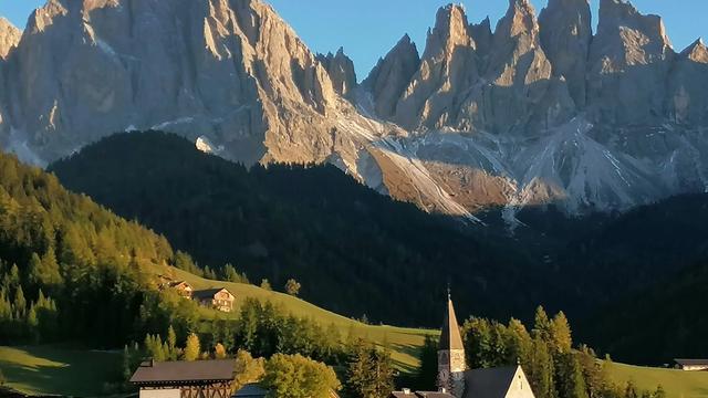
Funes is a comune in South Tyrol, north-eastern Italy, about 30 km northeast of Bolzano. It opens east off the Eisack valley (Val d'Isarco) and holds six villages — Koll, St Jakob, St Magdalena, St Peter, St Valentin and Teis — across 81.38 km² with some 2,550 residents; the comune stands at 1,132 m. At the head of the valley is the Odles Group, whose three peaks have formed the coat of arms since 1967. Funes is the Italian name: Villnöß in German, Funès in Ladin.
Funes

- Currency
- Euro (EUR)
- Language
- German, Italian; Ladin in some valleys
- Power plug
- Type C/F/L, 230 V
- Visa
- Schengen
- Time zone
- UTC+1 / UTC+2 (CET/CEST)
- Tap water
- Safe; most Italians prefer bottled
- Tipping
- Not expected; leave coins in bars, cafés
- Emergency
- 112
Things to do
All tours in Dolomites on GetYourGuide
Paid links: booking through them supports YowJourney.
When to go
Shoulder
Apr – May
The valley floor greens up while snow still holds on the high ground under the Odles. Weather swings between the two.
High season
Jun – Sep
Open meadows, long days and the busiest traffic on the one road up from the Eisack valley. Mornings are the calm part of the day.
Shoulder
Oct – Nov
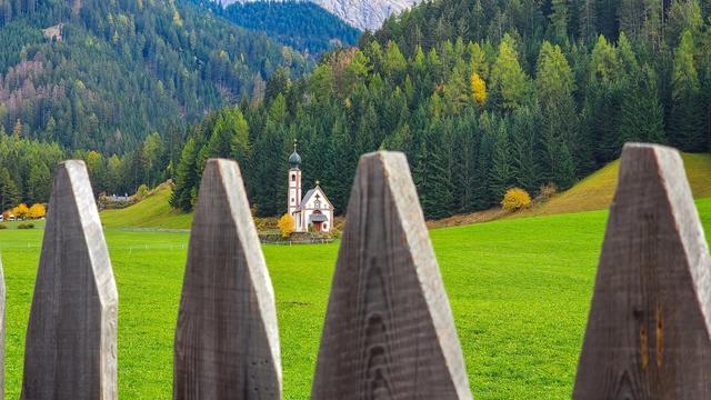
The larches turn and the valley empties out. The sun leaves the valley floor early while the Odles above still hold it.
Low season
Dec – Mar
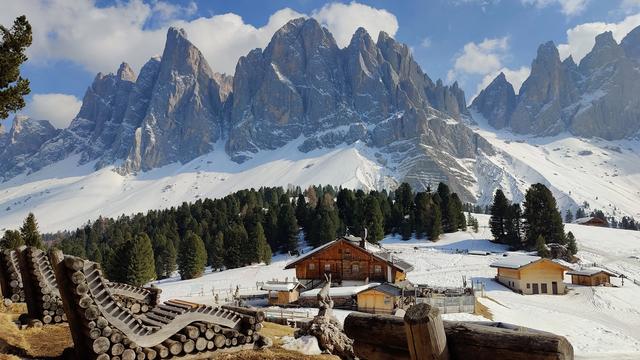
Snow lies in the valley, the villages are quiet and daylight is short. The Odles stand at their hardest against a winter sky.
How long to stay
Two or three days covers the valley without rushing: one for the villages and the meadows under the Odles, one for a walk towards the peaks, one spare for the weather. Plenty of people come up for a few hours from Brixen or Val Gardena, photograph St Magdalena from the road and drive out again. The evening is what they miss — the valley empties, and the sun stays on the Odles long after the meadows below have gone into shade.
Getting around
A car does most of the work here. Funes lies about 30 km northeast of Bolzano, and the way in is from the Eisack valley below, where Brixen and Klausen sit on the Brenner railway and the motorway that runs beside it. One road climbs east from there into the valley, with the villages strung along it and on the slopes above. Check a map before planning a loop through the Dolomites: Funes borders Urtijëi and Santa Cristina Gherdëina in Val Gardena and San Martin de Tor in Val Badia, but that boundary runs along the crest of the Odles. Nothing crosses it on wheels. Reaching any of those villages means dropping back down to the Eisack valley and going round.
What to see
Destinations in Funes
Frequently asked questions
Where is Funes?
In South Tyrol, north-eastern Italy, about 30 km northeast of Bolzano. The valley opens east off the Eisack valley by Brixen and Klausen, and the comune also borders Lajen, Feldthurns, Urtijëi, Santa Cristina Gherdëina and San Martin de Tor.Why does Funes have three names?
Funes is Italian, Villnöß German, Funès Ladin, and all three are in use. The 2024 census records German as the first language of 96.97% of residents, Italian of 2.49% and Ladin of 0.54%.Which villages make up the comune?
Six: Koll (Colle), St Jakob (San Giacomo), St Magdalena (Santa Maddalena), St Peter (San Pietro), St Valentin (San Valentino) and Teis (Tiso). Signposts and maps may use either the German or the Italian form.Which peaks close the head of the valley?
The Odles Group. Three of its summits became the municipal coat of arms — three silver piles on blue — adopted in 1967.