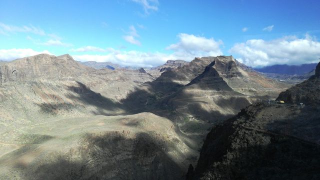
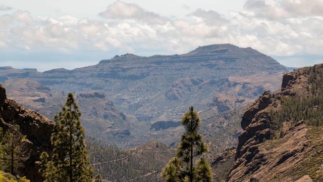
Barranco de Guayadeque is one of the largest ravines in the Canary Islands. It runs south-east from the Los Marteles crater (Caldera de Los Marteles), at about 1,500 m, and divides the municipalities of Ingenio and Agüimes on Gran Canaria. Once the most populated valley on the island, it holds hundreds of caves and one of Gran Canaria's most important prehistoric burial grounds. It is protected as an archaeological site and a Natural Monument, and is home to more than 80 endemic species.
Barranco de Guayadeque
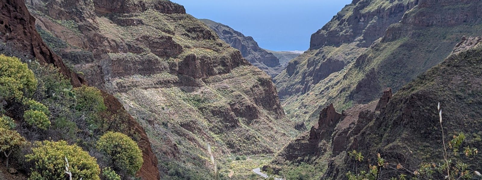
Deep basalt ravine lined with pre-Hispanic burial caves, cave homes and restaurants dug into the rock
- Entrance
- Free — there is no ticket for the ravine.
- Accessibility
- Much of the ravine can be seen from the car along the GC-103. The paved walk through the cave village has very steep slopes, hard going in a wheelchair; the paths around the museum are easy but have awkward steps.
- Parking
- Free parking for restaurant customers by the cave restaurants, and free public parking further down the road.
- Difficulty
- Easy by car. The paved cave-village loop has very steep slopes, and the trails up the hillsides are harder. The footpath beyond Montaña de las Tierras climbs to the Los Marteles crater at about 1,500 m.
- Transport
- Nearest bus stop: Tanausú, about 1.1 km away in a straight line.
- Advance booking
- Not needed for the ravine. At least one cave restaurant takes no reservations and hands out numbers on arrival.
- Hours
- The ravine is open at all times. The visitor centre in a cave at the valley entrance opens Tuesday to Sunday, all year round.
- Address
- GC-103, 21, 35260 El Ingenio, Las Palmas, Spain
What makes it special
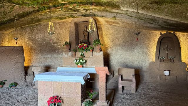
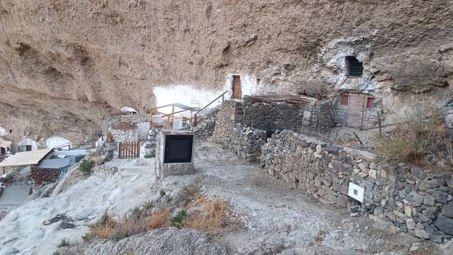
People still live in the rock here. In the hamlets of Cueva Bermeja and Montaña de las Tierras, houses, restaurants and even a hermitage are dug straight into the ravine wall, and a paved circular walk loops past cave homes with views down the dry riverbed.
The sides rise 300 to 400 m, roughly the height of the Eiffel Tower, and are pocked with older caves. The island's pre-Hispanic people lived, stored food and buried their dead in them; mummies were left in the hardest to reach, some with skulls wrapped in animal skins or woven reed. Much of what 19th-century grave robbers took ended up in the Museo Canario in Las Palmas, and the Guayadeque Museum (Museo de Guayadeque) at the mouth of the valley tells the story from the start.
Fig and almond trees grow on the old terraces, the remains of water mills sit along the stream, and the rocks belong to the Gran Canaria giant lizard (lagarto canarión), which reaches 80 cm.
Good to know
- Mobile phones lose signal in the valley: sort out maps and plans before you drive in.
- The paths are exposed to the sun. Bring a hat, sunscreen and water; there are no public toilets or drinking fountains nearby.
- The walk through the cave village is paved, but some slopes are very steep.
- Tables at the cave restaurants can be hard to get, and at least one takes no bookings: you take a number on arrival and wait outside.
Getting there
Almost everyone arrives by car, from Agüimes or Ingenio. The GC-103 leaves the GC-100 at Agüimes and follows the floor of the ravine, past the museum at the entrance, on through Cueva Bermeja 4 km further up, to its end at Montaña de las Tierras. From the towns the road drops narrow and twisting, with cars coming the other way. Restaurant customers park free by the cave restaurants, and there is free public parking further down the road.
Walking in is possible but long, around 10 km back out on the same road, so start early if you go on foot. The nearest bus stop, Tanausú, is about 1.1 km away in a straight line. Beyond Montaña de las Tierras a footpath climbs to the Los Marteles crater and meets the GC-130.
Best time to visit
Best: early in the day, and in late winter, when the almond terraces are in blossom.
Avoid: walking the ravine in the heat of the middle of the day.
The paths are open to the sun, the best of the valley lies furthest in, and the way back out is as long as the way in.
Access & restrictions
The ravine is protected twice over: as an archaeological Site of Cultural Interest and as a Natural Monument. The burial caves in its walls are part of that heritage, and the protection was brought in to stop them being plundered — do not climb into them and take nothing away. Some of the caves along the road are still homes, so keep to the road and the paths and leave doorways and terraces alone. The endemic plants on the slopes are protected as well; leave them where they grow.
Things to do nearby
All tours in Agüimes on GetYourGuide
Paid links: booking through them supports YowJourney.
Sun & daylight
Nearby Places

Similar Places
Featured in our guides
Barranco de Guayadeque on the map
The GC-103 is narrow and winding, with oncoming cars on the bends — take it slowly. Off the paths the ravine walls are steep and the rock is loose; keep to the trails.
Get directions

Your whole travel map in one place
Get inspired by new places around the world and find the ones worth the journey
Frequently asked questions
Do I need to book the cave restaurants?
Tables can be hard to get. At least one cave restaurant takes no advance reservations: you take a number on arrival and wait outside until a table is free.Can you walk into Barranco de Guayadeque instead of driving?
Yes, but it is a long route on a narrow road shared with cars, around 10 km back out again. Most people drive in and walk around the cave village and the hill paths from there.Is there mobile signal in the ravine?
Mobile phones lose signal in the valley, so download maps and arrange meeting points before you go in.What is the Guayadeque Museum?
An archaeological interpretation centre in a cave at the entrance of the valley, with an exhibition on human life in the ravine going back to pre-Hispanic times.