Caldera de los Marteles is a volcanic caldera on the eastern side of Gran Canaria's summit, in the municipality of Valsequillo de Gran Canaria. It belongs to a line of post-Roque Nublo cones, together with La Calderilla, formed in eruptions in which water played an essential part. The caldera gives its name to the Los Marteles Special Nature Reserve, declared in 1994 and covering 3,568.7 ha bounded by six municipalities. The area is also a Natura 2000 site.
Caldera de los Marteles
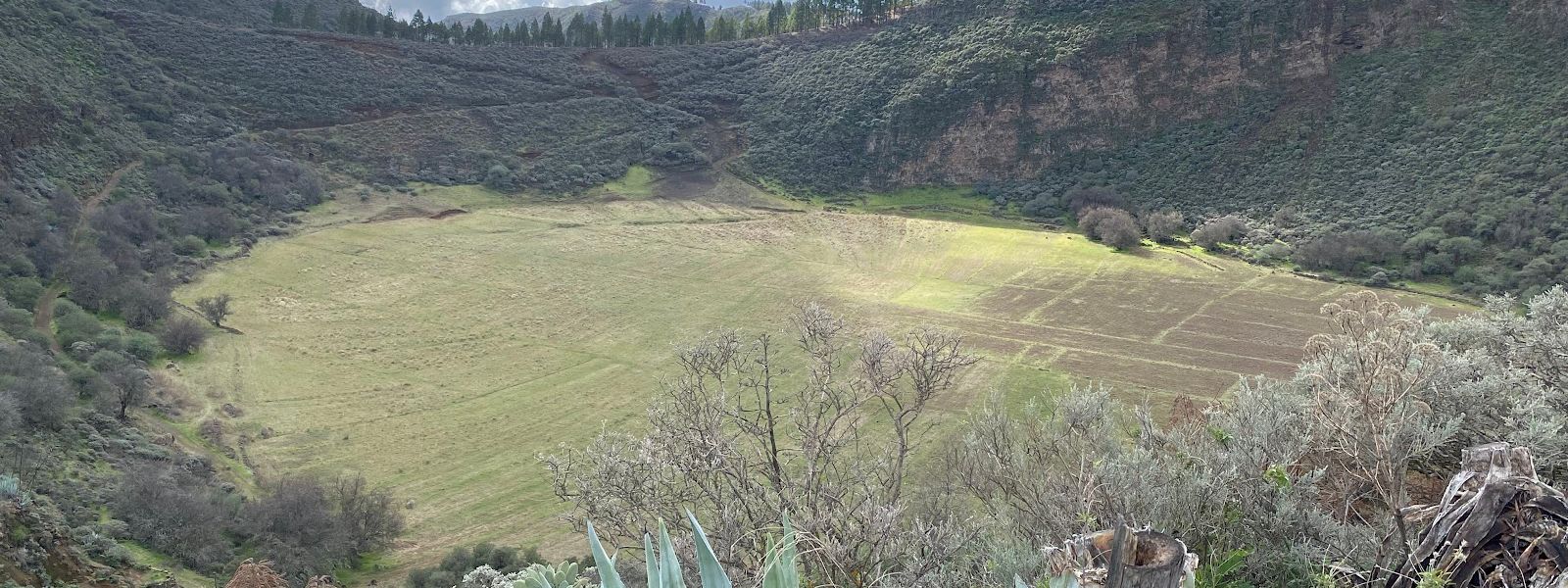
Volcanic caldera in a pine-planted nature reserve on Gran Canaria's summit, with a gravel path down to its floor.
- Accessibility
- The entrance is not wheelchair accessible. The way down into the caldera is a loose gravel path.
- Parking
- Car park with a view about 360 m from the caldera in a straight line; another at Fuente Los Cascajales, about 1.3 km away.
- Difficulty
- The view needs no walk from the car park. The path down into the caldera is loose gravel that slips underfoot, and the way back out is uphill.
- Transport
- Nearest bus stops: Casas del Rincón, about 2.7 km in a straight line, and Montecillo, about 3.3 km.
- Hours
- Open at all times.
- Address
- 35216, Las Palmas, Spain
What makes it special
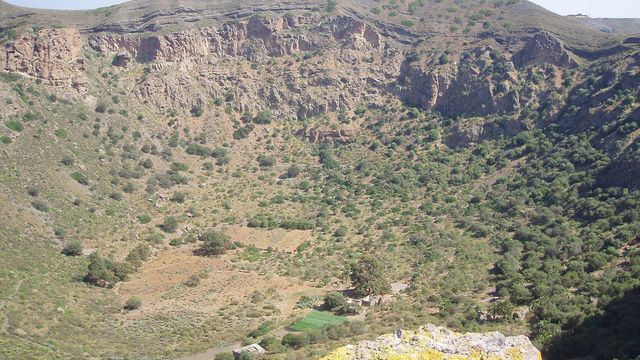
A gravel path drops into the caldera, and you can stand on the floor of a crater shaped by an eruption in which water played the leading part. From the roadside the hollow sits like a bowl pressed into the summit. Turn round, and across the road Las Palmas shows in the distance. The air is fresh and the place is quiet.
The reserve around it lays out the island's volcanic history: phonolite lavas and ignimbrite sheets from Gran Canaria's first volcanic cycle, Roque Nublo material above them, dykes cutting through. The slopes carry planted Canary pines, yellow-flowered Teline microphylla and Poa pitardiana, a grass found only on Gran Canaria. The crags give raptors such as the Barbary falcon a place to nest, flocks of canaries move through the trees, and the Gran Canaria giant lizard lives here. In Los Cernícalos ravine (Barranco de los Cernícalos), inside the same reserve, grows the best-preserved wild olive woodland on the island.
Good to know
- There are no toilets and no drinking water at the caldera or nearby. Fill up before you drive up.
- The summit is cooler than the coast, and the wind finds you on the open ground. Bring a jumper.
- The path into the caldera is loose gravel. Trainers with worn soles will slide on it; wear shoes with grip.
- The entrance is not wheelchair accessible.
Getting there
The approach is by road, climbing towards the summit. A car park with a view sits about 360 m from the caldera in a straight line, with a hiking trail crossing it; a second, at Fuente Los Cascajales, is about 1.3 km away. Look for an information board and a guidepost marked Caldera Los Marteles, both around 350 m out. A gravel path leads down into the crater itself.
On foot, the caldera lies on the hiking route between Cazadores and Pico de las Nieves. Without a car it is a walk: the nearest bus stops, Casas del Rincón and Montecillo, are about 2.7 km and 3.3 km away in a straight line.
Best time to visit
Best: a clear, dry day.
Avoid: days when cloud sits on the summit, and the hours after rain.
The panorama, with Las Palmas in the distance, needs clear air, and the gravel path into the caldera is slippery enough without being wet.
Sun & daylight
Nearby Places
Similar Places
Caldera de los Marteles on the map
The gravel path down into the caldera slips underfoot. Wear shoes with real grip and take the descent slowly.
Get directions

Your whole travel map in one place
Get inspired by new places around the world and find the ones worth the journey
Frequently asked questions
Can you walk down into Caldera de los Marteles?
Yes. A gravel path leads down to the crater floor. The gravel is slippery, so wear shoes with grip and take it slowly.Are there toilets or drinking water?
No. There are no toilets and no drinking water at the caldera or nearby, so bring what you need.Can you get to Caldera de los Marteles by bus?
The nearest stops are Casas del Rincón and Montecillo, about 2.7 km and 3.3 km away in a straight line. The rest is on foot.Is the caldera on a hiking route?
Yes. It lies on the route between Cazadores and Pico de las Nieves, and a hiking trail crosses the car park.