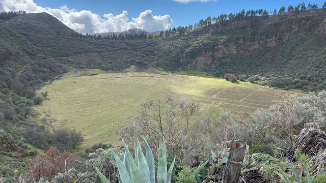
Bandama Caldera is the volcanic crater at the centre of the Bandama Natural Monument, part of the Tafira Protected Landscape on Gran Canaria. Geologically it is a maar, opened by eruptions about 2,000 years ago, the most recent volcanic activity recorded on the island. The crater is about 1,000 m wide and 200 m deep, and its rim reaches 569 m at Pico de Bandama. Volcanic ash in several colours covers the floor, and inside the crater grows an endemic bush, the Dama de Bandama (Parolinia glabriuscula), found nowhere else.
Bandama Caldera
Local name: Caldera de Bandama
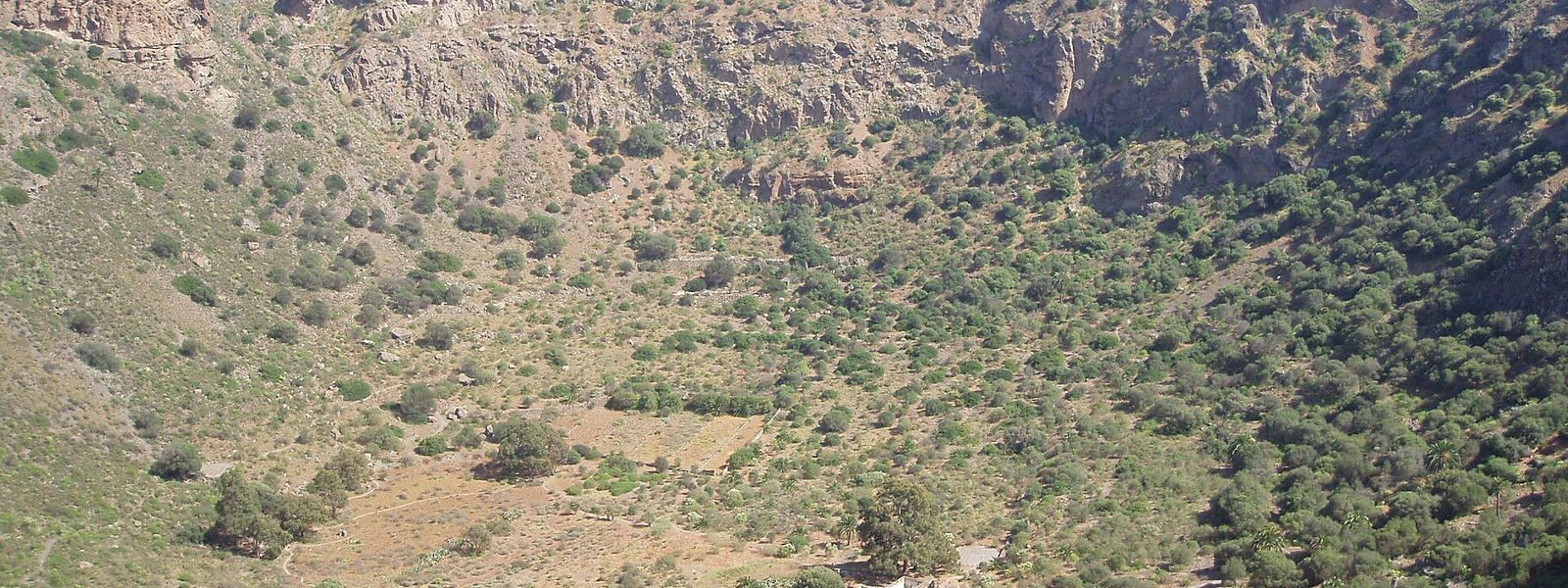
Volcanic crater about 1 km wide and 200 m deep, with a marked rim trail and a path down to its floor
- Accessibility
- The trails are rocky and uneven, with a steep path down to the crater floor. The Mirador de Bandama viewpoint can be reached by car.
- Parking
- Free roadside spaces along the road, hard to find. The golf club car park, about 410 m away, is for customers only; another car park lies about 530 m away.
- Difficulty
- Rim loop: 3.5 km, about an hour on a marked, rocky path, uneven in places and slippery. The path to the floor is steeper and tougher, with a climb back out of a crater 200 m deep.
- Transport
- Bus to the Bandama stop, about 600 m away in a straight line.
- Address
- Bandama Caldera, Las Palmas, Spain
What makes it special
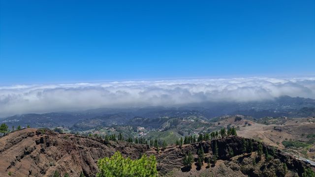
From the rim the ground falls 200 m into a bowl about a kilometre across, and on a clear day the same path looks the other way, out to the ocean. The marked loop around the edge runs 3.5 km and takes about an hour, with the crater beside you the whole way.
A second path drops to the floor. Down there the volcanic ash shows in different colours, and the walls rise on every side. Inside the crater grows the Dama de Bandama, a bush found nowhere else.
The eruptions that blew the crater open happened about 2,000 years ago, the most recent volcanic activity recorded on Gran Canaria. For the view without the walk, you can drive right up to the Mirador de Bandama viewpoint.
Good to know
- The trails are rocky and turn slippery going down and climbing up. Wear shoes with real grip.
- The rim loop is the easier walk, though uneven in places. The path to the floor is steeper and harder; skip it in the midday heat.
- There is no drinking water near the crater. Bring all you need, above all for the climb back out of the floor.
- Parking is awkward: spaces line the road, and the golf club car park nearby is for customers only.
- Toilets: a paid one about 420 m away and a free one about 610 m away, both in a straight line.
Getting there
The crater lies not far from Las Palmas de Gran Canaria, and you can drive right up to the Mirador de Bandama viewpoint. For the walks, parking is the awkward part. Spaces line the road and go to whoever finds them; the golf club car park, about 410 m away, is for customers only, and another car park lies about 530 m away.
By bus, the stop is called Bandama, about 600 m away in a straight line. Information boards for the Bandama Natural Monument stand about 390 m away. From the road everything is on foot: the 3.5 km loop around the rim, or the steeper path down to the floor.
Best time to visit
Best: early morning, on a clear day.
Avoid: the path down to the floor in the midday heat, and the rocky trails straight after rain.
The climb back out of a crater 200 m deep is the hardest part of the visit and heavy going in full sun, wet rock makes the slippery paths worse, and the ocean view from the rim needs clear air.
Sun & daylight
Nearby Places
Similar Places
Featured in our guides
Bandama Caldera on the map
The rim and crater paths are rocky and slippery, and parts of the rim run along an unfenced drop into the crater. Wear shoes with grip, keep back from the edge and take the descent slowly.
Get directions

Your whole travel map in one place
Get inspired by new places around the world and find the ones worth the journey
Frequently asked questions
How long does the walk around the rim take?
The marked loop around the rim is 3.5 km and takes about an hour. The path is rocky and uneven in places.Can you walk down into the crater?
Yes. A path leads down to the crater floor. It is steeper and harder than the rim loop, the crater is 200 m deep, and the descent is best avoided in the midday heat.Can you see the crater without hiking?
Yes. You can drive right up to the Mirador de Bandama viewpoint and look into the crater from there.When did Bandama last erupt?
The eruptions that formed the crater happened about 2,000 years ago, the most recent volcanic activity recorded on Gran Canaria.Where do you park?
Along the road, where finding a space is awkward. The golf club car park nearby is for customers only.