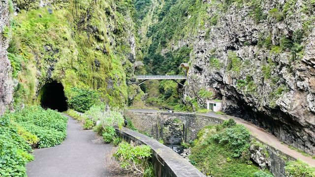
Caminho da Entrosa is a hiking trail on the north coast of Madeira, at Boaventura. From a trailhead where the road ends, the path splits: one branch drops past ruins and follows a stream down to the river mouth, where fresh water meets the Atlantic and a small cave sits by the sea; two others climb to cliffside restaurants above. Walked end to end, the route links Miradouro de São Cristóvão with Arco de São Jorge, with ocean views open along most of it. Parts of the trail are damaged.
Caminho da Entrosa
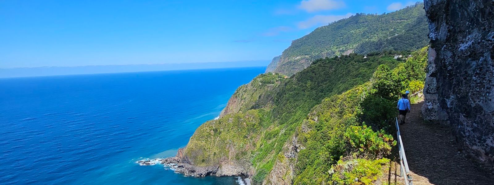
One trailhead, three walks: down to the river mouth where the stream meets the Atlantic, or up either of two paths that end at cliffside restaurants.
- Parking
- Free parking at the trailhead, about 50 m from the start of the path.
- Difficulty
- Steep climb at the start, then easier walking on to Arco de São Jorge and a descent on the way back. Sections of the trail are damaged.
- Transport
- Nearest bus stops are roughly 875 m and 1 060 m from the trailhead; no service reaches the start itself.
What makes it special
The road ends, and the walking starts from the same spot three different ways. Downhill, the path passes ruins, picks up a stream and finishes at the river mouth where the water meets the Atlantic — a place to cool off, with a small cave down by the sea. The two uphill branches both end at cliffside restaurants: 15 minutes to the left, 45 minutes to the right along the cliff. Taken as one traverse, the route runs from Miradouro de São Cristóvão to Arco de São Jorge, and the ocean stays in view for most of it. The steep work comes at the beginning; the middle stretch into the town is easy walking, and the way back is downhill. Tourist traffic does not reach here.
Good to know
- Trail damage: Parts of the path are broken and dangerous in places, and much of the route runs above cliffs.
- No information point: There is no information board near the trailhead; decide which of the three branches you want before setting off.
- Water: Fill up before you start — the nearest water point is roughly 490 m from the trailhead.
- Toilets: The nearest public toilets are about 660 m away and free to use.
- Food on route: Both uphill branches end at cliffside restaurants, one of them O Arco above Arco de São Jorge.
Getting there
Drive to Boaventura and carry on to where the road ends; that point is the trailhead, and the car park is right there. Nothing has to be walked in before the walk itself. All three branches leave from the same spot, so whichever you take, you finish back at the car. Buses do not come up to the trailhead.
Things to do nearby
All tours in São Vicente on GetYourGuide
Paid links: booking through them supports YowJourney.
Sun & daylight
Nearby Places

Similar Places



Caminho da Entrosa on the map
The trail is damaged and dangerous in places, and much of it runs along cliff edges above the Atlantic. Turn back rather than force a way through a broken section.
Get directions

Your whole travel map in one place
Get inspired by new places around the world and find the ones worth the journey
Frequently asked questions
Where does the trail go?
Walked end to end, it runs from Miradouro de São Cristóvão to Arco de São Jorge, with Atlantic views along most of the way. Shorter versions start and finish at the trailhead.How long are the climbs from the trailhead?
The left-hand climb reaches a cliffside restaurant in about 15 minutes. The right-hand one takes about 45 minutes to a second restaurant, along the cliff.What condition is the path in?
Damaged. Sections of it are broken and dangerous, which matters more here because the route runs above cliffs.Can you get into the water?
The downhill branch ends at the river mouth, where the stream meets the ocean. It is used for cooling off and water play, and there is a small cave by the sea.Is it busy?
No. The trail sits off the standard Madeira circuit and stays quiet, which is much of the reason people walk it.