Chorreras del Cabriel is a natural monument in the province of Cuenca, Castile-La Mancha, set on a 2.5 km stretch of the river Cabriel between the Víllora dam and the confluence with the Guadazaón, on the boundary between the municipalities of Enguídanos and Víllora. The river runs over a Quaternary tufa build-up resting on Jurassic limestone, and the stretch holds waterfalls, pools, gorges and caves cut into the side walls. It was declared a natural monument in June 2019 and covers 264 hectares.
Chorreras del Cabriel
Local name: Las Chorreras del Cabriel
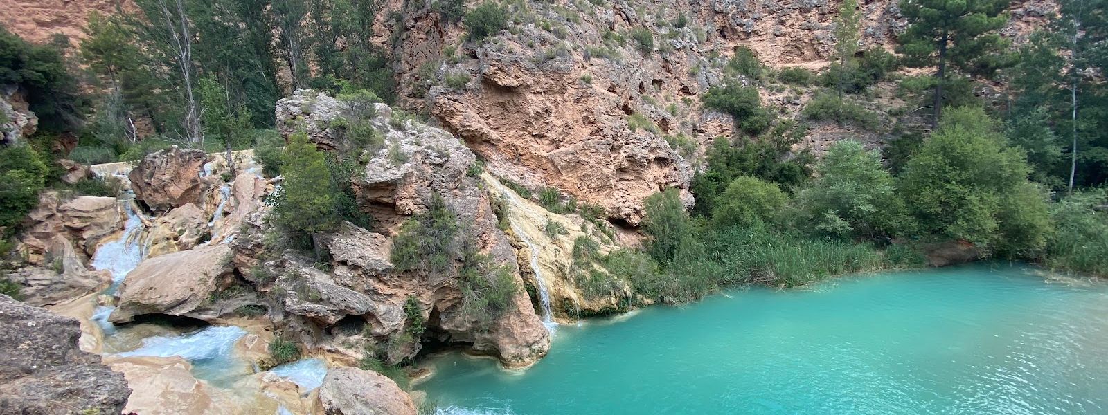
Protected tufa gorge on the river Cabriel, with stepped cascades and pools of clear water.
- Accessibility
- No step-free entrance and no accessible parking bay; the car park surface is bare ground.
- Parking
- Paid car park (Las Chorreras) about 224 m away, ground surface, for customers and cars only; a second area for vehicles about 363 m off. Parking on the roadside outside the carriageway is fined.
- Difficulty
- On foot from a car park about 224 m away; rock beside the water is wet and slippery.
- Transport
- None — no bus stop within 5 km.
- Hours
- Open daily, 10:00–20:00.
- Address
- El Salto de, 16372 Víllora, Cuenca, Spain
What makes it special
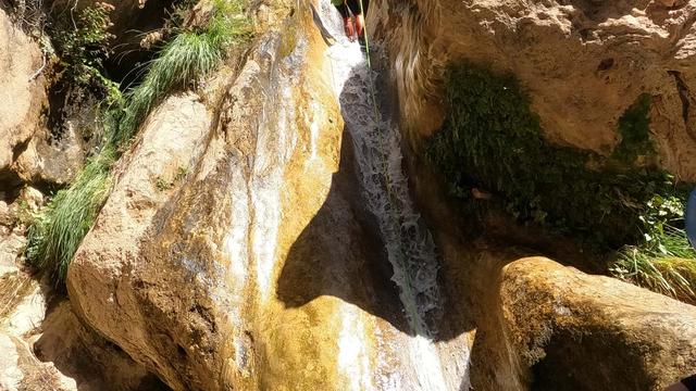
The water comes down a staircase of pale tufa, a thousand metres of it, ledge after ledge with pools set into the rock between them. The stone is not bedrock the river found but stone the river built, out of the lime it carries, and the stromatolite surfaces here are still partly alive and still laying down new rock. The laminations reach four metres thick, and the plant imprints held in them are unmatched anywhere else in the Iberian peninsula for variety and abundance. By the sheer bulk of its carbonate deposits the site ranks as the fourth most important Quaternary fluvio-lacustrine system in Iberia.
Around the water the slopes carry Aleppo pine and holm oak, the banks white poplar and willow. Kingfishers and dippers work the river, and peregrines nest on the limestone cliffs above the canyon.
Good to know
- Parking decides the day. The car park takes cars only, and the verge is fined — from anywhere legal the walk in runs about 5 km.
- Campervans are turned away. The nearest place to leave one is in the village, 5.7 km off, and no taxi service runs from there.
- No toilets and no drinking water within 800 m. Bring what you need for the day.
- The GR 66 passes close by. A guidepost for the Víllora–Enguídanos–La Pesquera route stands about 575 m away.
- Children do well here — the pools and the smoothed rock are the whole point of the visit, though wet tufa is slippery underfoot.
Getting there
Arrival is by car, and there is no alternative: no bus stop lies within 5 km of the site, which sits on the Cabriel between Enguídanos and Víllora. The Las Chorreras car park is about 224 m away, on bare ground, and a second area for vehicles about 363 m off; the last stretch from either is on foot.
The car park admits cars only. A campervan gets sent back to the village, 5.7 km away, with no taxi to bring you in from there. Leaving a vehicle on the side of the road outside the carriageway is fined, and the walk in from anywhere it is legal to stop runs about 5 km — which makes a space in the car park the single thing worth planning around. The waymarked GR 66 between Víllora, Enguídanos and La Pesquera passes within about 575 m, with a guidepost on it.
Best time to visit
Best: at opening, before the car park fills. A space there decides whether the day is a short walk to the water or a long trudge along a road.
Avoid: turning up once it is full. Parking outside the carriageway is fined, and from anywhere legal the walk back to the river is about 5 km.
The pools are the reason to come, so warm weather is what suits the place; in cold or wet weather there is a canyon to look at and not much else to do in it.
Access & restrictions
The whole stretch, 264 hectares of it, has been a declared natural monument since 2019, and the parts a visitor actually walks on are the protected ones: the tufa terraces, the canyon walls, the natural falls and the stromatolite build-ups are all listed in the regional catalogue of specially protected habitats and geomorphological features. The rock that makes such a good slide is a living deposit still forming — nothing should be broken off, carved or carried away. The otters, kingfishers, dippers and cliff-nesting peregrines along this stretch are protected species under the regional catalogue of threatened species.
Sun & daylight
Nearby Places

Similar Places
Chorreras del Cabriel on the map
Tufa is slippery wherever water runs over it, and the river drops through a gorge with unfenced edges above the pools. Move slowly on wet rock and keep children back from the lip of the falls.
Get directions

Your whole travel map in one place
Get inspired by new places around the world and find the ones worth the journey
Frequently asked questions
Can you swim at Chorreras del Cabriel?
Yes. The site is known for swimming and walking around the forested canyon, with cascades and pools of translucent water. The smoothed rock beside the falls is slippery wherever it is wet.Is there parking?
There is a paid car park about 224 m away on bare ground, and a second area for vehicles about 363 m off. Leaving a car on the side of the road outside the carriageway is fined, and the walk in from anywhere legal is about 5 km.Can you come by campervan?
No. The car park admits cars only. The nearest place to leave a campervan is in the village, 5.7 km away, and no taxi service runs from there.Is there public transport?
No. There is no bus stop within 5 km of the site, so the approach is by car.Are there toilets or drinking water on site?
Neither is to be found within 800 m. Bring water and plan accordingly before setting out.