Hellnar View Point stands above the shore at Hellnar, an old fishing village on the westernmost part of the Snæfellsnes peninsula in West Iceland. The ground falls away to basalt cliffs, sea arches and the open North Atlantic. Below the village is Valasnös, a cliff that juts into the sea with a cave tunnelled into it. The site lies within Snæfellsjökull National Park, and a coastal path links Hellnar with Arnarstapi.
Hellnar View Point
Local name: Hellnar
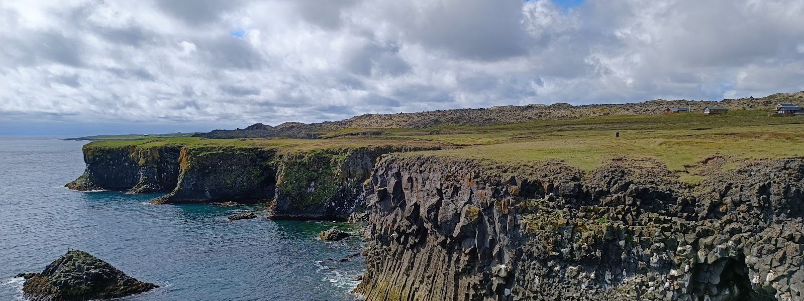
A cave tunnels into Valasnös, the cliff that juts into the sea at Hellnar, and its colours change with the daylight and the movement of the water.
- Entrance
- Free
- Accessibility
- Limited — uneven path and steps to the shore
- Parking
- Free car park on site.
- Difficulty
- A path leads down from the viewpoint to the rocks and the beach; the descent is easy in fair weather.
- Transport
- Self-drive — Hellnar turn-off (Route 574)
- Hours
- Open 24 hours, every day.
- Address
- Hellnavegur, 356 Snæfellsbær
What makes it special
The viewpoint sits on the edge of an old fishing port. Hellnar was the busiest fishing centre on Snæfellsnes, and the oldest written record of it as a port dates from 1560. The census of 1703 counted 194 inhabitants. What draws people now is the shore below. Basalt cliffs, sea arches and islets break up the water, and there are birds everywhere — on the rocks, on the water, in the air. Seals come in close. Among the rock formations is Valasnös, a cliff that pushes out into the sea, with a cave tunnelled into it whose colours change with the daylight and the movement of the water.
Good to know
- Wind: the coast is exposed and the wind gets up in the afternoon, hard enough to make walking around unpleasant.
- Birds: seabirds gather on the cliffs, the islets and the water below, so bring binoculars if you have them.
- Coastal path: the Arnarstapi–Hellnar path links the two villages along the shore and passes here.
- Nearby: Hellnar Church stands in the village, worth a stop on the way in or out.
Getting there
The viewpoint is reached by road, on the way down into Hellnar, and there is a car park at the site. From the top a path leads down to the rocks and the beach below; in fair weather the descent is easy. The coastal path between Hellnar and Arnarstapi runs along this shore, so the viewpoint also serves as a start or a finish for that walk.
Best time to visit
Better: clear, calm days, when the descent to the beach is easy and the whole sweep of coast is open.
Avoid: windy afternoons.
Wind is the deciding factor here. It gets up in the afternoon and can make it hard to walk around or to hold a camera steady. On a still day people sit in the grass at the top and watch the birds on the islets.
Sun & daylight
Nearby Places

Similar Places


Hellnar View Point on the map
The wind comes straight off the open Atlantic and can be strong, and the ground drops to basalt cliffs and the sea. Keep back from the edge, and go down to the rocks and the beach only in fair weather.
Get directions

Your whole travel map in one place
Get inspired by new places around the world and find the ones worth the journey
Frequently asked questions
Is Hellnar View Point windy?
It can be. The coast is exposed, and the wind gets up in the afternoon, strong enough to make walking around difficult.Is the viewpoint inside a national park?
Yes. It lies within Snæfellsjökull National Park, at the western end of the Snæfellsnes peninsula.What wildlife can be seen here?
Seabirds are the main sight, on the cliffs, the islets and the water. Seals come in close to shore, and whales are seen further out.Can you walk from Hellnar to Arnarstapi?
Yes. A coastal path links the two villages, and it is a popular walk on Snæfellsnes.