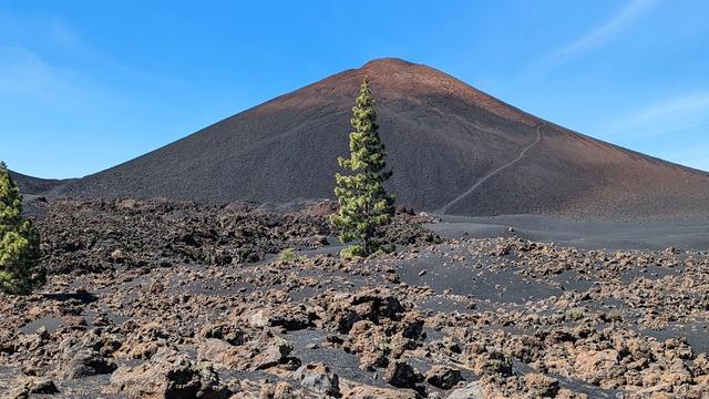
Pico Viejo is a volcano in the centre of Tenerife, in the Canary Islands, and the archipelago's second-highest peak after Teide, with a summit at 3,129–3,135 metres. It belongs to the Teide volcanic complex, which began forming about 200,000 years ago, and its crater, about 720 metres across, is one of the satellite craters around Teide. Its last eruption, in 1798, lasted three months and poured out around 12 million m³ of lava, leaving the black flows of the Narices del Teide on its flank.
Pico Viejo
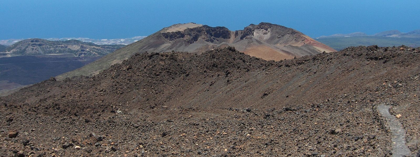
Volcano beside Teide with a crater about 720 metres wide and black lava fields from its 1798 eruption.
- Entrance
- No ticket. Reports differ on whether trail 23 to the summit needs a Teide National Park permit.
- Accessibility
- Not accessible by wheelchair or with limited mobility: the summit is reached only on foot, by mountain trail with around 1,000 metres of ascent over rock and gravel.
- Parking
- Free car park at Mirador Narices del Teide, about 3.7 km in a straight line from the summit, and a second free car park about 4.7 km away. The car park at Mirador de La Ruleta by Roques de García also serves the climb and fills up early.
- Difficulty
- Strenuous day hike: about 14 km return from Mirador de La Ruleta with roughly 1,000 metres of ascent, four to five hours. No scrambling; steady climb on rock and gravel, cold wind near the top, ice in winter.
- Transport
- Nearest bus stop: Teleférico del Teide, about 4.7 km in a straight line from the summit.
- Advance booking
- Reports differ on whether trail 23 needs a Teide National Park permit; check with the park before you go.
- Hours
- Open mountain ground with no set hours.
- Address
- Pico Viejo, 38300, Santa Cruz de Tenerife, Spain
What makes it special
At the rim the crater opens at your feet, about 720 metres across — roughly seven football pitches laid end to end — with Teide's cone rising right beside it. From the summit the whole volcanic landscape of the park runs out towards the Atlantic.
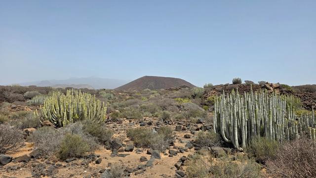
The colours are what stay with you. The lava fields shift from rust and ochre to grey, and the black flows of 1798 cut through them, darker than anything else on the mountain. It is quiet up here, with only the wind for company.
The climb is honest work: a steady ascent over rock and gravel with no scrambling, on a path marked with metal plates the whole way.
Good to know
- No shops, cafés or drinking water on the way up; the last are at the car park. Carry all the water you need.
- Wind and cold arrive in the last stretch below the summit, however hot it is at the start. Pack a jacket.
- Reports differ on whether trail 23 needs a national park permit. Check with Teide National Park before you set out.
- The car park at Mirador de La Ruleta, by Roques de García, fills fast. Arrive early.
- Trail 28 on the descent crosses sliding stones and sand. Wear boots with good grip.
Getting there
You arrive by car at one of the park's roadside car parks and walk the rest. Pico Viejo can be climbed from the road on its west and south-west sides, from the Parador, or from Mount Teide itself.
The shortest approach from the west and south-west starts at the Mirador Narices del Teide car park, about 3.7 km in a straight line from the summit. On the Parador side, the route leaves from the car park at Mirador de La Ruleta beside Roques de García: about 14 km there and back with roughly 1,000 metres of ascent, four to five hours in all, and a path marked with metal plates over hard rock and gravel. Another way up follows trail 26 from Llano de Ucanca, then trails 3 and 23, about four hours to the top with rests.
The nearest bus stop, Teleférico del Teide, sits about 4.7 km in a straight line from the summit.
Best time to visit
Best: an early start on a clear day outside winter.
Avoid: winter, and any late start.
The La Ruleta car park fills early and the round trip takes four to five hours on open volcanic ground with no shade at midday, while in winter slippery ice lies on the trail near the top.
Access & restrictions
Pico Viejo lies inside Teide National Park. Keep to the numbered, marked trails — trail 23 leads to the summit — and leave rocks, lava and plants where they are. Reports differ on whether trail 23 needs a park permit, so check with Teide National Park before setting out.
Sun & daylight
Nearby Places

Similar Places


Pico Viejo on the map
In winter slippery ice lies on the trail near the summit, and above 3,000 metres the wind turns cold whatever the weather below. Wear boots with grip, carry a jacket and plenty of water, and keep back from the unfenced crater rim.
Get directions
Your whole travel map in one place
Get inspired by new places around the world and find the ones worth the journey
Frequently asked questions
How long does it take to climb Pico Viejo?
From Mirador de La Ruleta the round trip is about 14 km with roughly 1,000 metres of ascent and takes four to five hours. Going up by trail 26 from Llano de Ucanca, then trails 3 and 23, takes about four hours to the summit with rests.Do I need a permit to climb Pico Viejo?
Reports differ on whether trail 23 to the summit needs a permit. Check with Teide National Park before you go.Is the climb technical?
There is no scrambling. It is a steady ascent over hard rock and gravel on a path marked with metal plates; the distance is the main challenge. Near the top the wind turns cold, and in winter there can be ice.Where do hikers park for Pico Viejo?
The shortest approach from the west and south-west starts at the Mirador Narices del Teide car park. From the Parador side, hikers start at the Mirador de La Ruleta car park by Roques de García, which fills up early.When did Pico Viejo last erupt?
In 1798. The eruption lasted three months and poured out around 12 million m³ of lava, which formed the black surface of the Narices del Teide.