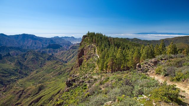
Pilancones Natural Park covers about 5,794 hectares of San Bartolomé de Tirajana municipality in southern Gran Canaria, bordered by the Roque Nublo protected area to the north and the Fataga protected area to the east. Ravines run south through it, and Canary pine forest holds the hilltops, with abundant birdlife. First protected in 1987, it is also a special protection area for birds. The name comes from pilancones, the natural pools left behind after runoff.
Pilancones Natural Park
Local name: Parque Natural de Pilancones
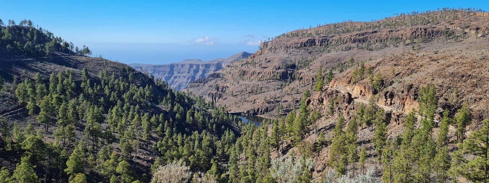
Natural park of rugged southward-running ravines and hilltop Canary pine forest on Gran Canaria
- Entrance
- Free.
- Parking
- Two car parks about 3.3 km away in a straight line.
- Difficulty
- Moderate hiking over rugged mountain ground, much of it open with no shade.
- Transport
- No bus stop near the park.
- Hours
- Open at all times.
- Address
- GC-505, 97, 35128 San Bartolomé de Tirajana, Las Palmas, Spain
What makes it special
From the high ground the ravines fall away southward in bare folds of rock, like a Grand Canyon cut down to island size. Canary pine holds the hilltops, a well-preserved forest with plenty of birds in it, and cactus and spurge grow among the rocks. After rain, water collects in natural pools, the pilancones that gave the park its name.
The park was also home to the Pino de Pilancones, a Canary pine 30 to 40 m tall that ranked among the hundred most notable trees in Spain. The fires of summer 2007 doomed it, and a storm brought it down in 2008. A sample studied in Madrid dated it to around the winter of 1457–1458, the oldest age known for any Canary pine.
Good to know
- No shade, no water. Much of the ground is open, and there are no toilets or drinking water nearby. Carry plenty to drink and sun protection.
- No bus. No bus stop serves the park, so plan on a car or a guided trip.
- Car parks sit well out. The nearest mapped car parks are about 3.3 km away in a straight line; expect to walk in.
- Open drops. Viewpoints look straight down into the ravines, which is hard going for anyone uneasy with heights or wide open space.
Getting there
No bus stop serves the park, so the approach is by car or with a guided trip. The nearest mapped car parks lie about 3.3 km away in a straight line, and from there the rest is on foot or by mountain bike: the park's trails carry both hikers and riders. The information point at Cruz de Agustina is a useful landmark once you are inside. Fill your bottles before you set out, as there is no drinking water and no toilets nearby.
Best time to visit
Best: early morning or late afternoon, in the cooler months of the year.
Avoid: the middle of a summer day.
The south of Gran Canaria is the island's hot, dry side, and the open ravine ground offers no shade once the sun is high. The pools that name the park only hold water after rain, which on Gran Canaria falls mostly in winter.
Sun & daylight
Nearby Places

Similar Places

Pilancones Natural Park on the map
Ravine edges are unfenced and the ground drops away sharply; keep well back from them. There is no shade and no water nearby, so carry plenty and stay out of the midday heat.
Get directions

Your whole travel map in one place
Get inspired by new places around the world and find the ones worth the journey
Frequently asked questions
Is there an entry fee for Pilancones Natural Park?
No. Entry is free and the park is open at all hours.How hard is the hiking?
The hiking is moderate. Much of the ground is open with no shade, so bring water and sun protection.Can you reach the park by bus?
No bus stop serves the park. Come by car or on a guided trip; the nearest mapped car parks are about 3.3 km away in a straight line.What happened to the Pino de Pilancones?
The great Canary pine, dated to around the winter of 1457–1458, was fatally weakened by the fires of 2007 and brought down by a storm in 2008.