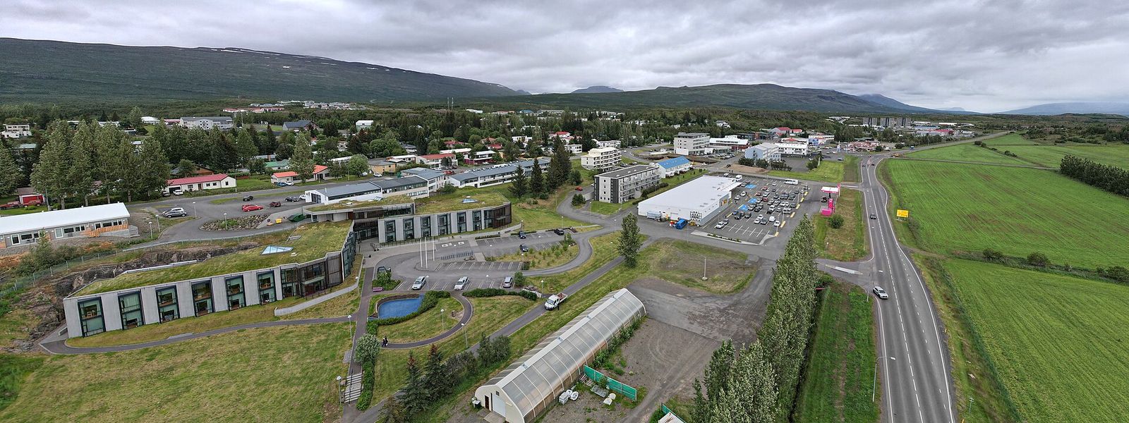
Egilsstaðir is a town of about 2,600 people in east Iceland, on the banks of the Lagarfljót river. It is the largest settlement in the east and the region's main service, transport and administration centre, with an airport, a health clinic and a gymnasium. The town was incorporated in 1947 and takes its name from a farmstead rather than from a landmark, which is unusual in Iceland. It stands by the bridge over Lagarfljót, where the Ring Road and the main routes east meet, and works as a base for Fljótsdalur, Hengifoss and Hallormsstaðaskógur.
Egilsstaðir
- Currency
- Icelandic króna (ISK)
- Language
- Icelandic; nearly all speak English
- Power plug
- Europlug and Schuko sockets, 230 V
- Visa
- Schengen; outside the EU
- Time zone
- UTC±00:00 (Atlantic/Reykjavik)
- Tap water
- Safe; hot water smells of sulphur
- Tipping
- Not customary
- Emergency
- 112
Things to do
All tours in Egilsstaðir on GetYourGuide
Paid links: booking through them supports YowJourney.
When to go
High season
Jun – Aug
Daytime highs often pass 15 °C, warmer than most of Iceland; the airport recorded 29.8 °C on 16 August 2025. At 65°N it stays light almost around the clock, and nights are still cold.
Shoulder
Sep – Oct
Daylight shortens quickly and nights cool off faster than on the coast. The weather here changes without warning.
Low season
Nov – Mar
January is the coldest month, and winters run colder than in the coastal towns nearby, though temperatures rarely drop far below zero. Daylight is down to a few hours.
Shoulder
Apr – May
Days lengthen fast and temperatures stay moderate. Snow lingers inland longer than on the coast.
How long to stay
A day is enough for the town itself, which is small and built around services rather than sights. Two or three nights make sense if you use it as a base. That covers Hengifoss and Skriðuklaustur in Fljótsdalur, the forest at Hallormsstaðaskógur, and Seyðisfjörður over Road 93 to the east.
Getting around
The town is small and walkable: the longest walking path in Egilsstaðir runs 3.2 km. Most of East Iceland shares one public bus system, split into 23 fare areas. A single ride inside the town costs 350 kr, ten tickets cost 3,150 kr, and children under 16 pay 175 kr. The longest route runs from Borgarfjörður, north of the town, to Höfn. Cycling works if you can handle a few hills and strong headwinds; the Lagarfljót bridge takes you over to Fellabær, which sits close by.
If you plan to travel only between the towns of East Iceland, the buses cover it and a car is not necessary. For anywhere beyond them, drive. Car hire desks are at Egilsstaðir Airport, between the town and Fellabær.
What to see

Destinations in Egilsstaðir
Frequently asked questions
How do you get to Egilsstaðir?
The Ring Road (Road 1) enters the town from the north and the south. Road 93, Seyðisfjarðarvegur, comes in from the east and links the town to Seyðisfjörður. Egilsstaðir Airport, between the town and Fellabær, takes Icelandair's domestic flights from Reykjavík.Do you need a car in Egilsstaðir?
Not for the town itself. It is small, the longest walking path is 3.2 km, and buses connect most of East Iceland. For anything outside the town, drive; car hire is available at the airport.Can you arrive by ferry?
Yes, indirectly. The Smyril Line ferry runs weekly from Hirtshals in Denmark via the Faroes to Seyðisfjörður. From there Road 93 leads to Egilsstaðir, and the local bus stops downtown and at the airport.What is worth seeing near Egilsstaðir?
Hallormsstaðaskógur, the largest forest in Iceland; the waterfall Hengifoss in Fljótsdalur; Skriðuklaustur, the mansion of the writer Gunnar Gunnarsson; and the Kárahnjúkar Hydropower Plant. Öxi, the mountain road to Djúpivogur, runs south from the town.Is Egilsstaðir warmer than the rest of Iceland?
In summer, often. The town lies inland at low elevation, shielded from sea winds, and it regularly records the highest summer temperatures in the country. Winters, in exchange, are colder than in neighbouring towns, and nights are colder year round.