Fagradalsfjall is a tuya volcano on the Reykjanes Peninsula in Iceland, around 20 km from Keflavík International Airport. Its highest summit, Langhóll, reaches 385 m. After 6,000 dormant years the mountain erupted on 19 March 2021, then again in August 2022 and in July 2023. All three eruptions were effusive and built a new lava field, Fagradalshraun, across the valleys around the mountain. A marked trail from the road near Grindavík leads out to viewpoints over it, and an estimated 700,000 people have walked in since 2021.
Fagradalsfjall
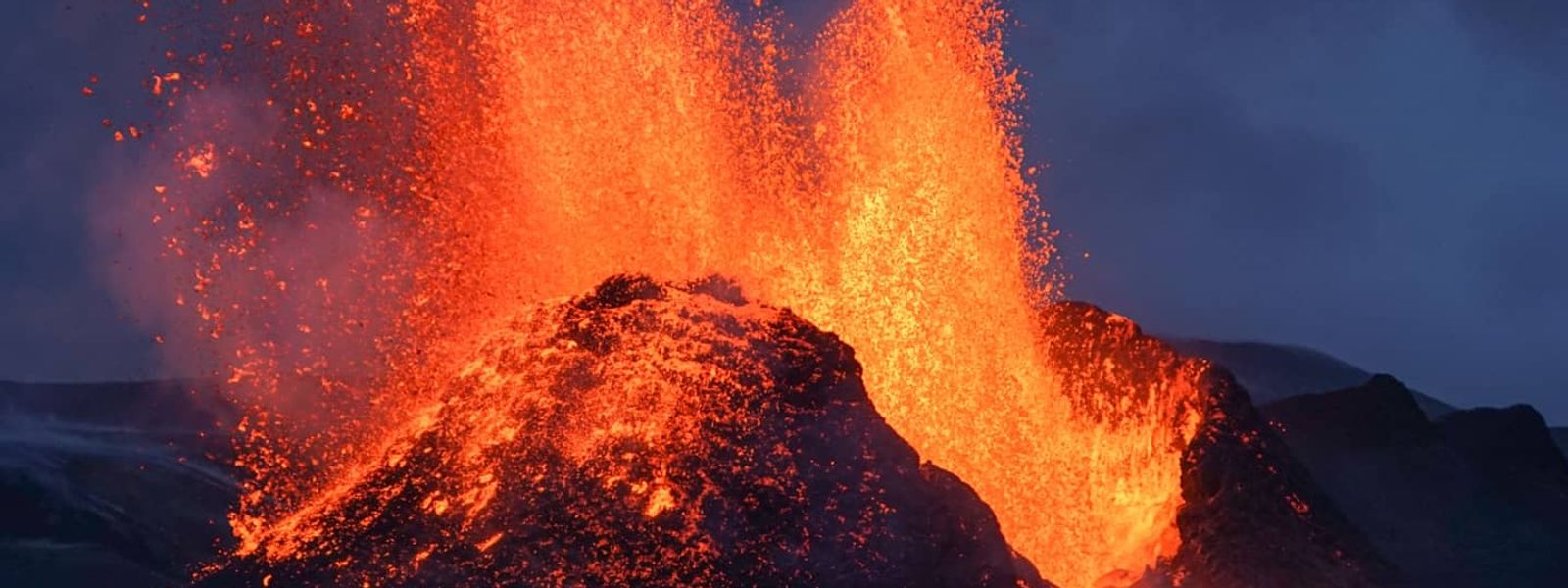
The Reykjanes Peninsula had gone 815 years without an eruption when a fissure opened here on 19 March 2021, and Fagradalsfjall itself had been quiet for 6,000 years.
- Accessibility
- No wheelchair access: the approach is a hiking trail over uneven rocky ground, steep in places.
- Parking
- Limited parking at the trailhead, off paved Road 427 from Grindavík.
- Difficulty
- Hiking route over uneven rocky ground, steep in places and poorly signed. About 3 km one way to the first viewpoint; 6–8 km each way and 3–6 hours of walking to the eruption sites.
- Transport
- Self-drive to trailheads off Road 427
What makes it special
The draw here is the ground itself. Three eruptions between 2021 and 2023 poured fresh basalt into the valleys around the mountain, and the field they left is black, sharp and still steaming in places. Vents and openings sit in the crust, which is why the trail across it is marked and why you stay on it. Walking on lava is harder than it looks: the surface is uneven and easy to slip on. From the first viewpoint the field is laid out below, and the craters are still kilometres beyond it.
Good to know
- Footwear: hiking boots are essential, and walking poles help on the lava.
- Weather: in mist and rain visibility drops and the signing becomes hard to follow. There is nothing to see from the viewpoints in low cloud.
- Stay on the trail: the cooled lava has steaming vents and openings, and the marked route exists to keep walkers clear of them.
- Injuries: broken ankles, hypothermia and lost walkers are the usual call-outs here. The weather changes fast.
- Closures: the site is open most of the time, but it has been shut in bad weather and evacuated for fast-moving lava.
Getting there
The road goes as far as the start of the walk and no further: paved Road 427 from Grindavík, with a car park at the trailhead. Everything beyond that is on foot — about 3 km one way to the first viewpoint at Storhóll, and 6–8 km each way on the longer routes out to the eruption sites.
Best time to visit
Better: clear, dry days.
Avoid: mist, rain and low cloud.
The reward here is the view over the lava field, and in low cloud there is nothing to see even from beside it. Poor visibility also makes the signing hard to follow, which matters on a route that is long, rocky and steep in places.
Sun & daylight
Nearby Places



Similar Places


Fagradalsfjall on the map
Volcanic gas builds up depending on wind direction, and it has made parts of the area inaccessible. The lava field is sharp and uneven, and broken ankles are among the injuries recorded here. Weather turns fast, and hypothermia and lost walkers are on the rescue teams' record. Never step off the marked trail: the cooled crust hides steaming vents and openings.
Get directions

Your whole travel map in one place
Get inspired by new places around the world and find the ones worth the journey
Frequently asked questions
Is Fagradalsfjall still erupting?
The three eruptions ran from 19 March to 18 September 2021, from 3 to 21 August 2022, and from 10 July to 5 August 2023 near Litli-Hrútur. Activity ceased on 5 August 2023. Scientists expect the wider area to stay volcanically active for years.How long is the walk?
About 3 km one way to the first viewpoint, so 6 km there and back. The longer routes across to the eruption sites run 6–8 km each way and take 3–6 hours of walking, not counting stops.Can you walk on the lava field?
A marked trail crosses it, and that is where to stay. The cooled crust has steaming vents and openings, and the surface is uneven enough to trip on.What should I bring?
Hiking boots, and walking poles if you have them. Wind- and waterproof layers as well: the weather changes fast, and hypothermia is one of the common problems here.Does the site ever close?
Yes. The authorities keep it open most of the time and prefer to inform rather than ban, but it has been closed in bad weather and evacuated for fast-moving lava. In busy periods volunteers from the Icelandic Association for Search and Rescue and local police are on site.