Los Ajaches is an ancient volcanic massif in the south of Lanzarote, stretching from Punta del Papagayo at the island's southern tip to near Playa Quemada. Its volcanoes are estimated at around eleven million years old, and erosion has worn them down into rounded ridges and broad valleys, their slopes whitened by caliche crusts. The massif is protected as a natural monument and a special protection area for birds. Its viewpoint summit, Atalaya de Femés, rises above the village of Femés.
Los Ajaches Natural Monument
Local name: Monumento Natural de Los Ajaches
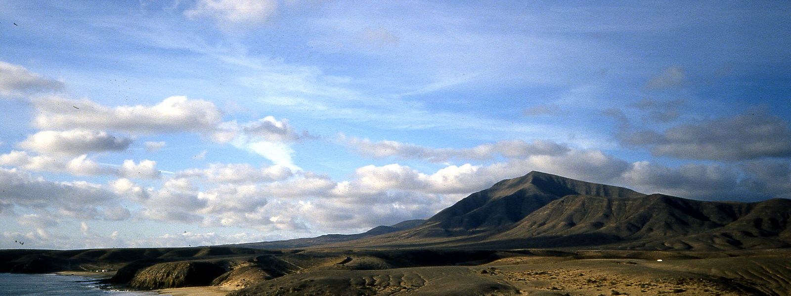
Eroded volcanic massif in southern Lanzarote, with a 360-degree summit view over Playa Blanca to Fuerteventura.
- Entrance
- Free; there is no ticket.
- Accessibility
- Not wheelchair accessible: there is no accessible parking, and the summit is reached only on foot by a climbing track.
- Parking
- Parking in Femés village, about 750–780 m away in a straight line; one area is asphalted.
- Difficulty
- A straightforward hike: about 35 minutes and 200 m of ascent on a signed, gradual track, with no shade and a windy, exposed summit.
- Transport
- Bus stop Iglesia de Femés, in Femés village, about 800 m away in a straight line.
- Advance booking
- No booking needed.
- Hours
- Open at any time; this is open hillside.
- Address
- 35570 Yaiza, Las Palmas, Spain
What makes it special
Turn a full circle on top of Atalaya de Femés and the south of Lanzarote is laid out below you: the volcanic landscape rolling away inland, the white houses of Playa Blanca on the coast, and Fuerteventura across the water.
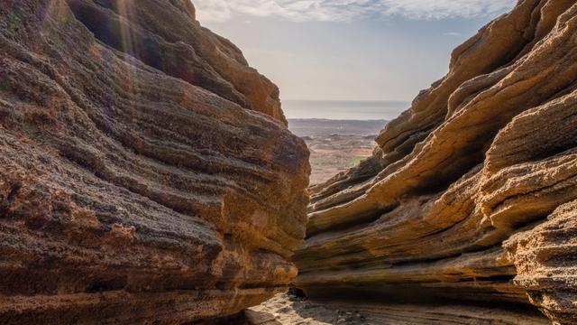
The ground itself is old. These volcanoes are put at around eleven million years, and erosion has rounded them into soft ridges with wide valleys between. The slopes are not terraced, and caliche crusts give them a pale, chalky cast. In the Femés valley, dry grassland and fields of onions, beans, watermelon and tomatoes sit against the bare rock.
The summit rewards a little extra time. A volcanic crater lies just below the top, and an easy walk runs along the ridge. A shelter just under the summit makes a good place to sit with something to eat and the view.
Good to know
- There are no toilets or drinking water near the summit. Bring water with you.
- The hillside is bare, with no shade on the way up or at the top.
- The track to the summit is no road for a hire car. Leave the car in Femés and walk.
- The wind on the summit builds in the heat of the day. Bring a layer and keep hold of hats.
- The top is shared with communications facilities, which is why the track up is well maintained.
Getting there
The walk starts in Femés. There is parking in the village, about 750–780 m away in a straight line, and one of the areas is asphalted. The nearest bus stop, Iglesia de Femés, is about 800 m away in a straight line.
From the village, follow the LZ-702 for roughly a mile, then branch left onto the track that climbs to the summit. The ascent is gradual and signed: about 35 minutes and 200 m of height gain. The track is kept in good order for the communications facilities at the top, but it is no road for a hire car, so walk it. The views open up across the volcanic landscape well before you reach the summit.
Best time to visit
Best: early morning or late afternoon, on a clear day.
Avoid: the middle of a hot day, and days of haze.
The hillside has no shade, the wind on the summit picks up in the heat of the day, and haze can hide Fuerteventura, which is half the reason to climb.
Access & restrictions
Los Ajaches is a protected natural monument and a special protection area for birds (ZEPA), and it is also classed as an area of ecological sensitivity. Keep to the existing tracks and paths, leave rocks and plants where they are, give nesting birds a wide berth, and take all litter back down with you.
Sun & daylight
Nearby Places
Similar Places
Los Ajaches Natural Monument on the map
The summit and ridge are exposed, and the wind there turns strong in the heat of the day. Keep back from the edges and the crater rim, and turn back if the gusts make your footing unsteady.
Get directions

Your whole travel map in one place
Get inspired by new places around the world and find the ones worth the journey
Frequently asked questions
How long does the climb to Atalaya de Femés take?
The hike is about 35 minutes with around 200 m of height gain, on a signed track with a gradual gradient. Before it, the route follows the LZ-702 from Femés for roughly a mile.Can you drive to the top?
The track to the summit serves the communications facilities there and is no road for a hire car. Park in Femés and walk up.Can you see Fuerteventura from the summit?
Yes. The view runs a full 360 degrees, over the volcanic landscape and Playa Blanca and out to Fuerteventura. Haze can hide it, so pick a clear day.Are there toilets or water on the way?
No. There are no toilets or drinking water near the summit, so carry all the water you need for the walk.Is there anything to see beyond the viewpoint?
A volcanic crater lies just below the summit, and an easy walk runs along the ridge. A shelter just under the top is a good place for a break.