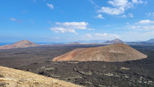
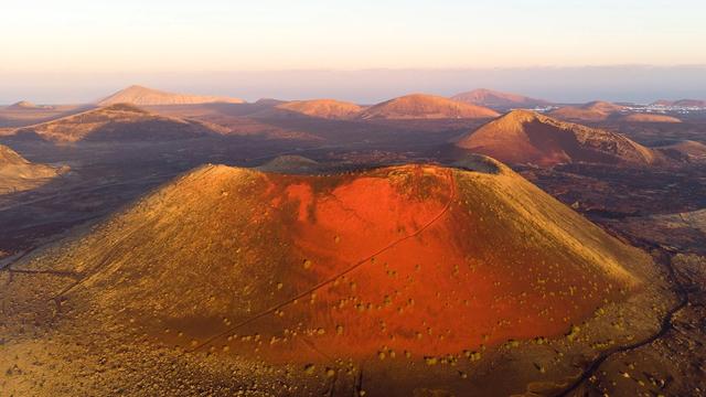
Timanfaya National Park is a protected volcanic landscape in the south-west of Lanzarote, spread across the municipalities of Tinajo and Yaiza. Established in 1974, it covers 51 square kilometres made up entirely of volcanic ground and is the only national park in Spain that is wholly geological. Most of it was formed by the eruptions of 1730 to 1736; the last eruption came in 1824. The park is a core area of the Lanzarote biosphere reserve, and César Manrique's devil figure, El Diablo, is its symbol.
Timanfaya National Park
Local name: Parque Nacional de Timanfaya
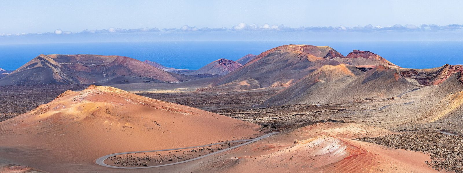
Lava-covered national park shaped by the eruptions of 1730–1736, toured by coach on a closed road.
- Entrance
- €30 (June 2026), paid at the entrance; cards and contactless accepted.
- Accessibility
- Wheelchair-accessible parking, entrance and seating; the slope up from the car park to the main building is steep.
- Parking
- Car park for paying visitors at the main building, about 2 km past the entrance gate; the camel station (Echadero de los Camellos) has its own free car park.
- Difficulty
- Little effort: you drive about 2 km from the gate to the main building, and the tour is about 35 minutes seated in an air-conditioned coach. The slope up from the car park is steep.
- Transport
- No public bus serves the park; come by car or with an organised tour.
- Advance booking
- The fee is paid at the entrance on the day. The two footpaths open only with prior authorisation and a guide.
- Hours
- The last coach tour leaves at 16:00 (June 2026).
What makes it special
Water poured into a hole in the ground comes straight back out as steam. Thirteen metres down, the rock still runs between 100 and 600 °C, nearly three centuries after the eruptions that buried this corner of Lanzarote.
The coach tour is the way into the heart of it. The road is closed to everything else, and it twists for about 35 minutes past rocks, craters and steep drops, with the ground covered in lava on every side. Back at the main building come the short heat demonstrations — a steam geyser and dry brush catching fire — and the El Diablo restaurant, which cooks with the heat of the ground. The demonstrations are what stays with most people, children included.
Good to know
- No public bus reaches the park: you need a car or an organised tour.
- After paying at the gate, cars can queue on the drive to the car park, and a steep slope climbs from there to the main building.
- The coach commentary plays in Spanish, English and German; for another language, download the commentary app before boarding.
- The coach road winds constantly, enough to bring on travel sickness.
- The fire demonstration gets crowded, and small children struggle to see.
Getting there
There is no public bus, so the approach is by car or on an organised tour. You pay at the gate, then keep driving for about 2 km to the main building on the Islote de Hilario, where the car park, the restaurant and the toilets are. At busy times the cars back up along this stretch.
From the car park a steep slope climbs to the building, and the coach tour leaves from there and returns for the heat demonstrations. Camel rides start from a separate spot, the camel station (Echadero de los Camellos), which has its own car park.
Best time to visit
Best: early in the day, with time in hand for the queue of cars between the gate and the car park.
Avoid: the middle of a summer day, and arriving close to the last coach departure.
The lava fields are bare black rock with no shade, and a slow queue at the gate can eat the time you need for the coach tour and the demonstrations.
Access & restrictions
Access to the park is strictly regulated to protect its fragile plant and animal life. The route through the eruption landscape is driven only by the park coaches, on a road closed to other traffic. There are just two footpaths, and both can be walked only with prior authorisation and a guide. Outside those, the lava fields are off limits on foot.
Things to do nearby
All tours in Yaiza on GetYourGuide
Paid links: booking through them supports YowJourney.
Sun & daylight
Nearby Places

Similar Places
Featured in our guides
Timanfaya National Park on the map
Just below the surface the ground is hot enough to turn water into steam almost instantly. Keep children close at the demonstrations and do not touch the vents.
Get directions

Your whole travel map in one place
Get inspired by new places around the world and find the ones worth the journey
Frequently asked questions
Can you walk in Timanfaya National Park?
Only on two footpaths, and both need prior authorisation and a guide. Everyone else sees the eruption landscape from the park coach, on a road closed to other traffic.Can you drive your own car through the park?
Only as far as the main building, about 2 km past the gate. The route through the lava fields is covered by the park coach.How long does the coach tour take?
About 35 minutes. The commentary plays in Spanish, English and German, and an app carries it in other languages.Can you get to Timanfaya by public bus?
No public bus stops at the park. Come by car or with an organised tour.When did the Timanfaya volcanoes last erupt?
Most of the park was formed between 1730 and 1736, starting at the Caldera de los Cuervos and ending at Montaña Colorada. The last eruption came in 1824.