Madeira Natural Park covers 444 km² of the island of Madeira, nearly two-thirds of its territory. It was created in 1982 to safeguard the natural heritage of the archipelago, and it takes in nature reserves, protected landscapes and leisure zones. Its key habitat is the laurel forest, the evergreen woodland that UNESCO placed on the World Heritage list in 1999. The park holds endemic flora and fauna and a number of endangered species, among them the global rarity Zino's petrel. Trails run through the forest, over exposed mountain ridges and along coastal cliffs.
Madeira Natural Park
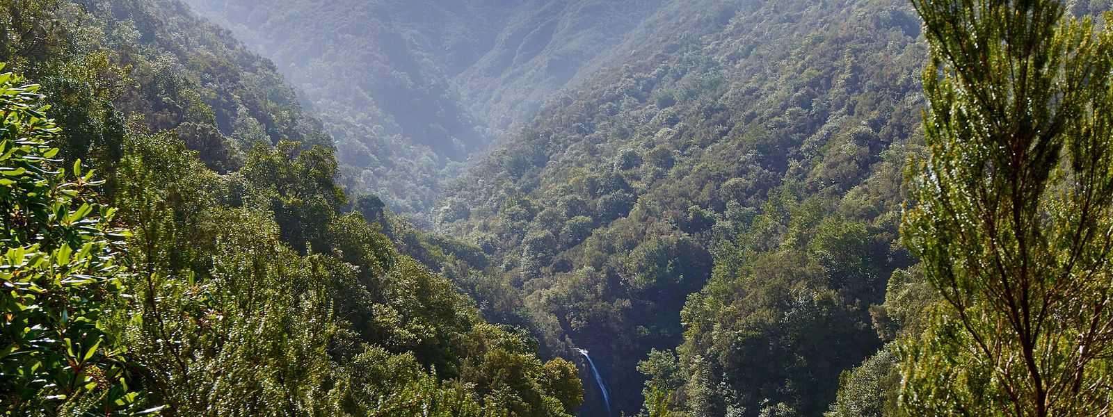
Protected area covering nearly two-thirds of Madeira, with laurel forest, ridge paths and coastal cliffs.
- Parking
- A free car park about 1.9 km away in a straight line, and a second about 2 km. Trail parking is beside the souvenir shop.
- Difficulty
- Extensive trails through forest, over exposed ridges and along coastal cliffs; the roadside viewpoints and picnic stops need no walking at all.
- Transport
- Bus stop Boca da Encumeada, about 2.3 km away in a straight line.
- Advance booking
- Not needed.
- Hours
- Open at any time, every day.
What makes it special
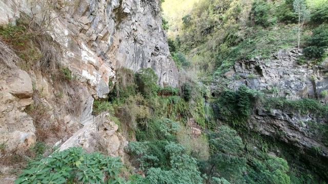
Wind the car windows down and the forest comes in with the air. The road through the park has pull-ins with picnic tables, and the drive between them is as much of the visit as any walk. The woodland is laurisilva, the evergreen laurel forest that covers the wet slopes and that UNESCO listed as World Heritage in 1999; it is the habitat the whole park was built around when it was created in 1982.
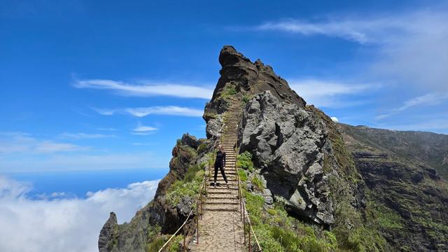
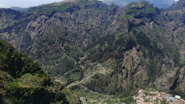
Above the trees the trails climb onto open ridges and run out to the coastal cliffs. Cloud is part of the place — it sits on the high ground for hours and then lifts off a green bowl of forest. The park shelters endemic plants and animals along with endangered species, the global rarity Zino's petrel among them.
Good to know
- Find the trailheads, not the pin. The walks start by the souvenir shop; the map point for the park lands away from them, so navigate to the shop.
- Nothing on site. No toilets, drinking water or information point within 800 m of the park point — carry water with you.
- Cloud decides the day. When it is down on the high ground the viewpoints show white and nothing else, so keep the ridge drive flexible.
- There is no single gate. The protected land runs across nearly two-thirds of the island, and what you visit is a road, a viewpoint or a trailhead within it.
- Good with children at the roadside picnic stops; the ridge and cliff paths are another matter.
Getting there
There is no single entrance. The park spreads across nearly two-thirds of Madeira, so arriving means driving to one road, one viewpoint or one trailhead inside it, and most visitors come by car.
Park by the souvenir shop: the trails begin there, and the map point for the park sits elsewhere, which catches people out. The nearest car parks lie about 1.9 km and 2 km away in a straight line. The closest bus stop, Boca da Encumeada, is about 2.3 km off, which leaves a road walk before any trail starts.
Best time to visit
Best: first light on the high ground, when the ridges come out of the dark and the forest below is still holding its cloud.
Avoid: days with cloud sitting low. The park disappears into it, the viewpoints give white, and the ridge paths lose their edges.
The cloud is what keeps the laurel forest wet, so it is never far away; a clear morning here is worth getting up for.
Sun & daylight
Nearby Places

Similar Places

Madeira Natural Park on the map
The ridge and cliff paths run along unfenced edges, and cloud can close over them fast. Keep well back from the drop, and turn round when the visibility goes.
Get directions
Your whole travel map in one place
Get inspired by new places around the world and find the ones worth the journey
Frequently asked questions
Do the trails start where the map shows the park?
No. The trails begin by the souvenir shop, and the map point for the park sits away from them. Drive to the shop and start from its car park.How big is the park?
It covers 444 km², nearly two-thirds of the island of Madeira, and has been protected since 1982. Nature reserves, protected landscapes and leisure zones sit inside it.What is there to see?
Laurel forest — the evergreen laurisilva listed as UNESCO World Heritage in 1999 — along with exposed mountain ridges, coastal cliffs and endemic wildlife including Zino's petrel.Are there toilets or drinking water?
Not within 800 m of the park point, and no information point either. Bring water, and plan on the souvenir shop being the only building you meet.Is it worth coming with children?
Yes. The drive with its picnic pull-ins makes an easy visit for families; the ridge and cliff paths, with their unguarded edges, are a different proposition.