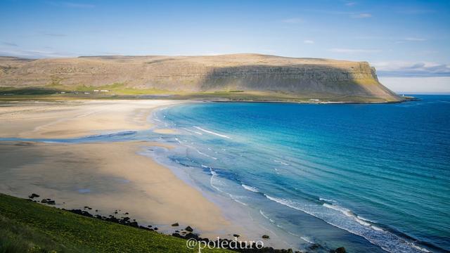
Raudasandur is a beach of red and orange sand on the southern coast of the Westfjords, in the far north-west of Iceland. It lies under high cliffs, with birdlife-rich grassland behind it. Route 614 crosses a mountain pass and drops to the coast in hairpin turns to reach it. The sand is long enough to walk for miles, and at low tide it widens far out towards the sea. There is no entry fee and nothing to buy on site; an old church and a campground are the only buildings.
Raudasandur Beach
Local name: Rauðasandur
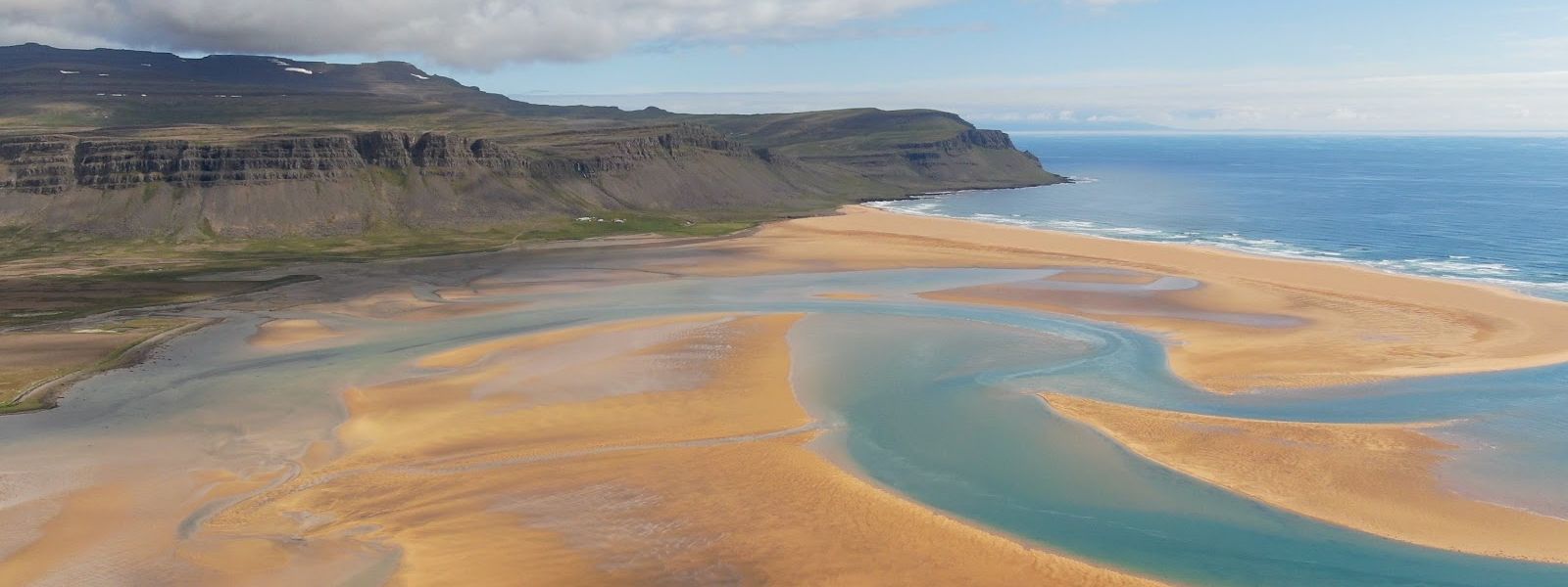
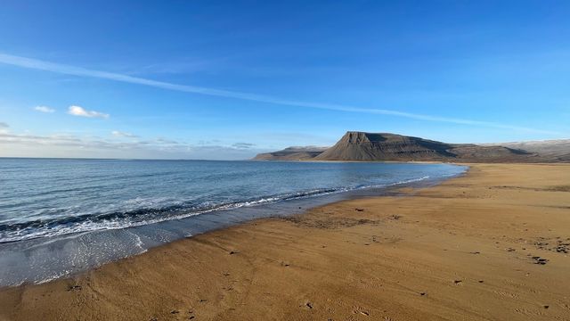
At low tide the sand runs out so far that the sea is hard to pick out from the top of the beach.
- Entrance
- Free, no tickets.
- Accessibility
- No wheelchair-accessible parking and no wheelchair-accessible entrance. The approach is a grassy track and open sand.
- Parking
- Free. The main area is a lay-by in front of the old church; there is more than one car park along the coast.
- Difficulty
- 1.5–2 km each way from the car park, 20–45 minutes on foot. No climb: grassy track, then sand, with a small channel to cross.
- Transport
- Self-drive (gravel Route 614)
- Hours
- Open 24 hours, every day.
- Address
- Rauðasandur, Saurbær, Westfjords
What makes it special
The sand at Raudasandur is red and orange, not black — unusual on a coast built of basalt. The beach sits under high cliffs, with grassland and birdlife behind it. At low tide the flats run out so far that the waves are hard to make out from the shore. The sand is long enough to walk for miles in either direction, and that is what most people come to do. Sun changes the place completely: the colour lifts out of the ground. Beyond an old church and a campground, nothing is built here.
Good to know
- The descent: Route 614 crosses a mountain pass and zigzags down in hairpin turns. The surface is gravel and it is comfortable to drive in summer.
- No services: nothing at the beach sells anything — no shop, no café. Bring your own food and drink.
- Soft ground: the flats between the track and the sea are boggy. Wet sand gives way underfoot; follow footprints where you find them.
- Staying over: there is a campground at the beach.
Getting there
Getting to Raudasandur means driving Route 614 over the mountain and down a run of hairpin turns to the coast. The last stretch is around 10 km of gravel. The road ends at car park areas above the beach, the busiest being the lay-by in front of the old church. From there a grassy track runs out to the sand, with a small channel to cross on the way. The alternative is to head straight out over the wet sand, which is bog in places.
Best time to visit
Better: a sunny day at low tide.
Avoid: turning up hungry — nothing here sells food.
Colour is the point of this beach, and sun pulls the red and orange out of the sand. Low tide draws the water back and opens the flats to their full width, which is when the long walk along the shore is worth the drive.
Sun & daylight
Nearby Places
Similar Places


Featured in our guides
Raudasandur Beach on the map
The flats between the track and the sea turn to bog. Wet sand gives way underfoot, so cross where footprints already run. The descent on Route 614 is steep and narrow, on gravel, with hairpin turns.
Get directions

Your whole travel map in one place
Get inspired by new places around the world and find the ones worth the journey
Frequently asked questions
Does it cost anything to visit Raudasandur?
No. There are no tickets, and parking is free.How far is the walk from the car park to the sand?
Between 1.5 and 2 km each way, 20 to 45 minutes on foot. There is no climb, but there is a small channel to cross.Is there anywhere to buy food?
No. Nothing is trading at the beach. Bring food and drink with you.Can you stay overnight?
Yes. There is a campground at Raudasandur Beach.What is the road down like?
Route 614 comes over a mountain pass and descends in hairpin turns. The last stretch is gravel, narrow and steep, and comfortable to drive in summer.