The Westfjords: a 3-day road trip through Iceland's remotest region
11 min read11 destinations
Westfjords · Iceland
The Westfjords aren't on the way to anywhere — they're a separate peninsula shaped like a spread hand hanging off Iceland's northwest corner, joined to the rest of the country by a single road that most Ring Road itineraries skip entirely. That's the whole appeal, and the whole catch: fewer buses, fewer crowds, and roads that switch from smooth asphalt to washboard gravel without warning. Three days is a workable minimum to see the region's three faces — the puffin cliffs and shell-sand beaches of the south, Dynjandi's waterfall country in the middle, and the fjord towns of Ísafjörður and Bolungarvík in the north — without spending the whole trip behind the wheel.
Day 1 — South: Rauðasandur and the cliffs of Látrabjarg
There are two ways in. Drive road 60 (Vestfjarðavegur) from Route 1 near Búðardalur — a good half-day of driving before you're even in the region proper — or cut it in half with the Baldur car ferry from Stykkishólmur on Snæfellsnes, which crosses Breiðafjörður via the island of Flatey and lands at Brjánslækur in the south. Baldur runs year-round, with more sailings on summer weekends than on winter weekdays — check the current timetable at ferja.is before you fix a departure time, since it shifts by exact date and day of the week — and a stop on Flatey has to be booked in advance if you want it. It's a genuinely nice way to arrive regardless.
Be honest with yourself about the roads before committing to three days. Long stretches of roads 60, 62 and 63 are still gravel, several mountain passes — Dynjandisheiði on road 60, Kleifaheiði on road 62, the pass between Patreksfjörður and Tálknafjörður on road 63 — close with the first heavy snow and don't reopen reliably until late spring, and a resurfacing project on Dynjandisheiði is scheduled to finish only in autumn 2026, so expect a construction detour there even in summer. June through early September is the dependable window; outside it, this itinerary mostly stops being a self-drive trip and becomes a winter-specialist one. Check road.is and safetravel.is the morning you leave, not the week before.
Fuel is the other non-negotiable. Stations sit in Patreksfjörður, Bíldudalur, Þingeyri, Ísafjörður and Bolungarvík, with 60–100 km of nothing at all in between and no guarantee a small-town pump is staffed after hours. Fill up in every town you pass, not only when the gauge looks low — there's no phone signal on some of these passes to call for help either.
However you arrive, road 62 threads southwest from the Flókalundur junction into Barðaströnd, a strip of farms and fjord-mouth wetlands where roads 60 and 62 briefly overlap. The first stop is barely a detour: Hellulaug is a hot spring carved straight into the rock at the edge of Vatnsfjörður bay, no changing room, no fee, no barrier between the pool and the tide line. Go early if you can — it holds only a handful of people comfortably, and it fills up fast.

A little further along, Bardastrandarsandur stretches out below the road — a long, gently sloping beach where the sand runs from pale cream to warm orange and, according to the sagas, is tied to the earliest Norse landings in Iceland. At low tide the flats open up for a couple of hundred metres; it's a good stretch-the-legs stop before the road climbs.

From there road 62 climbs the Kleifaheiði pass — gravel, single-lane in places, manageable in a 2WD car in summer but not a road to rush (our guide to planning a self-drive trip in Iceland covers when you actually need a 4x4 out here) — before dropping into Patreksfjörður, the largest town on this leg and the first fuel stop (N1) since Flókalundur. Fill up regardless of what the gauge says; the next reliable pump is an hour or more away. A short gravel side road just before town leads down to the Gardar BA 64, the rusted hull of Iceland's oldest steel ship — built in Norway in 1912 as a whaler, then decades as an Icelandic herring boat, beached here in Skápadalur since 1981.

Past Patreksfjörður, a signed turn onto road 614 drops steeply toward Rauðasandur — ten kilometres of red-gold sand made from crushed shells rather than the usual black basalt, backed by low cliffs and, depending on the tide, wide reflective pools. It's a detour and a half: the descent is a series of gravel switchbacks, and Rauðasandur itself is a dead end you have to climb back out of, so budget an hour beyond the drive if you want to walk any of the beach. Seals haul out on the sandbanks fairly reliably.

Back on the main road, Hnjótur (its formal name is Minjasafn Egils Ólafssonar, after the local farmer who spent a lifetime collecting the exhibits, in the Örlygshöfn area) is worth the stop even if museums aren't usually your thing: old fishing boats, salvage from Westfjords shipwrecks, and, incongruously, a Soviet An-2 biplane once used to fly supplies to remote farms. A little further, the road narrows past Breiðavík — a turquoise-water, golden-sand bay with a small church above it, and the last settlement before the cliffs.
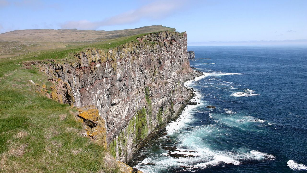
Látrabjarg runs 14 kilometres along the edge of the country, rising to 441 metres at its highest point, and holds one of the largest seabird colonies in Europe — up to 40% of the world's razorbills nest here alongside guillemots, fulmars and puffins. There are no fences or railings anywhere along the cliff — only a painted line warning you back from the edge — and the turf right at the lip is often undercut by puffin burrows and genuinely capable of giving way. Keep dogs and kids well back, and treat the painted line as the real edge, not a suggestion — the cliff doesn't give you a second one.
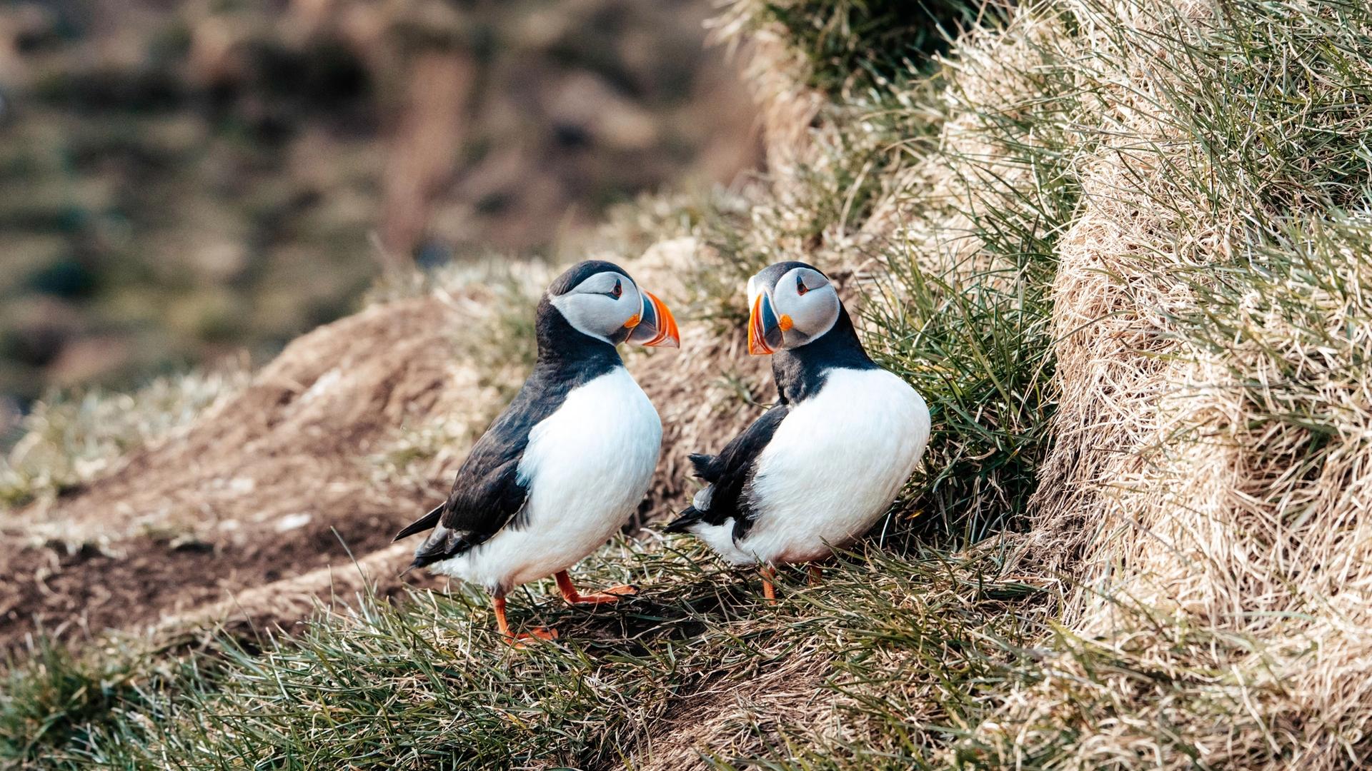
Puffins are present from mid-May to late August, but June and early July is the real window: birds are actively provisioning chicks in their burrows and are least skittish then, especially in the evening (locals suggest arriving around 8–10pm, when the light is still good and the puffins are back from fishing). By late August most have already headed out to sea for the winter — for how that trades off against the aurora, the Highland roads and everything else, see our season-by-season breakdown of when to visit Iceland.
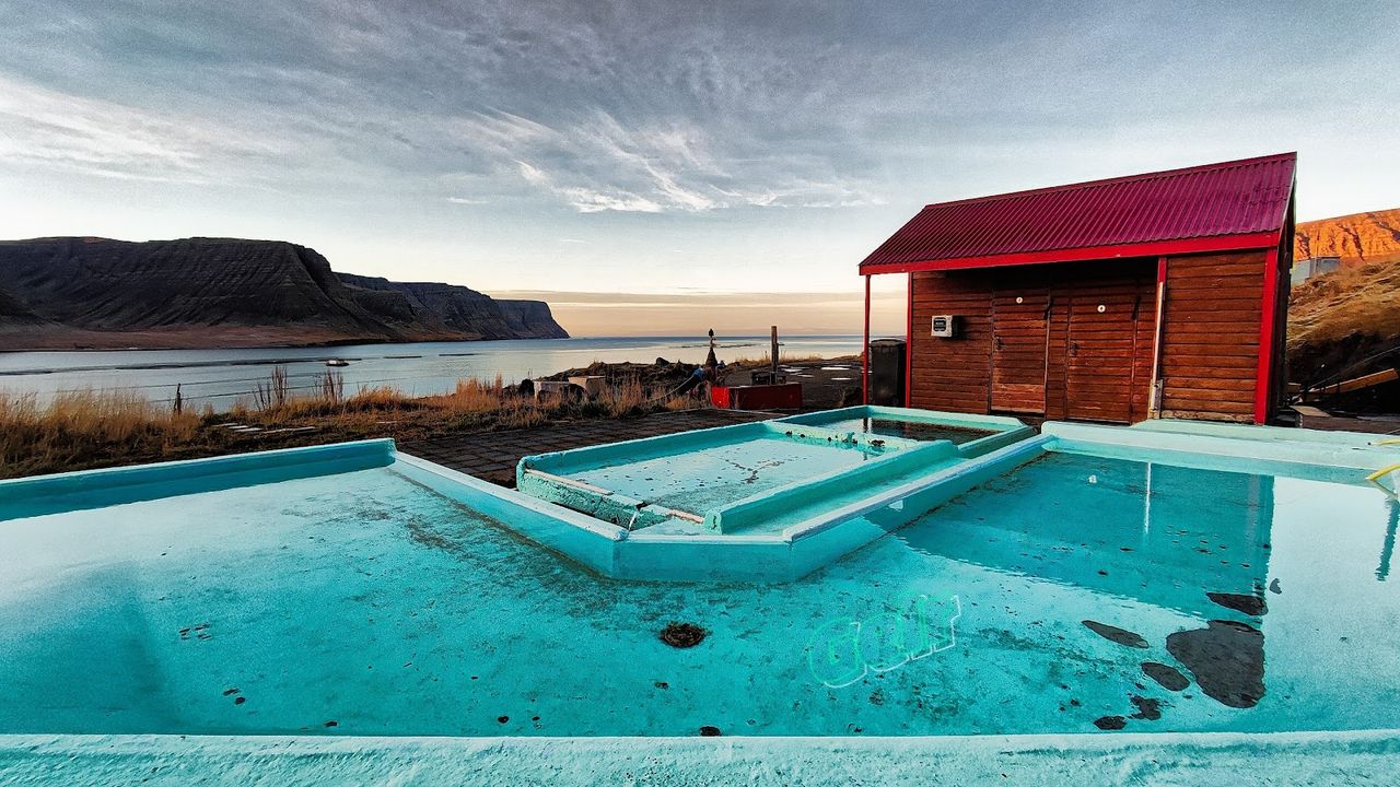
For the night, backtrack to Patreksfjörður and cross road 63's second gravel pass into Tálknafjörður, a small fishing village whose one real attraction is worth the detour: Pollurinn, three small thermal pools of different temperatures built straight into the hillside, with sunset views down the fjord and just a changing room and a shower — nothing more elaborate than that.
Things to do in Westfjords
Paid links: booking through them supports YowJourney.
Day 2 — Central: Dynjandi and the fjords around Þingeyri
From Tálknafjörður or Bíldudalur, road 60 wraps around Arnarfjörður toward Dynjandi — Kaldbakur, the Westfjords' highest peak at 998 metres, is visible across the fjord to the north for most of the drive, with Strengfell's more modest ridgeline closer to the road. This section of 60 is currently a mix of old gravel and newly paved road: the third and final phase of resurfacing over the Dynjandisheiði pass is under construction and isn't due to finish until autumn 2026, so expect a signed detour or a slow, dusty stretch even in high summer.
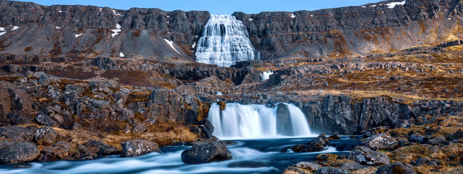
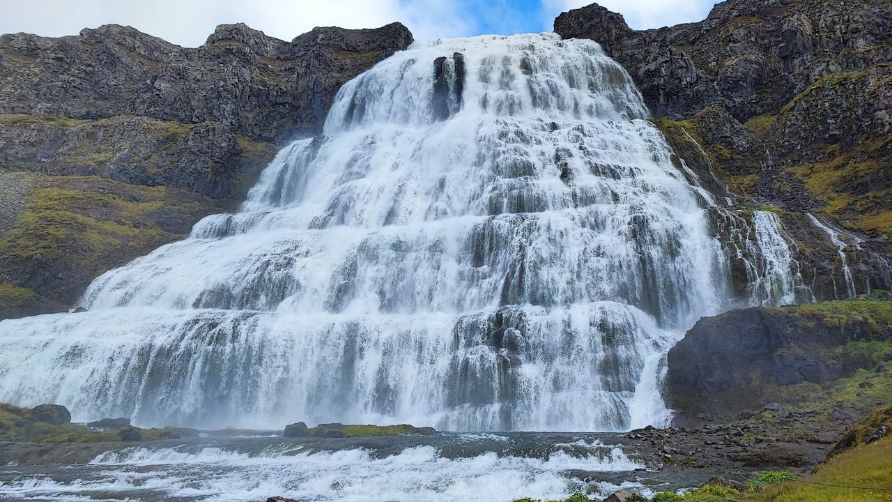
Dynjandi announces itself as a distant white streak on the fjord wall long before you reach the car park. It's the largest waterfall in the Westfjords — a 100-metre drop that fans out from 30 metres wide at the top to 60 metres at the base, which is why it's also called Fjallfoss, and locally regarded as the region's single best sight. The walk up is around 15–30 minutes over a bit more than a kilometre, passing five smaller named falls on the way — Háifoss, Úðafoss, Göngufoss, Hundafoss and Bæjarfoss — worth pausing at rather than rushing past on the way to the big one. It earns its spot in our roundup of Iceland's best waterfalls, and unlike most of that list, you won't be sharing it with a tour-bus crowd.
If you'd rather skip the crowds at the main falls, Gljúfurárfoss drops through a quieter gorge nearby — a short, gentle walk in, moss on the basalt on both sides and nobody else around most of the day.
North of Dynjandi, road 60 now runs through the Dýrafjarðargöng tunnel — 5.6 km, opened in 2020, cutting 27.4 km off the old route and bypassing Hrafnseyrarheiði, a mountain pass that used to close the whole region off from Þingeyri for a good chunk of the year. On the far side, Þingeyri is a quiet fishing village worth an hour: Sandafell rises straight behind it, a gentle enough climb for most fitness levels with a payoff view over the whole of Dýrafjörður from the top.

West of Þingeyri, road 622 becomes the start of the Svalvogar loop — a 49 km, single-lane track cut directly into the cliff face along Kjaransbraut, passable by 4x4 only, tide-dependent in places, and open for only a couple of months a year. It is not a rental-2WD road and not really a solo-drive road either: no cell signal for long stretches, rockfall from above, and blind corners on a shelf road with nowhere to reverse. If you've got the right vehicle (or booked a guided trip), Svalvogaviti, a small orange lighthouse marking the point where Dýrafjörður meets Arnarfjörður, is the reward. If you haven't, this is one to skip rather than improvise.
From Þingeyri it's a straightforward, fully paved run north to Ísafjörður for the night — the last of the day's driving without a gravel surface in sight.
Day 3 — North: Ísafjörður and Bolungarvík
Ísafjörður is the Westfjords' de facto capital — about 2,600 people on a sand spit inside Skutulsfjörður, ringed by steep tabletop mountains that keep the town in shadow for weeks either side of midwinter. It's worth slowing down here: a working fishing harbour, a cluster of restored 18th-century timber buildings around the old Neðstikaupstaður trading post, and the best coffee and fuel selection you'll see all trip.
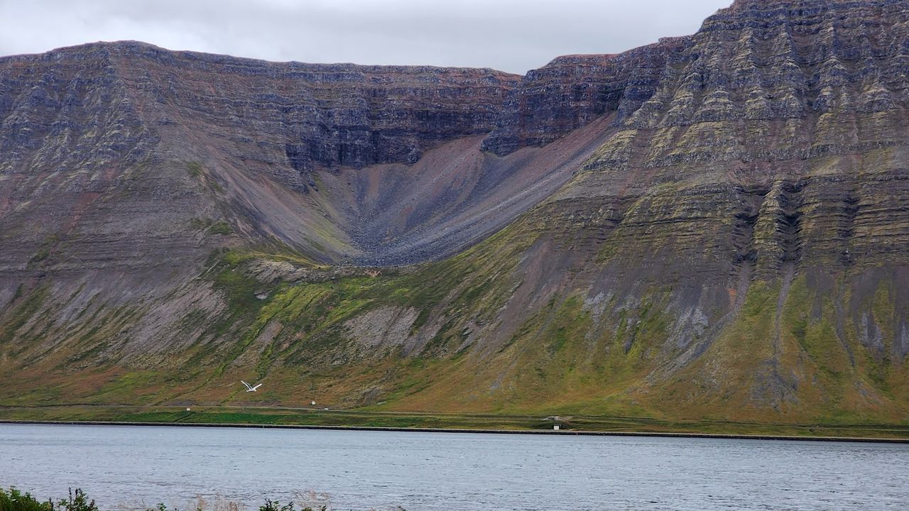
The mountain above town holds the reason most people budget a whole morning for Ísafjörður: Naustahvilft, known locally as the Troll Seat, a smooth half-bowl notch carved into the flat-topped ridge by a glacier that melted out at the end of the last ice age (Icelandic folklore prefers a different explanation — a troll who sat down here at dawn and turned to stone). The trail up is short but genuinely steep, about 170 vertical metres in well under two kilometres, so budget more like a proper hike than a stroll — trail runners underestimate it. The reward is a direct view straight down over the town and the fjord.
From Ísafjörður, the Bolungarvíkurgöng tunnel — 5.4 km, opened in 2010 — cuts under the mountain to Bolungarvík in about ten minutes flat and paved. It replaced the old coastal road along Óshlíð, which ran directly under an unstable cliff face and was closed by avalanches and rockfall often enough that it's now a walking and cycling path instead of a road anyone drives.
In Bolungarvík


Above Bolungarvík, a steep, unpaved but manageable road climbs to the 638-metre summit of Bolafjall, open only from roughly mid-June to mid-September — snow and wind close it the rest of the year. The payoff at the top is a viewing platform, added in 2022, cantilevered out over the cliff edge with nothing but 60 tonnes of steel between you and Ísafjarðardjúp, the Hornstrandir peninsula, and, on a clear day, Greenland on the horizon.
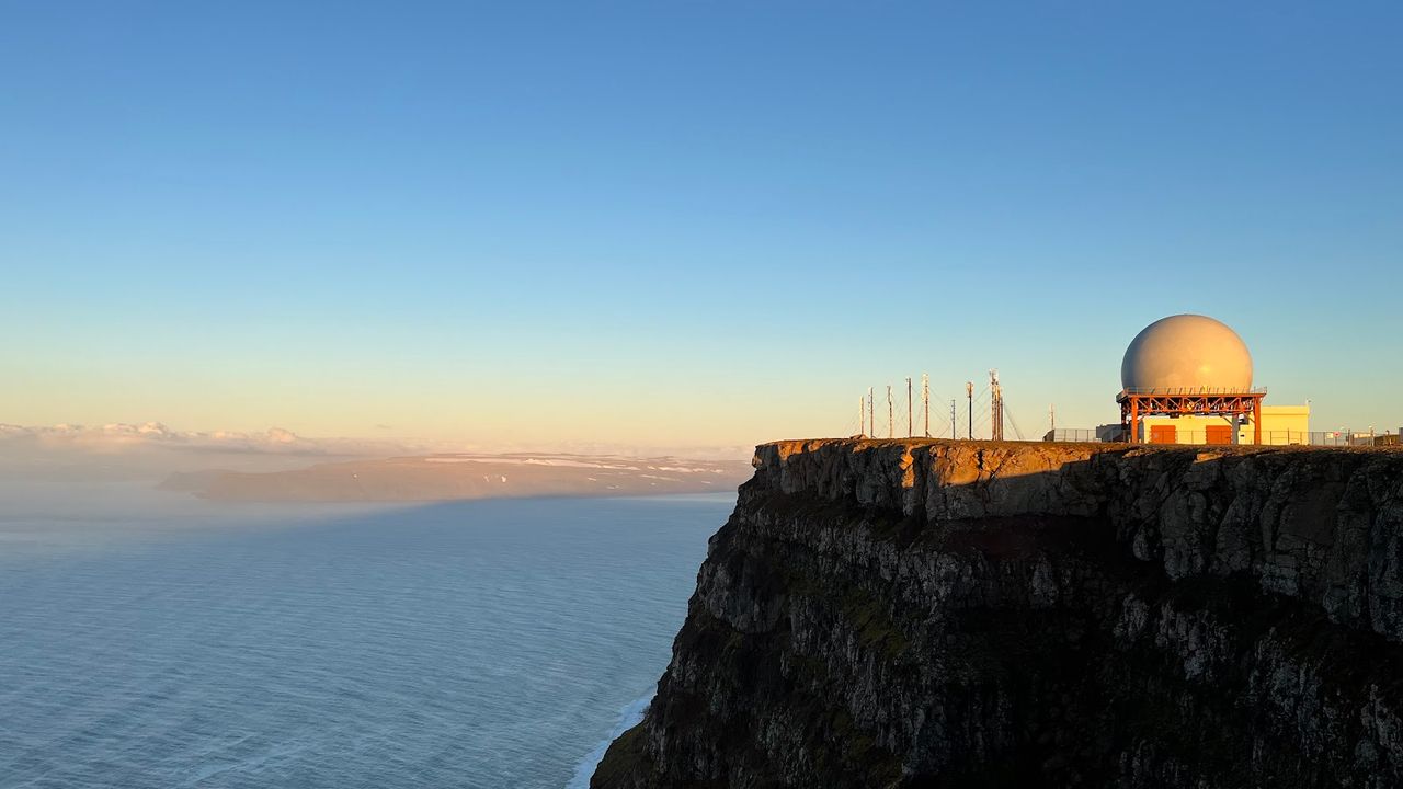
That view is also the honest place to end a three-day loop: Hornstrandir, the roadless nature reserve visible from Bolafjall's platform, has no road access at all — you get there by boat from Ísafjörður or Bolungarvík, or on foot, and it deserves its own multi-day trip rather than a rushed add-on to this one. If you've got a fourth day instead, the quieter option is to follow Ísafjarðardjúp's northern shore back toward Route 60, where the fjord narrows and the traffic all but disappears.

Three days is enough to get a real sense of the Westfjords without pretending you've seen all of it — Strandir's abandoned herring stations on the east coast, the roadless wilderness of Hornstrandir, and half the region's hot springs are still out there for a longer trip. What three days does buy you is the version most visitors skip entirely: puffins at the edge of Europe, a 100-metre waterfall with almost nobody else at it, and a fjord town that still runs on fishing rather than tourism. Build in slack for the gravel, fill the tank more often than feels necessary, and don't try to force this route into any season but summer — the roads decide the schedule out here, not the map.