Volcano craters of Iceland you can actually walk up to
8 min read10 destinations
Below are ten real, magmatic craters plus one caldera, chosen because you can genuinely stand on the rim of each, and ranked by how much effort that takes — from a staircase five minutes off the Ring Road to a highland caldera that needs a full day and a proper 4x4. What follows reflects conditions heading into summer 2026; F-road access changes year to year with the snowmelt, so check road.is before committing to anything past the sixth entry.
Paid links: booking through them supports YowJourney.
Icelandic tourism calls almost any volcanic hole a "crater," and that flattens some real differences. A true crater is the vent a single eruption built — Grábrók and Saxhóll are textbook scoria cones, straightforward walks up to a rim. An explosion crater, or maar, like Víti, formed when steam blew a hole in the ground with little or no lava involved, and the bowl often fills with a lake. A caldera, like Askja, is a different order of thing: not one vent but the collapsed roof of an emptied magma chamber, kilometres across rather than metres — though Kerið, despite its modest size, belongs in the collapse camp too: no ash evidence for an explosion has ever turned up there, so what looks like a maar is really a miniature caldera. And some of Iceland's best-known "craters" — the ones dotting Lake Mývatn's south shore — are pseudocraters, steam-explosion mounds where lava rolled over wet ground and no magma ever passed through them. None of that type made this list.
Saxhóll, where an iron staircase does the climbing for you, is one stop on our 2-day Snæfellsnes itinerary — worth timing alongside the peninsula's other craters, caves and black-pebble beach rather than visiting on its own.
Kerid Crater
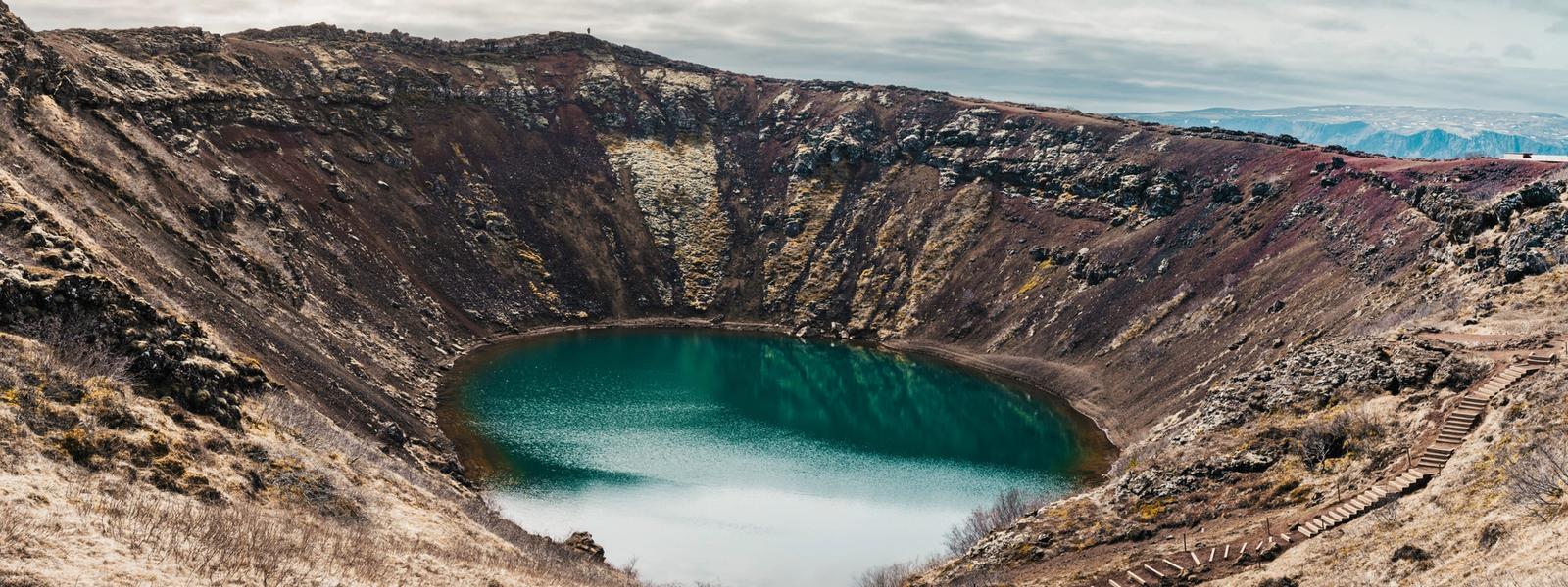
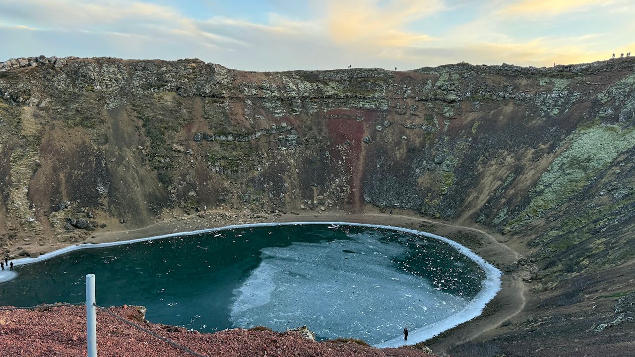
Kerið is the easiest crater on this list to schedule: it sits right on the Golden Circle between Selfoss and Þingvellir, easy to fold into the same afternoon as Geysir and Gullfoss. Brochures still call it an explosion crater, but no ash from a steam blast has ever turned up here — the summit collapsed into its own drained magma chamber three to six and a half thousand years ago, leaving a 55-metre-deep bowl, roughly 170 by 270 metres, slowly filled by groundwater. The rim path loops the full circle in about 15 minutes, with steps down toward the aquamarine lakeshore. Kerið is privately owned — expect a roughly 700 ISK fee at the gate, card only.
Grabrok Crater
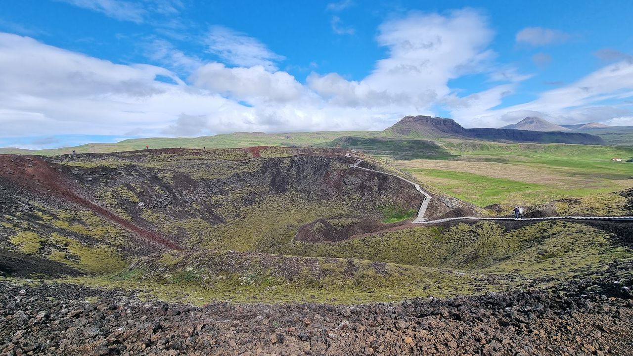
Grábrók barely counts as a detour — a couple of minutes off Route 1 near Bifröst, between Reykjavík and Akureyri. It's the largest of three craters thrown up by the same fissure eruption roughly 3,000–4,000 years ago; the other two, Rauðbrók and Small Grábrók, sit right beside it. A wooden stairway and boardwalk reach the rim in 15–20 minutes — about 55–90 metres of real climbing, though the cone rises some 170 metres above the valley floor. Free, no ticket booth, and the path doesn't stop at the rim: it loops down into the crater bowl itself, an interior view most staircase craters on this list don't offer. Protected as a natural monument since 1962.

Saxholl Crater
Saxhóll is the postcard staircase: roughly 400 iron steps switchback up the crater's outer slope inside Snæfellsjökull National Park, a design that won the international Rosa Barba landscape prize in 2018 for how little it disturbs the ground around it. The climb gains about 100 metres and takes 10–15 minutes; the cone itself is around 3,000 years old. The payoff is a genuine two-ocean view: the Atlantic on one side, the glacier-capped Snæfellsjökull volcano on the other, the Neshraun lava field between them. It's the most-visited crater on this list and the stairs are one person wide — go early or in the evening if you want it quiet.
Viti Crater
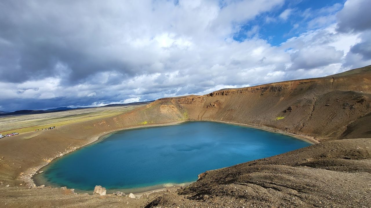
Iceland has at least two craters called Víti ("Hell") — this is the Krafla one, near Lake Mývatn in the northeast, not the one inside Askja 150 km away. A genuine explosion crater from 1724, the opening blast of the Mývatn Fires, it's also the most convenient walk-up on this whole list: Route 863 is paved all the way from Reykjahlíð, about 20 minutes, and the car park sits right at the rim. The loop around the turquoise-green lake takes 20–30 minutes; the ground still radiates warmth in patches, and sulphur drifts over from the Krafla geothermal field. With an extra hour, the same car park is the trailhead for Leirhnjúkur, a still-steaming lava field from the 1975–84 Krafla Fires.
Hverfjall Crater
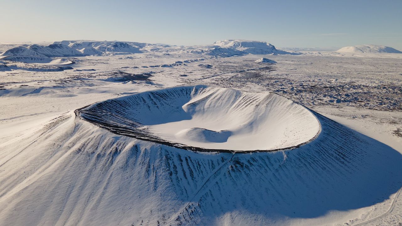
Hverfjall is the structural odd one out: not a scoria cone but a tuff ring, built in a single phreatomagmatic explosion — magma flashing groundwater into steam — around 2,500 years ago, which is why its slopes are fine, well-sorted ash rather than chunky black scoria. It's also by far the biggest walk here: the crater is roughly a kilometre across, and the full rim circuit runs about 3 km, 60–90 minutes, against 15–30 minutes for most of this list. The north car park gives a direct 20-minute climb to the rim; the south one links the walk with the Dimmuborgir lava formations nearby. No entrance fee, just a parking charge — and stay on the marked path, because the tephra slopes erode fast.
Things to do in Iceland
Paid links: booking through them supports YowJourney.

Eldborg Crater
Iceland has two volcanoes named Eldborg, and mixing them up sends you to the wrong peninsula — this is the Snæfellsnes one, near Búðir; the other sits on Reykjanes, with a shorter, easier trail. This Eldborg is the closest thing on this list to a real hike: no boardwalk, just a moss-covered lava field, about 3–3.3 km each way from the trailhead near Snorrastaðir, 1.5–2 hours round trip. The reward is a genuine spatter cone with near-vertical walls rising about 60 metres above the surrounding lava — a near-perfect 200-metre-wide ring built five to eight thousand years ago. From the rim you look straight down into the throat: no gentle interior slope like Kerið's, just a sheer drop.
Ljotipollur Crater
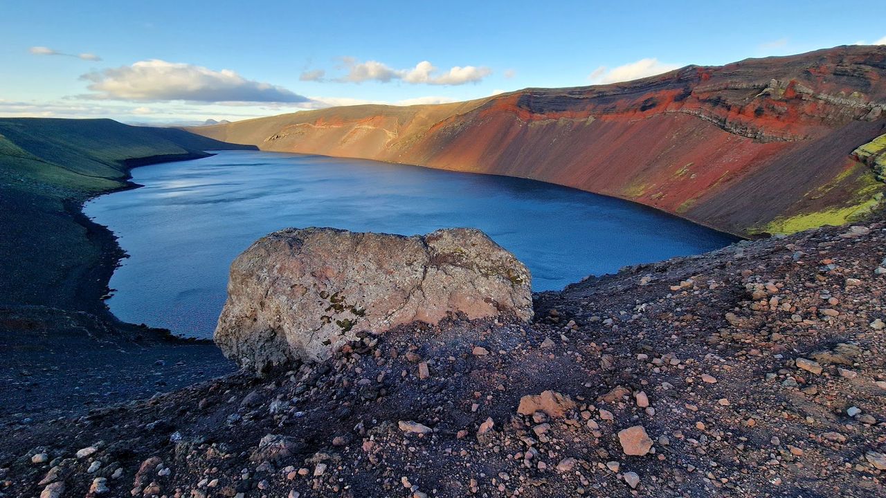
Ljótipollur means "Ugly Puddle" — Icelandic humour, presumably, because the oval crater lake with brick-red, iron-stained walls is one of the most photographed spots in the Highlands. It comes from the same 1477 Veiðivötn fissure eruption that opened dozens of craters across this stretch of the interior. Here the list changes character: it sits off F208 (or F225 from the west) in the Fjallabak Nature Reserve near Landmannalaugar, 4x4-only, with the road typically open from late June to mid-September — check road.is, because early snow closes it without much warning. From the car park the walk to the rim is a few flat minutes over black highland sand; trout, somehow, live in the lake.

Askja Caldera
Everything before this is a single crater; Askja is a caldera several kilometres across, left by a magma-chamber roof collapse in 1875. It now holds Öskjuvatn, Iceland's second-deepest lake at 217 metres. Nine of the twelve Apollo moonwalkers trained here in 1965 and 1967 — NASA found the barren basalt and ash the closest thing on Earth to lunar terrain. Getting in is an expedition: F88 from Route 1 near Mývatn fords the unpredictable Lindaá river (search-and-rescue points smaller 4x4s to F905/F910 instead) and is usually passable from late June or early July to early-to-mid September. Most visitors join a super-jeep or highland-bus day tour from Mývatn; budget most of a day.

Viti Crater Lake
This is the second, harder Víti — a small explosion crater right on the Askja caldera's rim, from the same 1875 eruption, with a milky turquoise lake at the bottom genuinely warm enough to swim in. The catch is getting down: a steep 30–50-metre descent over loose scree turns to thick mud in rain, and snow can sit in the bowl into early July, when a slip is likeliest. Even then bathing isn't guaranteed — sections of the lake are marked off-limits, and access has tightened before, after a 2014 landslide and tsunami in the adjoining Öskjuvatn. Treat any blog's confident "yes, you can swim" as a starting point, not a promise, and check with a ranger or local operator first.

Laki Viewpoint
Laki isn't one crater — it's roughly 130 strung along a 25-km fissure, and the viewpoint is Laki mountain at its centre: the park's steep L1 trail, 2 km and 60–90 minutes each way, rated "Challenging," puts the whole chain below you at once. The 1783–84 eruption is one of the deadliest in recorded history: fluorine and sulphur killed over half of Iceland's livestock, the famine that followed took roughly a fifth of the population, and the haze disrupted weather as far as continental Europe. Access is the hardest here — F206 inside Vatnajökull National Park, open roughly late June to September, realistically an organised super-jeep tour out of Kirkjubæjarklaustur, 8–10 hours round trip.
The first six craters here sit on paved roads or short trailheads — on a first visit, Kerið, Grábrók, Saxhóll and Víti at Krafla are realistic in one loop of the Ring Road and Golden Circle, no special vehicle required. The last four are highland-only and locked to summer: give Ljótipollur, Askja and Laki their own day (or days), with a proper 4x4 or a booked highland tour. Whichever you choose, check road.is and safetravel.is the morning you go — F-roads open and close on their own schedule, and the crater that's a five-minute stroll in August can be under snow by October.