Canyons of Iceland: From Fjaðrárgljúfur to Stuðlagil
8 min read10 destinations
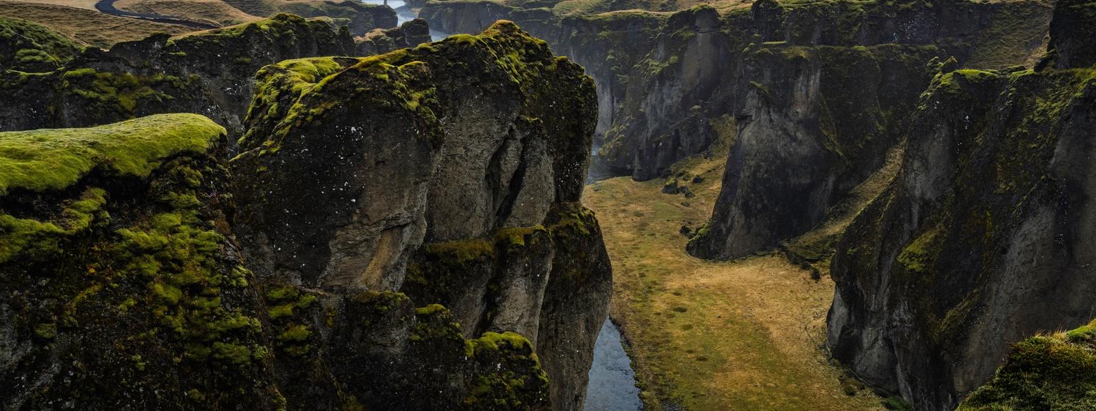
Iceland
Iceland doesn't lack for waterfalls, but its canyons are where the geology does the most talking — river-cut gorges up to 100 metres deep, a rift you can walk straight through, and a basalt-column slot that stayed hidden underwater until a dam changed the river beneath it. We picked ten that earn a detour, ordered loosely from the easiest Ring Road add-on to the ones that ask for a highland F-road and a spare afternoon. For each: how to reach the view that makes it famous (not just the parking lot), when the light or water colour is worth timing around, and what closes, floods, or now needs a permit.
Rauðfeldsgjá, the peninsula entry on this list, works better as a quick add-on to a longer day than as a destination in itself — it slots into day one of our 2-day Snæfellsnes itinerary, alongside the craters and beaches nearby.
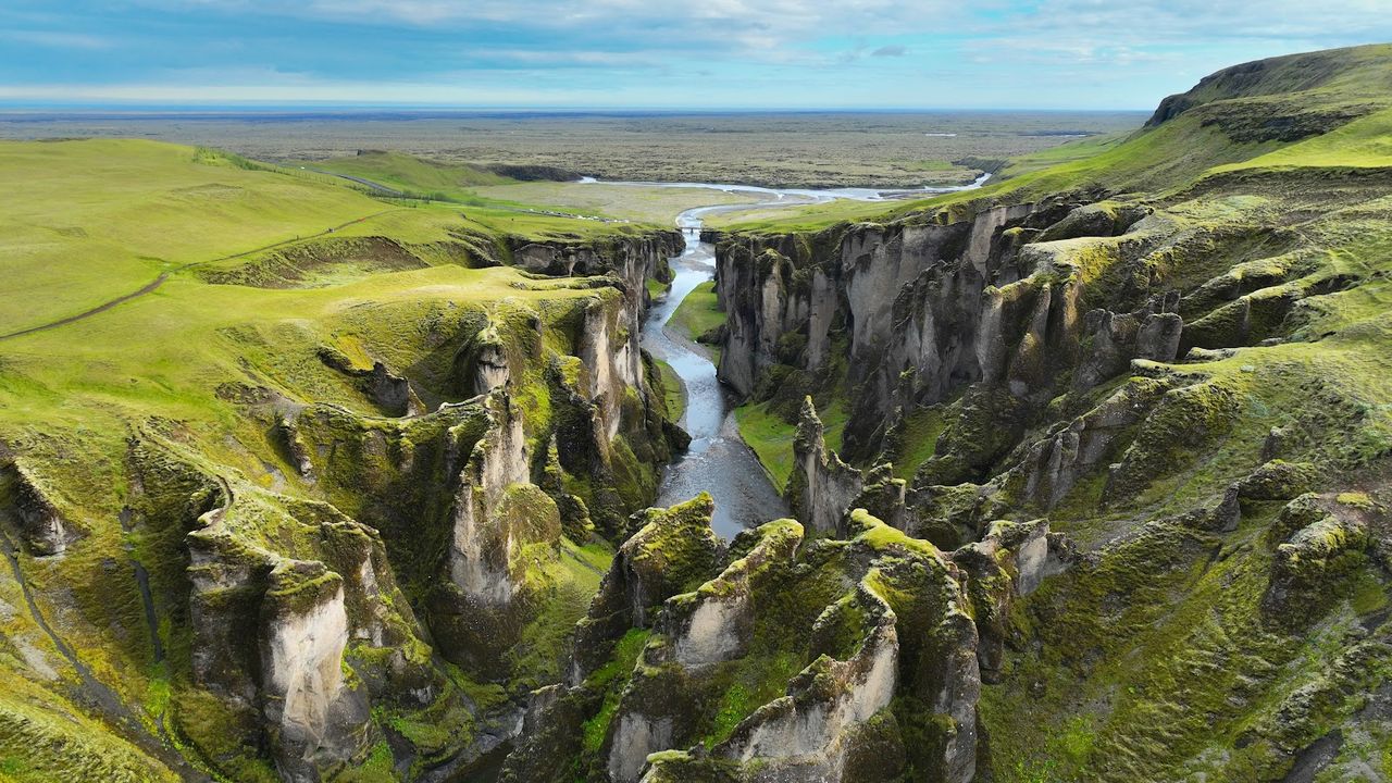
Fjadrargljufur Canyon
Iceland's poster-child canyon: the Fjaðrá river has carved a two-kilometre serpentine gash up to 100 metres deep, with green-mossed walls that curve back on themselves at almost every viewpoint. From the paved parking a boardwalk and rope-lined path runs about 800 metres to the main overlook; the rim trail continues for the classic look-down-the-throat shot. Trampled moss after a 2015 music video forced a March-to-June closure in 2019 — hence the duckboards, occasional short spring closures, and permit-only drone rules in this protected nature reserve. Go on an overcast day: flat light softens the green and spares you the harsh midday shadows across the gorge.
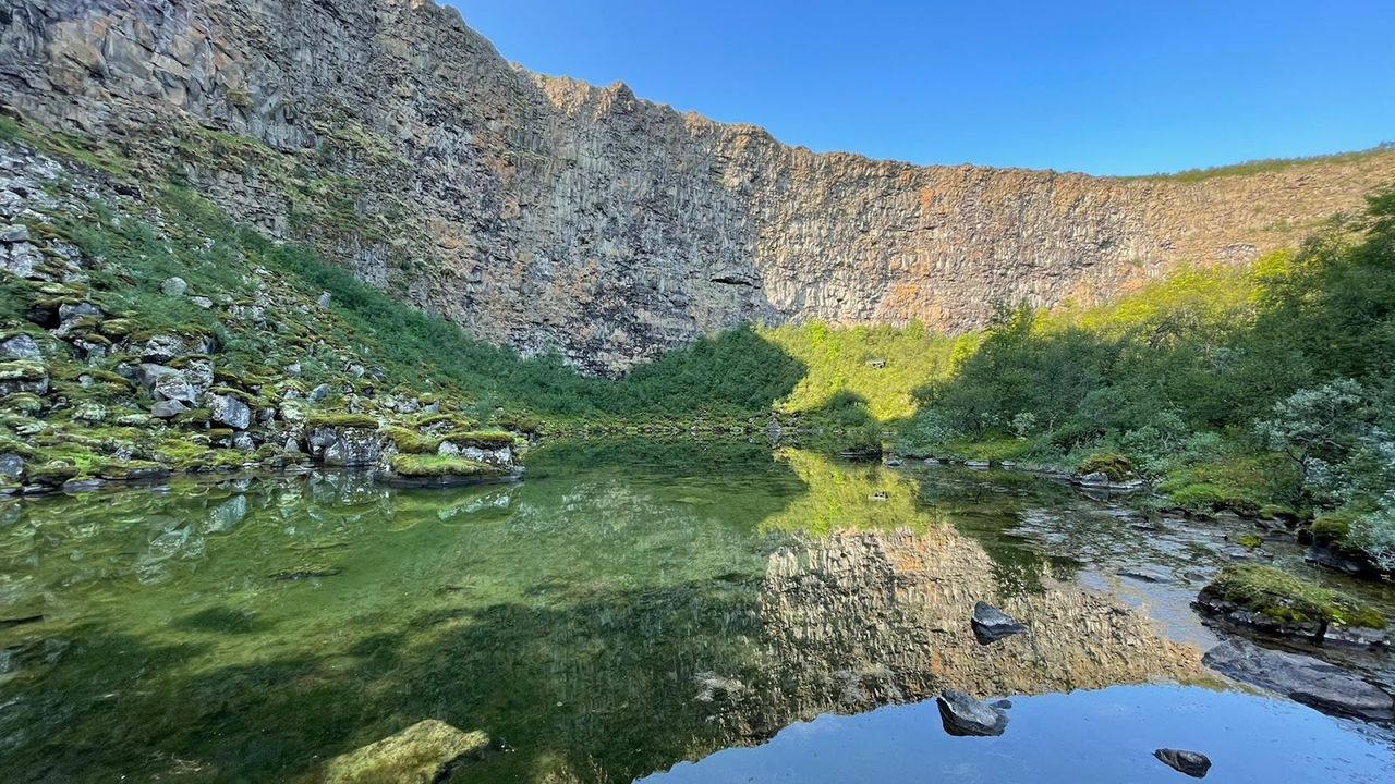
Asbyrgi Canyon
A horseshoe-shaped gash in the northern lava plain — 3.5 km long, over a kilometre wide, its 100-metre cliffs wrapping a forested valley floor of rare-for-Iceland birch woodland. Geologists trace the shape to catastrophic glacial floods (jökulhlaups) from Vatnajökull; in Norse folklore it's the hoofprint of Sleipnir, Óðinn's eight-legged horse. The rock pillar Eyjan ('the Island') splits the floor for over half its length, with an easy marked trail to a viewpoint over the whole horseshoe. Part of Vatnajökull National Park, free and open year-round, with the main cliffs a short walk from the visitor centre car park — the easiest big canyon to fold into a Diamond Circle day.

Dettifoss Waterfall
Dettifoss doesn't just drop into a canyon — it's the loudest chapter in one: the Jökulsárgljúfur gorge, cut through basalt by the Jökulsá á Fjöllum over thousands of years of glacial floods. Road 862 on the west side is paved, with a marked path to a front-on viewpoint; gravel road 864 on the east — closed roughly from winter until early June — gets you closer and square-on, with far less spray on the lens. From the east car park a rough, bouldery trail follows the rim 2.5 km downstream to Hafragilsfoss, a far less-visited second fall between the same basalt walls — 1.5–2 hours round trip, minus the crowds at Dettifoss. Flow, and the ground shaking underfoot, peak with summer glacial melt.

Kolugljufur Canyon
The easiest canyon on this list to add without planning around it: turn off Route 1 onto Route 715 for about 6 km, and it's under five minutes on foot from the car park to a bridge crossing right over the gorge. The Víðidalsá river has cut a canyon roughly a kilometre long and up to 50 metres deep, with the Kolufossar waterfalls stacked in a series below the bridge. It's named for Kola, a troll giantess said to have lived on a ledge in the canyon wall and fished salmon out of the pool below the falls by hand — a detail worth narrating to kids in the back seat. Free, open year-round, no hiking gear required.

Studlagil Canyon
Most of Stuðlagil's basalt columns sat underwater until the Kárahnjúkar dam roughly halved the Jökla's flow after 2009; the exposed canyon was only 'found' in 2016 and is now East Iceland's most-photographed spot. The east-bank trail from Klaustursel — 4–5 km each way from the free car park, half from the paid upper lot over the bridge — is the only route down to the water among the columns, source of the postcard shot. The west-bank path is close to 1 km, with 2025-added stairs and platforms dropping it toward river level too — the better pick if short on time or mobility. Time the water: turquoise from about March to July, silty grey from August as the Hálslón reservoir upstream overflows.
Things to do in Iceland
Paid links: booking through them supports YowJourney.

Raudfeldsgja Gorge
A narrow cleft on the Snæfellsnes Peninsula that you walk straight into, following a shallow stream over rounded boulders as the walls close in fast. The first 200 metres are an easy scramble in trainers; beyond that you'll want a head torch — daylight all but disappears once the walls meet overhead — and most visitors turn back around the 400-metre mark, where real scrambling starts. The saga behind the name is grim: after his nephew Rauðfeldur pushed Bárður's daughter out to sea on an iceberg, Bárður — the half-troll said to guard the peninsula — threw him into this gorge in revenge. Pair it with nearby Arnarstapi and you've got a half-day loop without touching a highland road.

Mulagljufur Canyon
Not signposted from Route 1 between Skaftafell and Höfn — watch for an unmarked gravel turn near Hnappavellir, then a 1 km track to a small pay-and-display car park (the Parka app, not cash) and a further 7–8 minute walk to the trailhead. From there it's about 3.8 km one way along the canyon rim to Hangandifoss, a slender fall dropping close to 120 metres into the gorge, with a second waterfall, Múlafoss, further along — allow 2.5–3 hours round trip. A 2WD car manages the access road in dry summer weather, but a stream crossing and rutting after rain make 4x4 the safer call. It's one of the least crowded big canyons in the South, mostly because so few visitors know the turn-off exists.

Sigoldugljufur Canyon
Nicknamed the 'Valley of Tears' for the dozens of thin waterfalls that stripe its mossy walls after snowmelt, making the cliff look like it's weeping, this one sits in the Central Highlands off F208 toward Landmannalaugar — a 4x4-only road that typically opens mid-June and closes mid-September, so this is strictly a summer stop. Most people spend 20–45 minutes walking the rim between viewpoints rather than committing to a full hike; the reward is a canyon that still feels genuinely unvisited compared to the Ring Road classics. Combine it with a Landmannalaugar day so the F-road drive earns its keep twice over.
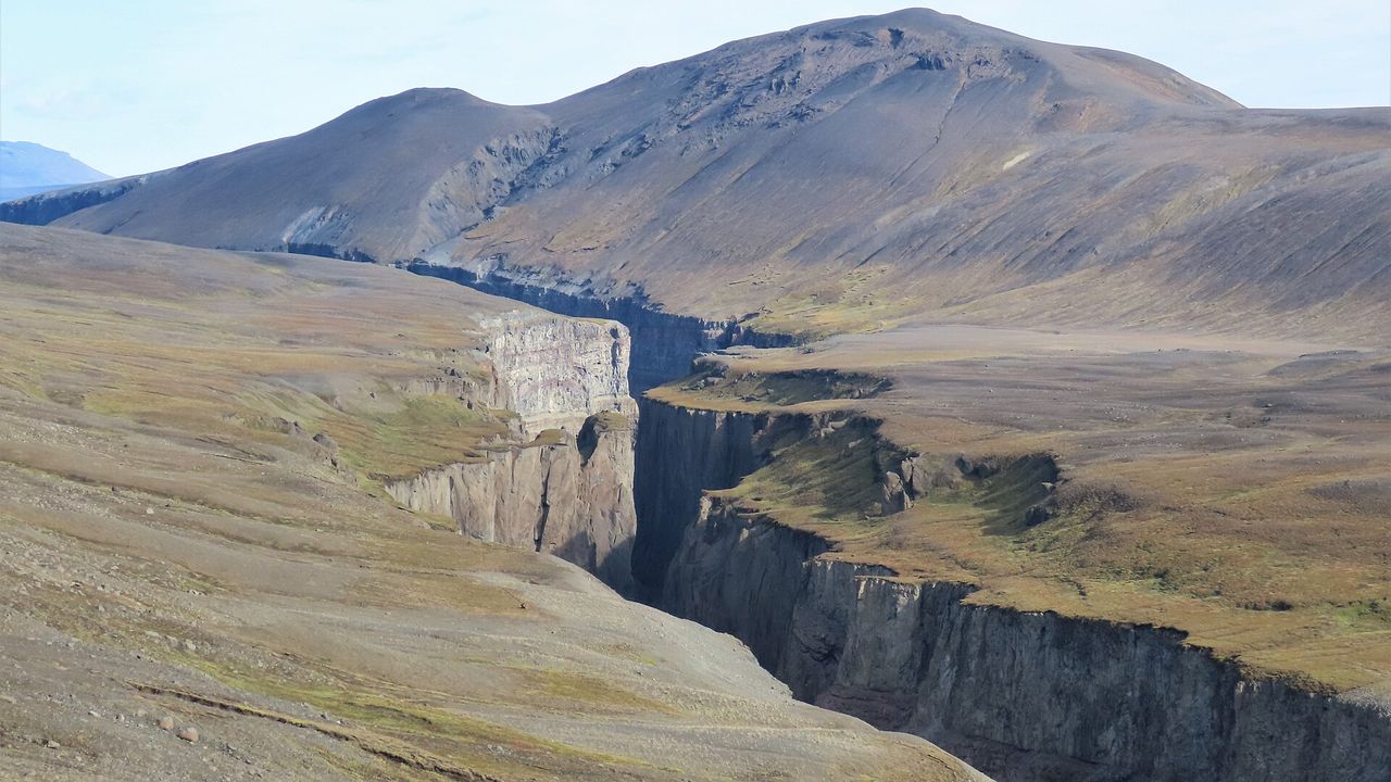
Hafrahvammagljufur Canyon
Also called Dimmugljúfur, 'the dark canyon' — and at over 200 metres deep while barely 20 metres wide in places, it's the deepest canyon in Iceland, cut through layered volcanic tuff in the eastern highlands above the Kárahnjúkar dam. There's no easy version of this one: reaching it means highland roads (F910 past the dam requires a proper 4x4) open only in summer, roughly July to mid-September. What you get for the drive is total isolation — no crowds, no boardwalks, just a slot of rock disappearing into shadow far below the rim. Go for the scale, not for a quick photo stop; this is the one canyon on this list that asks for a real highland detour.

Lambafellsgja Canyon
A slot canyon on the Reykjanes Peninsula formed by the same rift that's pulling the North American and Eurasian plates apart — you're walking through the join, not just near it. Park near Keilir off Route 41 and it's about a 1 km walk over a bumpy lava track (a 4x4 helps, summer only) to the fissure, then an easy hour threading between walls of hardened lava and tuff up to 50 metres deep — doable with kids. It's the one canyon here that sits close to Keflavík Airport and Reykjavík, so it works as a first- or last-day stop rather than a detour that eats a whole day.
Group these by region rather than chase all ten on one trip: Fjaðrárgljúfur and Múlagljúfur sit on the South Coast, Ásbyrgi, Dettifoss and Kolugljúfur cluster around the Ring Road's north loop and Diamond Circle, and Sigöldugljúfur and Hafrahvammagljúfur only open up once the F-roads do, roughly mid-June to mid-September — check road.is before committing to any highland detour. Drone rules inside Iceland's protected reserves and national parks have been tightening, with permits now required at sites like Fjaðrárgljúfur, so check current guidance rather than assume you can fly.