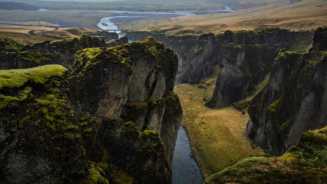
Mulagljufur Canyon is a deep ravine in South Iceland, visited on foot. The trail leaves a gravel car park and runs about 2.5 km each way, climbing over rock along the rim. It gives views of glaciers, snow-capped mountains, waterfalls and a broad valley, with cliffs dropping sheer below the path. A waterfall viewpoint lies partway up. The walk is of moderate difficulty and needs proper boots.
Mulagljufur Canyon
Local name: Múlagljúfur
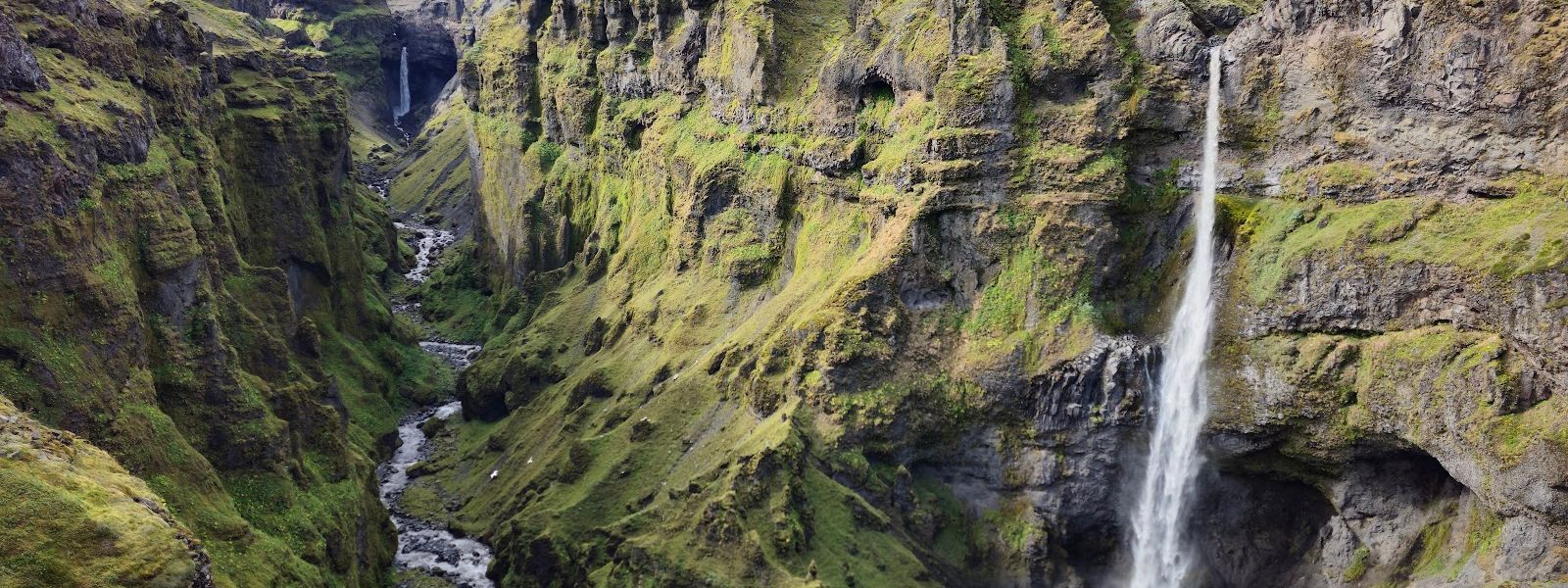
The left-hand path reaches the waterfall viewpoint in about 45 minutes, and there is no need to walk to the end of the canyon to see it all.
- Accessibility
- Not wheelchair accessible: no accessible parking or entrance, and the path is rocky and steep with a river crossing.
- Parking
- Paid car park at the trailhead, gravel surface. It has been found closed in winter, which adds about 3 km on foot.
- Difficulty
- Moderate. Rocky and steep in places, with a small river crossed on stones; sturdy hiking boots needed. About 2.5 hours return from the car park, an hour more for the top.
- Hours
- Open 24 hours, every day.
- Address
- Route 1 (Ring Road), 785
What makes it special
The trail opens views to glaciers, snow-capped mountains and waterfalls, one after another. The view of the valley stands out, and the cliffs beside the path drop sheer into a deep canyon. There is moderate elevation gain about halfway along. Late April and midwinter look entirely different here. At the end of April the slopes still carried snow, with birds nesting on them and a large waterfall running. In January the ground was bare and the wind was the main obstacle rather than the cold.
Good to know
- Footwear: wear sturdy hiking boots. Parts of the path are rocky and tricky, and a small river is crossed by stepping on stones.
- Wind: in January the ground was bare, but the wind was hard enough to need full winter gear.
- Two ways up: the left-hand branch takes about 45 minutes to the waterfall and an hour more to the top.
- The top is steep: the final section suits people who enjoy hiking. Coming down from it takes a little over an hour.
- Crowds: an afternoon in late July was quiet. A new path is under construction and will bring more people.
Getting there
The last stretch is on foot. Cars stop at the gravel car park, and the canyon is reached only by trail, about 2.5 km each way. The path splits into two routes up. The left-hand branch climbs steadily over rock, runs narrow beside the ravine, and crosses a small river on stones. Steep sections come near the top, so many people turn back at the waterfall viewpoint.
Best time to visit
Better: an afternoon in summer.
Avoid: midwinter without full winter clothing.
An afternoon arrival in late July found only a few people on the path. Late April still had snow on the slopes and nesting birds below the rim, and the waterfall was running strongly. In January the trail was walkable with no snow on the ground, but the wind required full winter gear.
Sun & daylight
Nearby Places



Similar Places


Featured in our guides
Mulagljufur Canyon on the map
The path runs close to the edge of a deep canyon and has almost no safety ropes. Rock underfoot is easy to slip on, especially where the trail narrows above the ravine. Do not step towards the edge for photographs.
Get directions

Your whole travel map in one place
Get inspired by new places around the world and find the ones worth the journey
Frequently asked questions
How long does the hike take?
About two and a half hours there and back from the car park, and roughly an hour more for the highest viewpoints. On the left-hand path the waterfall comes after 45 minutes, the top an hour after that, and the descent takes a little over an hour.How hard is the walk?
Moderate. It is a continuous climb over rock, with narrow sections beside the ravine and a small river to cross on stones. Some parts are very steep, mainly on the last stretch to the top. Sturdy hiking boots are needed.Do you have to walk all the way to the top?
No. The views open up well before the end of the canyon, and the waterfall viewpoint about 45 minutes up is enough for most people. The final climb to the top is worth it only if you enjoy hiking.Is there parking at the trailhead?
Yes, a paid gravel car park. It has been found closed in winter, which added about 3 km of walking to reach the start of the trail.Can the canyon be visited in winter?
Yes. In January the ground was bare and the walk took three to four hours with the extra distance from the closed car park. Full winter clothing was needed because of the wind.