Nauthusagil is a narrow ravine in the Rangárþing eystra district of South Iceland. A stream runs through it and a waterfall stands at its head, listed on maps as Nauthusafoss. There is no made path: the falls are reached either by walking up the riverbed through the canyon or by climbing the hill above the gorge. Entry is free, the car park is free, and the site is open at all hours. Come for the walk in, not for an easy viewpoint.
Nauthusagil Ravine
Local name: Nauthúsagil
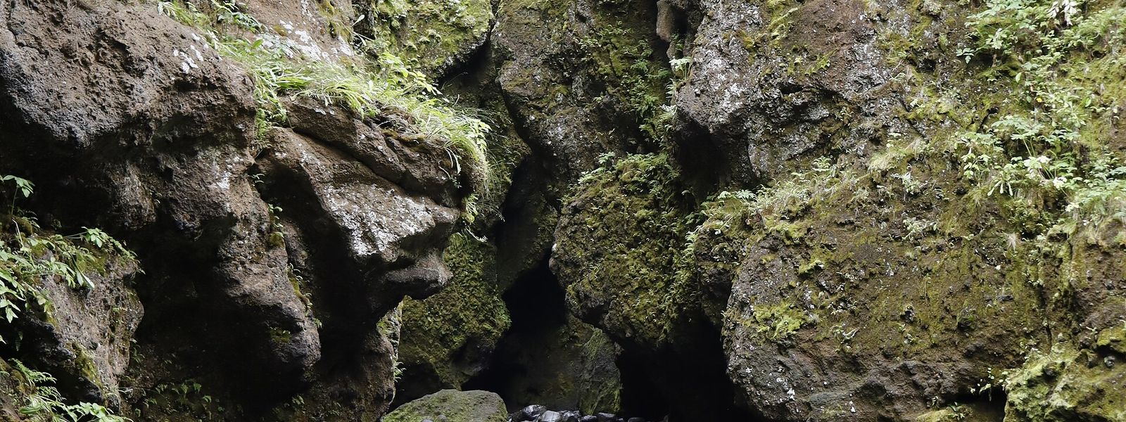
The last climb to the main waterfall goes up a smaller waterfall, on a fixed chain.
- Entrance
- Free
- Accessibility
- Not wheelchair accessible: no step-free entrance and no accessible parking spaces
- Parking
- Free car park at the site
- Difficulty
- Hard. No made path: wading, rock-hopping and scrambling up the riverbed; waterproof boots with grip needed
- Transport
- Self-drive (2WD ok) — Road 249 toward Þórsmörk
- Hours
- Open 24 hours, every day
- Address
- Road 249, 861 Stóridalur
What makes it special
The way to the waterfall is the riverbed itself. The route crosses the stream and works up the canyon over stones that shift underfoot, past a line of small waterfalls. The last of them is climbed with the help of a fixed chain, and the main fall stands just beyond it. Getting wet is not a risk here but a certainty: one visitor in waterproof boots went into the river anyway, and some people walk it barefoot. The hill above the gorge gives the wider view, over the waterfall on one side and the country around it on the other. The wind up there is strong and the ground runs close to the edge. The site sits off the main run of stops, and the gorge is often empty.
Good to know
- Footwear: Waterproof boots with a proper grip sole. The stones in the river are slippery and the water is unavoidable.
- Winter: Ice forms on the stones in the riverbed. One visitor in February slipped and fell during the crossing.
- Children: The wading and the scrambling are not for small children.
- Road: The last stretch to the car park runs on an F road.
- No made path: Nothing is surfaced or stepped. Rock-hopping and a chain-assisted climb are part of the way in.
Getting there
Access is by car, and the last stretch runs on an F road. There is a free car park at the site, and everything past it is on foot. Two ways lead in. One climbs the hill above the gorge; the other crosses the river and follows the streambed into the canyon. Both are hard going, and the canyon route means wading.
Best time to visit
Better: summer, when the streambed is clear of ice and the water is the only obstacle.
Avoid: winter — in February there is ice on the stones in the river, and the crossing is where people fall.
The stream runs through the gorge all year, so the walk is wet whenever you come. The site is off the main routes and rarely crowded, so conditions underfoot matter more than the hour of the day.
Sun & daylight
Nearby Places


Similar Places



Nauthusagil Ravine on the map
The river crossing is the dangerous part. The stones are slippery, they move underfoot, and in winter they carry ice — one visitor fell here. The hill route runs close to the edge of the gorge in strong wind. Neither route suits small children.
Get directions

Your whole travel map in one place
Get inspired by new places around the world and find the ones worth the journey
Frequently asked questions
What footwear is needed?
Waterproof boots with a proper grip sole. The stones in the river are slippery, they shift underfoot, and the water cannot be avoided.Is there a marked path to the waterfall?
No made path leads in. One route follows the riverbed through the canyon, the other climbs the hill above it, and both are hard going.Is it suitable for small children?
No. The river crossing is slippery and the canyon requires scrambling and rock-hopping.How busy does it get?
It is off the main routes and often quiet. Tour groups do come: one visitor found a tour bus already in the car park on a May afternoon.