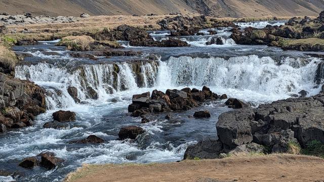
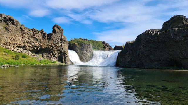
Gluggafoss, also called Merkjárfoss, is a waterfall on the river Merkjá in Fljótshlíð, in South Iceland. Both names appear on the signpost at the site. It is the most prominent of a series of falls on the river, and drops in two stages into a narrow recess below. The river has bored holes and tunnels through the soft palagonite of the cliff, and water shows through them from the base. Trails on the neighbouring hills lead to both drops and to a view from above.
Gluggafoss Waterfall
Local name: Gluggafoss (Merkjárfoss)

Until 1947 the upper half of the waterfall could be seen only through three holes in the rock, one above the other; ash from the Hekla eruption plugged them, and erosion has since opened them up again.
- Parking
- Two gravel car parks. The one beside the falls is charged; the one about 850 m away is free.
- Difficulty
- About 240 m uphill from the nearer car park to the foot of the falls. The path on to the upper falls is steep and rocky near the top.
- Transport
- No public transport: there is no bus stop within 5 km. Access is by car.
- Hours
- Open at all hours, every day.
- Address
- Gluggafossavegur, 861
What makes it special
The cliff is palagonite on top and basalt below, and the palagonite is soft enough for the river to bore through it. The holes it has made are the gluggar, the windows. From the foot of the falls you see water moving inside the rock, half hidden, before it comes back out. The drop happens in two stages: 44 m into a narrow recess, then a further 8.5 m in three channels, about 52 m in all. Small trails on the hills beside the falls lead to both stages and to a view from above. The upper section cannot be seen from the bottom at all. Seljalandsfoss, of similar size or larger, is nearby and takes the crowds; Gluggafoss stays quiet.
Good to know
- Allow about 20 minutes at the foot of the falls. The climb to the upper section adds to that.
- No toilets and no drinking water at the site. There is a picnic table.
- Wear hiking shoes. The path to the upper falls is rocky and steep near the top, and the descent is harder than the climb.
- From the south, satnav routes drivers onto a rough unpaved road. The paved way round adds distance.
- The second fall beside Gluggafoss cannot be reached, but it photographs well from the path.
Getting there
Gluggafoss lies off Route 261 in Fljótshlíð, 17.3 km from Hvolsvöllur, which is itself 106 km east of Reykjavík. There is no bus stop within 5 km, so this is a drive. The nearer car park sits just off the road, and from it the path runs uphill to the foot of the falls. A made path continues up the right-hand side to the upper falls. If you are driving on to Seljalandsfoss afterwards, expect a long gravel road that rejoins Route 1 just before it.
Best time to visit
Better: summer, for long evening light and few other people. Avoid: the climb to the upper falls in wet weather.
Gluggafoss draws far fewer visitors than Seljalandsfoss nearby, and having the place to yourself is normal even in high season. The upper path is awkward in dry, sunny weather, so keep it for a dry day.
Sun & daylight
Nearby Places

Similar Places

Gluggafoss Waterfall on the map
The path beside the falls is steep and rocky in its upper sections, and coming down is harder than going up, even in dry, sunny weather. Wear boots with grip, and turn back rather than push on if the rock is wet.
Get directions

Your whole travel map in one place
Get inspired by new places around the world and find the ones worth the journey
Frequently asked questions
Why is it called Gluggafoss?
Gluggar means windows. The river has cut holes and tunnels through the soft palagonite, and water shows through them. The signpost on site carries the second name too, Merkjárfoss, after the river Merkjá.Can you see the whole waterfall from the bottom?
No. The upper section is hidden from the foot of the falls. A made path up the right-hand side reaches it, and trails on the neighbouring hills give a view from above.How does it compare with Seljalandsfoss?
Seljalandsfoss is nearby and of similar size or larger, and it gets far more visitors. Gluggafoss is quieter, and you can get close to both tiers. Driving between the two means a long stretch of gravel road.Is there anything at the site apart from the waterfall?
A picnic table and a signpost explaining the falls and their two names. No toilets, no drinking water, no shop.