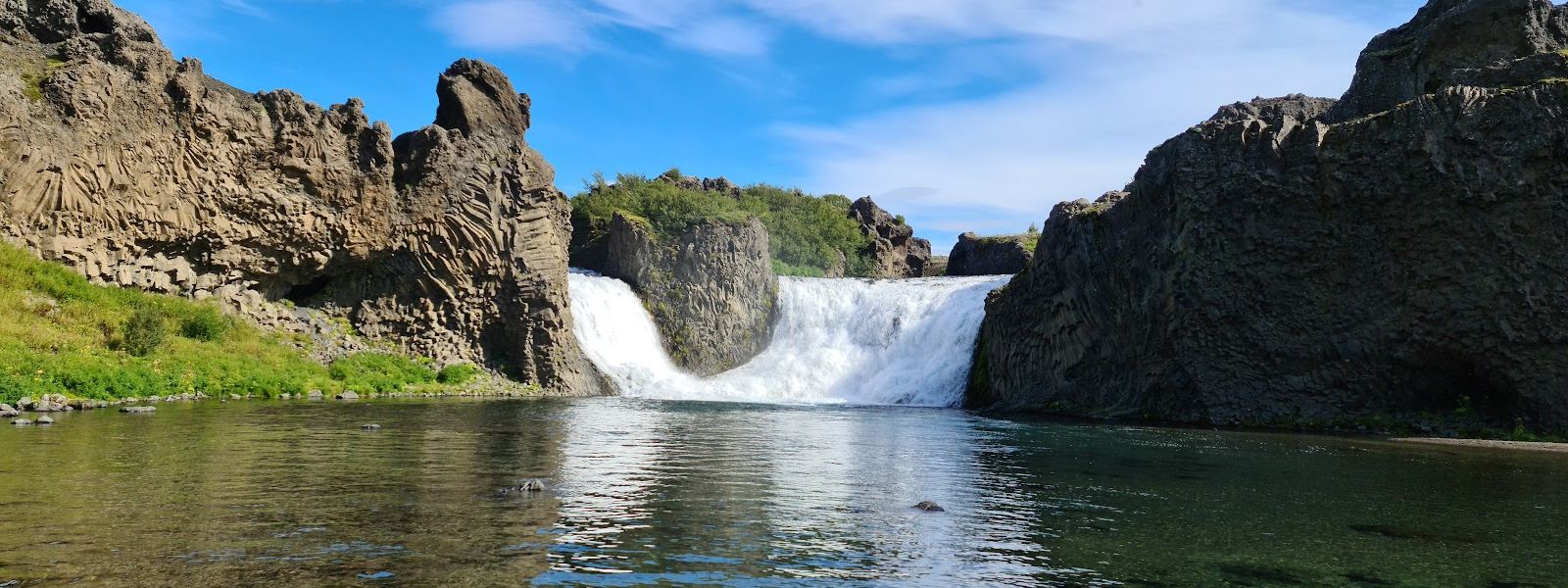
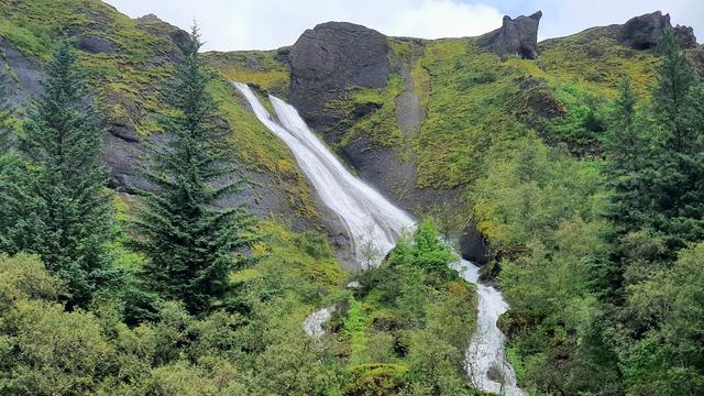
Hjálparfoss is a waterfall in the Þjórsárdalur valley in South Iceland, in the lava fields north of the volcano Hekla, close to where the river Fossá joins the Þjórsá. Two cascades fall side by side into a single pool, framed by dark volcanic rock and columnar basalt. It lies about 30 km east of Flúðir and is reached by a gravel road off Route 32. Lookout points sit above the pool, and the site is quieter than the larger falls on the south coast. Þjófafoss is about 5 km south.
Hjálparfoss
The name means Help's Waterfall: the point on the highland crossing where travellers stopped to rest and water their horses.
- Entrance
- Free
- Parking
- Large free car park at the falls.
- Difficulty
- A short walk down from the car park to the viewpoints. Reaching the water's edge means climbing over rock.
- Transport
- Self-drive; gravel Route 32 in Þjórsárdalur
- Hours
- Open 24 hours.
- Address
- Hjálparvegur 3361, 804
What makes it special
Two streams drop side by side into one pool. That symmetry is the reason people make the detour, and it is uncommon among Icelandic falls. The basin is walled with columnar basalt and dark volcanic rock, and the columns lean and fan rather than standing in even ranks. Several lookout points sit above the water, and the shape of the falls changes as you move between them. The name means Help's Waterfall: for travellers crossing the highlands this was the place to stop, rest and water the horses. It stays quiet. Compared with the falls on the south coast, the car park sees few people.
Good to know
- Toilets: There are toilets at the site, but they are not always open. Do not plan around them.
- A detour: From the Kerið crater it is about an hour's drive, off the Golden Circle.
- Winter: In December it is freezing and windy at the falls, and visits get cut short.
- With children: The walk down to the viewpoint is short and children manage it. The rocks below the viewpoint are another matter.
Getting there
The last stretch is a gravel road off Route 32, running through the Vikrar lava fields. Hjálparfoss lies about 30 km east of Flúðir. Cars come right up to the falls, and from the car park a short walk leads down to the viewpoints. Going further, to the water's edge, means climbing over rock, and it is optional: the twin cascades are in full view from above.
Best time to visit
Better: a clear, settled day. The falls sit in an open basin with no tree cover, and the twin cascades photograph best when the rock is dry.
Avoid: deep winter, if you want to linger. In December the cold and the wind cut visits short.
Crowds are not the issue here. The car park stays quiet, and having the falls to yourself is normal rather than lucky.
Sun & daylight
Nearby Places



Similar Places

Hjálparfoss on the map
Getting down to the water's edge means climbing over rock. Take it slowly, and keep children back from the edge above the pool.
Get directions

Your whole travel map in one place
Get inspired by new places around the world and find the ones worth the journey
Frequently asked questions
Why is it called Hjálparfoss?
The name means Help's Waterfall. It was a welcome sight for travellers crossing the harsh highlands, a place where horses could rest and drink.How many waterfalls are there?
Two. The cascades fall side by side into one calm pool, close to the point where the river Fossá joins the Þjórsá.Can you get down to the water?
Yes. From the viewpoint you can climb down the rocks to the water's edge. It calls for care, and the falls are fully visible from above without it.Are there toilets?
There are toilets at the site, but they are not always open. Treat them as a bonus rather than a plan.What else is nearby?
Þjófafoss lies about 5 km south. Further east are Háifoss on the Fossá and Tangafoss on the Þjórsá. Just downstream is Búrfellsstöð, Iceland's second-largest hydroelectric power station.