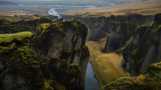
Hafrahvammagljúfur is a canyon in the highlands of East Iceland, in the Múlaþing municipality. The glacial river Jökulsá á Dal cut it through layered basalt, and the Kárahnjúkar dam now stands at its upper end. The draw is a single viewpoint on the rim, reached by an unsurfaced side road and then a marked path with stairs at the end. Away from the main touring routes, it sees far fewer people than Iceland's roadside canyons.
Hafrahvammagljufur Canyon
Local name: Hafrahvammagljúfur
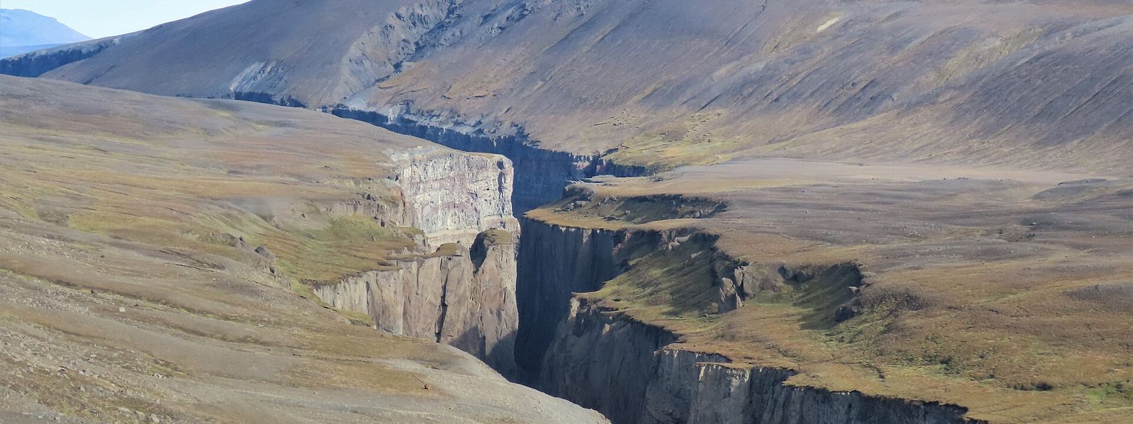
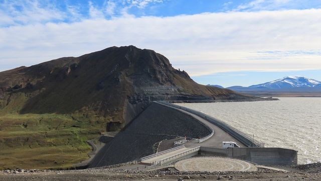
The Kárahnjúkar dam stands at the head of the canyon: the glacial river that cut these walls is now held in a reservoir above them.
- Entrance
- Free
- Accessibility
- Not wheelchair accessible: the viewpoint is reached by stairs, and there is no wheelchair-accessible parking or entrance.
- Parking
- Two car parks: one at the signed turn-off, the second at the start of the marked path, reached by an unsurfaced track.
- Difficulty
- Marked path from the upper car park to the viewpoint, 20 minutes to an hour on foot, with stairs at the end. Unsurfaced access road.
- Transport
- 4x4 only; highland F-road past Kárahnjúkar, summer only
- Hours
- Open 24 hours, every day.
- Address
- Kárahnjúkar highland, 701
What makes it special
Hafrahvammagljúfur is seen from one place, and reaching that place is most of the visit. A marked path leaves the upper car park and runs out to the rim, with stairs on the last stretch. Below it the Jökulsá á Dal has cut a deep, narrow gorge through layered basalt, and the walls drop away in steps of dark rock. The Kárahnjúkar dam stands at the head of the canyon, so the water moving below is set by a power scheme rather than by the glacier. The last part of the drive is unsurfaced track across open highland, which keeps the numbers at the viewpoint low.
Good to know
- Vehicle: the last stretch of road is unsurfaced and rough in places, with loose rock and potholes. Come in a 4x4.
- Navigation: map apps get this one wrong. The way in is a minor side road, not the main route they offer.
- No shortcut: the viewpoint is a walk from the car park, and the path ends in stairs.
- With children: the site suits families, though the only route to the view is that path and its stairs.
Getting there
You drive in, and the last section of road is not tarmac. The turn-off is marked with a blue sign reading Hafrahvammagljúfur; from there the track runs on to a second car park, where three large signs stand at the start of the trail. The rest is on foot: a marked path out to the rim, with stairs at the viewpoint itself.
Sun & daylight
Nearby Places



Similar Places


Featured in our guides
Hafrahvammagljufur Canyon on the map
There are no guardrails, shelters or services at the canyon: stay well back from the crumbling, unfenced edges, watch for sudden strong winds, and treat it as full highland travel — go only in summer, in a capable 4x4, self-sufficient for weather and breakdowns.
Get directions

Your whole travel map in one place
Get inspired by new places around the world and find the ones worth the journey
Frequently asked questions
Do you need a 4x4 to get to Hafrahvammagljúfur?
The access track is unsurfaced and rough in places, with loose rock and potholes. A 4x4 is the safe assumption; an ordinary car is not suited to it.Will a map app take you to the right place?
Not reliably. The way in is a minor side road. Look for the blue sign reading Hafrahvammagljúfur and follow the track from there to the car park with three large signs, where the marked path starts.How long is the walk to the viewpoint?
Between 20 minutes and an hour from the car park, on a marked path, with stairs on the last stretch.Is the canyon suitable for children?
Yes. The site is good for children, but the viewpoint is reached on foot only, and the path ends in stairs.