Waterfall Circle is a marked hiking loop in East Iceland, starting from the Laugarfell lodge. The yellow route runs about 8 km and passes several waterfalls, the biggest of them Faxi. There is no scrambling, but the ground is uneven, some sections are steep, and parts of the trail are boggy. Boardwalks carry the path across the wettest ground at either end of the circuit. The lodge at the trailhead has food and hot tubs.
Waterfall Circle
Local name: Fossahringurinn á Laugarfelli

An 8 km loop past a string of waterfalls that begins and ends at a lodge with hot tubs.
- Accessibility
- Not wheelchair accessible: neither the car park nor the entrance. The trail crosses uneven and boggy ground.
- Parking
- Car park at the trailhead. The road is paved as far as the turn-off to it; small non-4WD cars get up the rest.
- Difficulty
- Yellow-marked loop, about 8 km, roughly two hours' walking. No scrambling, but close to 210 m of ascent, uneven terrain and some steep sections. Boggy in places; waterproof boots needed.
- Hours
- Open 24 hours.
- Address
- Laugarfellsvegur, 701
What makes it special
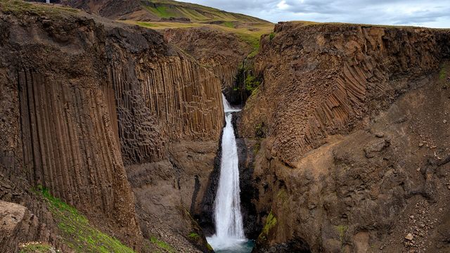
Two big waterfalls anchor the loop, and Faxi is the one walkers single out — the more impressive of the pair, if the less photogenic, and reached by the steepest climb on the route. The 8 km circuit strings several more falls together with open views. There is no scrambling and no exposure anywhere on it.
The ground between the two waterfalls is the wettest part of the walk, and boardwalks take the path across the boggiest sections at the start and the end. The loop begins and finishes at Laugarfell, where there is food and a hot tub.
Good to know
- Footwear: waterproof boots. The trail is boggy in spots, and the wettest ground lies between the two waterfalls.
- Waymarking: the loop follows sticks with red tops, under a metre high and easy to lose against the ground.
- Boardwalks: the path is boarded at the beginning and the end of the circuit, depending which way round you go.
- Short version: heading straight for Faxi cuts the walk and skips the soggiest ground, but it is the steepest line.
- At the trailhead: the Laugarfell lodge serves food and has hot tubs; using them is charged.
Getting there
There is a car park at the trailhead. The road is paved as far as the turn-off to it, and small non-4WD cars manage the last stretch. From the car park, head for one of the sets of steps over the fence and look for the sticks with red tops — those mark the route. The loop starts and finishes in the same place, so you come back to the car.
Best time to visit
Better: dry weather, and a day with clear visibility across the ground.
Avoid: the days after heavy rain.
Water is the variable here. The stretch between the two waterfalls turns boggy, and the route is marked by sticks with red tops under a metre high. In flat light they are hard to pick out, and that is exactly where walkers drift off the line — on the wettest ground, looking for a dry way round.
Sun & daylight
Nearby Places


Similar Places

Waterfall Circle on the map
The waymarkers are sticks with red tops, under a metre high and hard to see in places. Where the ground is wettest, walkers leave the marked line and end up off trail. Have the next stick in sight before you leave the last one.
Get directions

Your whole travel map in one place
Get inspired by new places around the world and find the ones worth the journey
Frequently asked questions
How long is the walk?
The yellow loop is about 8 km, and walking it takes in the region of two hours.How hard is it?
Easy to moderate. There is no scrambling, but close to 210 m of ascent, uneven terrain and some steep sections. The boggy ground, not the climbing, is what slows people down.Do I need a 4WD to get to the start?
No. The road is paved most of the way, and small non-4WD cars reach the car park after the turn-off.Are there hot springs on the trail?
The hot water is at Laugarfell, at the start and finish of the loop, not out on the route. One walker looked for hot springs along the trail and did not find them.Can the loop be shortened?
Yes. Going straight to Faxi cuts the walk and avoids the soggiest parts of the trail, at the cost of taking the steepest section.