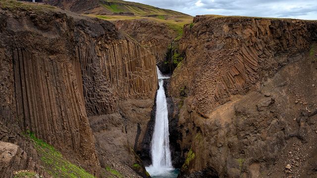
Hengifoss is a waterfall on the Hengifossá river in East Iceland, about half an hour's drive from Egilsstaðir. At 128 metres it is the third highest in the country. It drops against a cliff of stacked basalt with thin red bands of clay between the layers, and that banded rock is as much of the draw as the water. A path runs from the car park up to the falls. Litlanesfoss, a lower waterfall ringed by columnar basalt, sits further down the same river.
Hengifoss Waterfall
Local name: Hengifoss

At 128 metres it is the third highest waterfall in Iceland, and the red clay bands in the cliff beside it hold fossilised conifer trunks from a warmer age.
- Accessibility
- Not wheelchair accessible. The only approach is a steep hill path.
- Parking
- Paid car park at the trailhead, with restrooms and a café. 1,000 ISK in summer 2026.
- Difficulty
- Around 5 km with some 300 m of ascent; 40–60 minutes to the falls. Steep in places and well maintained, with the steepest section in the first 20 minutes.
- Hours
- Open 24 hours.
- Address
- Fljótsdalsvegur, 701 Egilsstaðir
What makes it special
The cliff behind the water is striped. Layers of basalt alternate with thin red bands of clay, and the falls come down 128 metres through the middle of them. The red bands hold fossilised trunks of conifers and lignite, laid down when this part of Iceland was warmer than it is now.
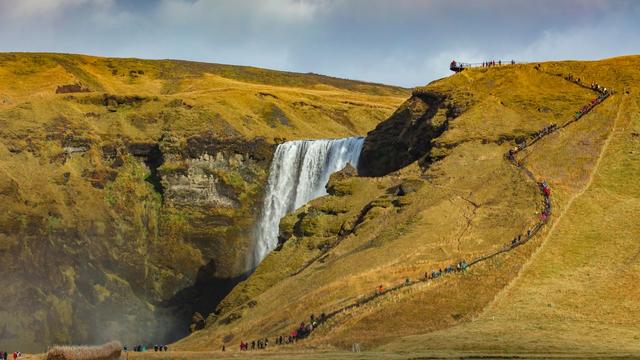
The walk in counts for as much as the arrival. The path climbs above the canyon of the Hengifossá, past gigantic basalt columns, and the left-hand branch passes Litlanesfoss, a lower waterfall ringed by columnar basalt. Hengifoss is the most walked hiking route in East Iceland.
Good to know
- Two paths up. Two trails leave the car park and join at the top. The left is steeper and shows Litlanesfoss; the right does not.
- The start is the hardest. The first 20 minutes are the steepest part of the climb. After that the path eases.
- Cloud can hide the falls. In low cloud and fog the drop and the canyon views are lost, and the climb is still the same climb.
- Facilities are at the trailhead. There are restrooms and a café at the car park.
Getting there
Hengifoss is about a 30-minute drive from Egilsstaðir, and the road ends at a car park with restrooms and a café. Two paths leave the car park and loop together at the top before running on to the falls; the left one is steeper and goes fairly straight up. The walk is around 5 km with some 300 m of ascent and takes 40–60 minutes to the waterfall. You can go up one path and come back down the other.
Best time to visit
Best: early morning, from around 8am. Avoid: late morning, when the flow of walkers heading up is steady.
Just after 8am the path is close to empty. By the time the early walkers are coming back down, a steady line is going up. Cloud matters as much as the hour: in low cloud and fog both the falls and the canyon views disappear.
Sun & daylight
Nearby Places


Similar Places


Featured in our guides
Hengifoss Waterfall on the map
The path climbs along the rim of the Hengifossá canyon and in places runs near the edge. It is wide, and there is room to walk on the far side and keep well back from the drop. Cloud and fog can close in over the canyon.
Get directions

Your whole travel map in one place
Get inspired by new places around the world and find the ones worth the journey
Frequently asked questions
How long is the hike to Hengifoss?
Around 5 km with some 300 m of ascent, and 40–60 minutes each way. The path is steep in places but well maintained, and the first 20 minutes are the hardest.How high is Hengifoss?
128 metres, which makes it the third highest waterfall in Iceland.Is there parking at the trailhead?
Yes. The road ends at a paid car park with restrooms and a café.Can you see Litlanesfoss on the way?
From the left-hand path, yes; it is not visible from the right-hand one. Litlanesfoss lies lower down the Hengifossá and is ringed by columnar basalt.Why is the rock beside the waterfall striped red?
The basalt layers are separated by thin beds of clay. They also contain lignite and fossilised trunks of conifers, from a warmer period in Iceland's past.