The Iceland Ring Road: a 7-day self-drive itinerary
10 min read
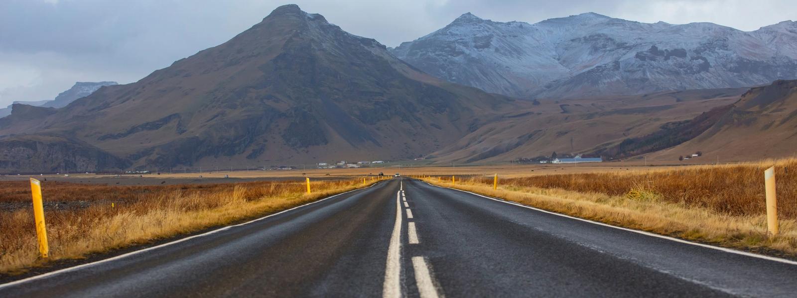
The Ring Road (Route 1) is 1,332 km of paved loop around Iceland. Seven days is enough to drive it without backtracking, but it is a full week of driving — plan on 4 to 6 hours behind the wheel most days, and treat the times below as "with stops," not GPS estimates. This itinerary runs counter-clockwise (south coast first), so you hit the busiest sights early and finish near Reykjavík with the Golden Circle.
Contents
- Day 1 — Reykjavík to Vík along the south coast
- Day 2 — Vík to the glacier lagoons and Höfn
- Day 3 — Höfn through the East Fjords to Egilsstaðir
- Day 4 — Egilsstaðir to the Diamond Circle and Húsavík
- Day 5 — Lake Mývatn and geothermal North Iceland
- Day 6 — Akureyri across the north to Borgarfjörður
- Day 7 — the Golden Circle back to Reykjavík
Day 1 — Reykjavík to Vík along the south coast
Summer (June–August) is the easy version: bright nights, dry tarmac, a 2WD copes fine. From October to April the same loop is a different trip — 4–5 hours of daylight in December, black ice, and storms that close the East and Westfjords with little warning; take a 4WD, studded tyres (legal Nov 1–Apr 15), and check road.is every morning. Highland F-roads are not part of this route and stay shut until roughly late June.
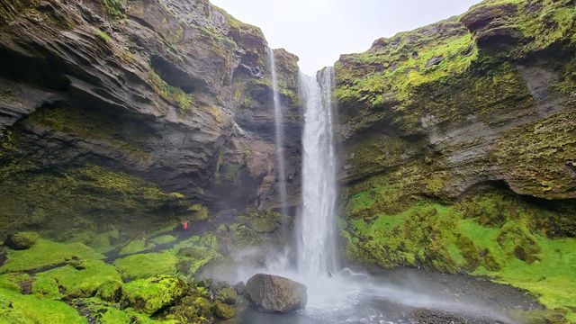
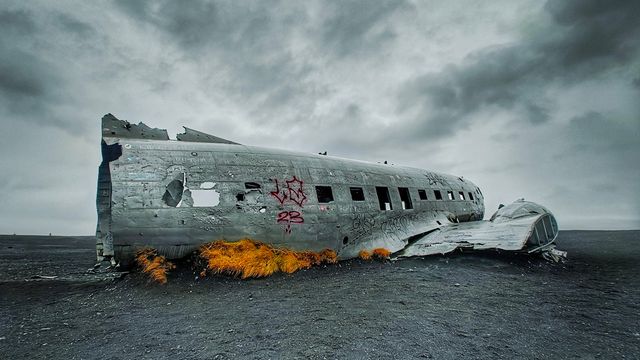
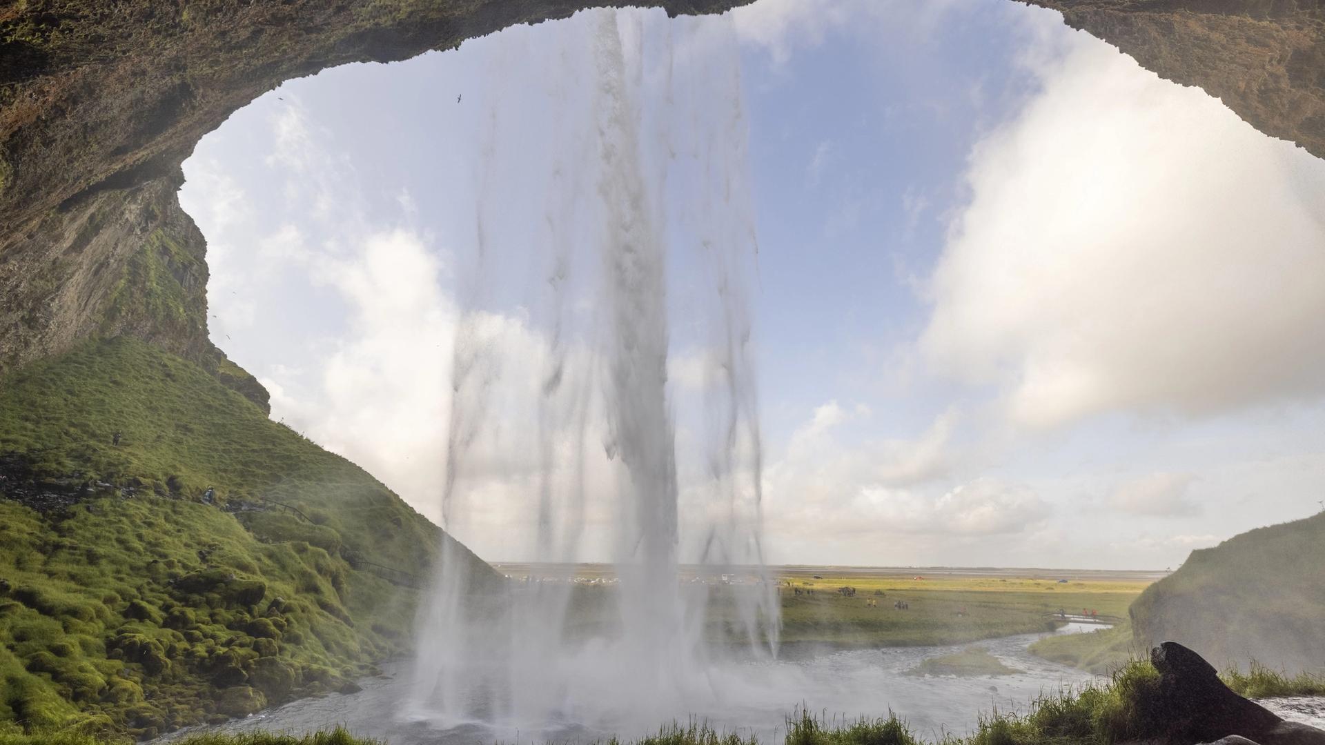
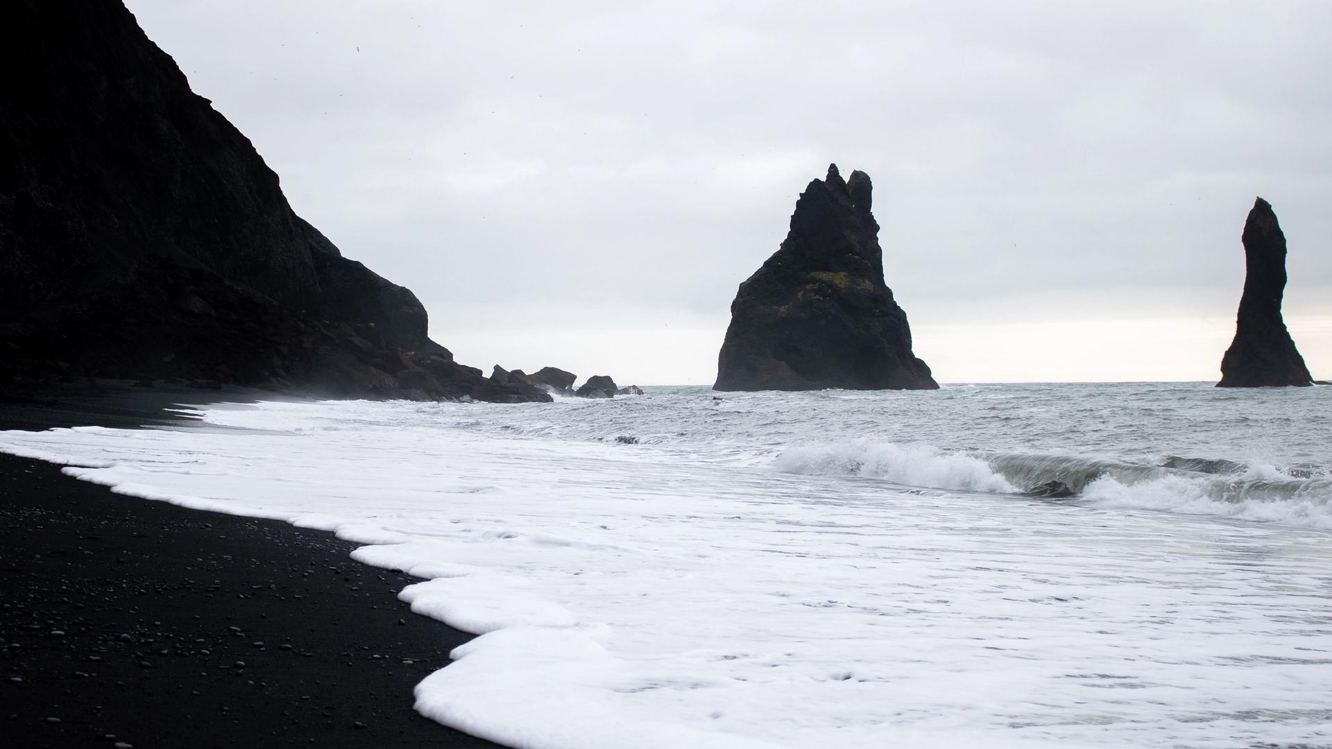
The south coast is the densest stretch of the whole loop, so leave early. First stop, about 90 minutes out, is Seljalandsfoss — the waterfall you can walk behind (bring a rain jacket, the spray soaks you). A five-minute walk north along the cliff is Gljúfrabúi, half-hidden in a mossy gorge and much quieter. Another 30 km east brings Skógafoss, a flat 60-metre curtain; climb the stairs beside it for the view, or detour to Kvernufoss, its tucked-away neighbour that most buses skip. If you like offbeat stops, the Sólheimasandur DC-3 plane wreck is a flat 4 km walk each way across black sand — allow up to 1.5–2 hours round trip. End the day at Reynisfjara, the black-sand beach below Reynisdrangar's basalt stacks — see our full rundown of Iceland's black-sand beaches if you want to compare it with the others. Sleep in Vík (roughly 190 km, 2.5–3 h of driving plus stops).
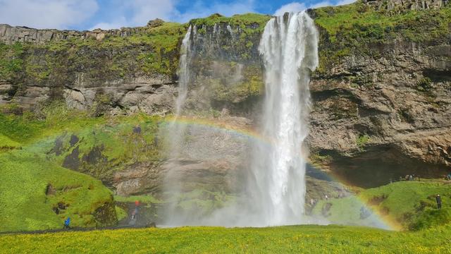



The cliff Seljalandsfoss pours over is Iceland's former coastline — the flat farmland between it and today's shore was seabed not so long ago, geologically speaking. Its water starts up on Eyjafjallajökull, the ice-capped volcano whose 2010 ash cloud grounded flights across Europe. Photographers stay for sunset, when low light hits the curtain straight on; the walk-behind path, though, closes whenever spray ice makes it treacherous — in winter, more often than not.
Reynisfjara, where the day ends, needs one serious caveat. Sneaker waves here have killed several visitors, and the beach runs a three-tier yellow/orange/red hazard system: orange means stay at least 25 metres back from the water, red closes the beach outright. However good the light on the basalt columns, never turn your back on the sea.
Day 2 — Vík to the glacier lagoons and Höfn
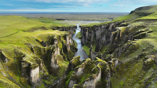
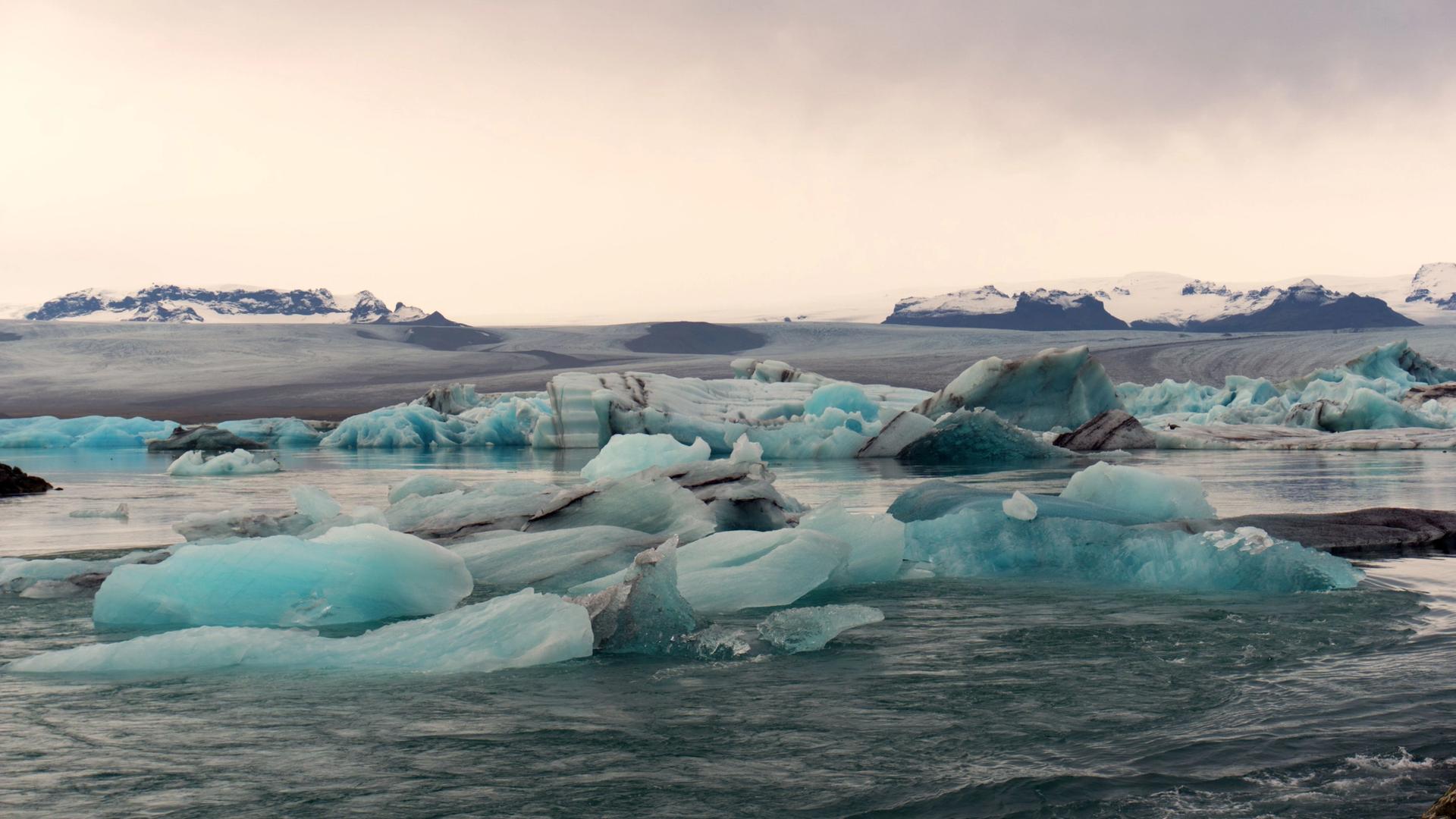
East of Vík the road crosses the vast Eldhraun lava field and the Skeiðarársandur outwash plains — long, empty, and hypnotic. Stop at Fjaðrárgljúfur, a serpentine canyon with a short rim walk (the trail closes in early spring to protect the vegetation, so check before you go) — one of several dramatic canyons in our guide to Iceland's canyons. Skaftafell, part of Vatnajökull National Park, is worth an hour or three: the 1.8 km walk up to Svartifoss, framed by black basalt columns, is the classic short hike, and Skaftafellsjökull's glacier tongue is an easy 3.7 km round trip on flat ground. The day's headline is Jökulsárlón, the glacier lagoon where icebergs drift toward the sea; cross the road to Diamond Beach, where they wash up on black sand. Fjallsárlón, a smaller, calmer lagoon a few km back west, is the quieter alternative. Sleep in or near Höfn (about 270 km from Vík, 3.5–4 h with stops). If the light is good, the Vestrahorn massif at Stokksnes is a 15-minute detour past Höfn.
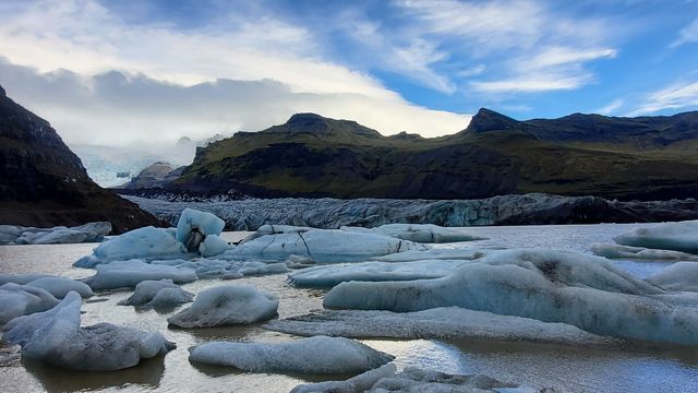

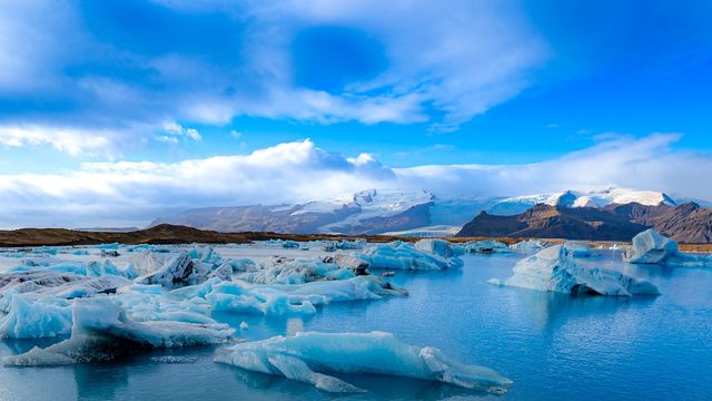
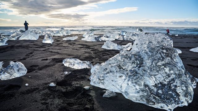


Jökulsárlón is Iceland's deepest lagoon, and the ice drifting across it comes in every shade from white through electric blue to black streaked with volcanic ash. Watch the narrow channel where the lagoon empties into the sea — seals cruise it year-round, weaving between the bergs. Diamond Beach is literally across the road, so give yourself time for both sides.
Day 3 — Höfn through the East Fjords to Egilsstaðir
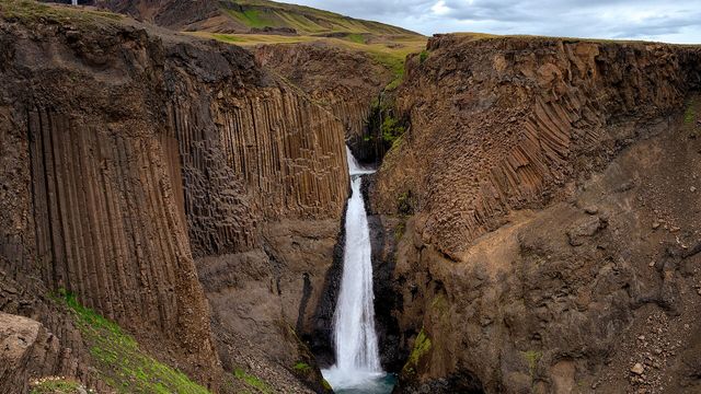
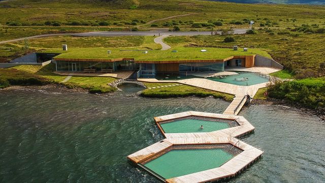
This is the slowest 265 km of the trip. GPS says three hours; reality is four to five, because Route 1 winds in and out of every fjord and the speed limit drops to 50–60 km/h for long stretches. That's fine — the East Fjords are the least-crowded part of the Ring Road, all sheer walls, fishing hamlets and reindeer. Near Egilsstaðir, detour into the Lagarfljót valley for Hengifoss, Iceland's third-tallest waterfall at 128 m, with striped red clay bands in the cliff (a 2.5 km uphill walk; you pass slender Litlanesfoss on the way). If you have energy left, Stuðlagil is a canyon of tall basalt columns over a glacier-blue river — the west (Grund) side is a short stair descent to the viewpoint, while the east (Klaustursel) side is the long hike, a roughly 5.6–9.6 km round trip to the famous down-canyon view. Sleep in Egilsstaðir; soak at the nearby Vök Baths, floating geothermal pools on Lake Urriðavatn, to reset.


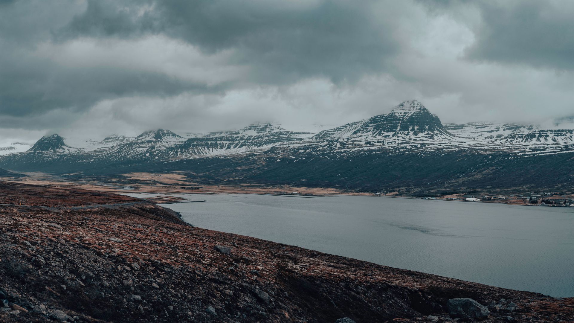
On this stretch the road itself is the sight, and it asks for discipline: single-lane bridges keep coming — the "Einbreið brú" sign means slow down, and the car that reaches the bridge first has priority — and photo stops belong only in marked pull-outs, because stopping on the roadway is illegal in Iceland and genuinely dangerous on blind fjord bends. Watch for reindeer too: the East is the only region where they live wild, descended from herds brought over from Norway in the late 18th century, and in winter they graze right beside the asphalt.
Things to do in Iceland
Paid links: booking through them supports YowJourney.
Day 4 — Egilsstaðir to the Diamond Circle and Húsavík
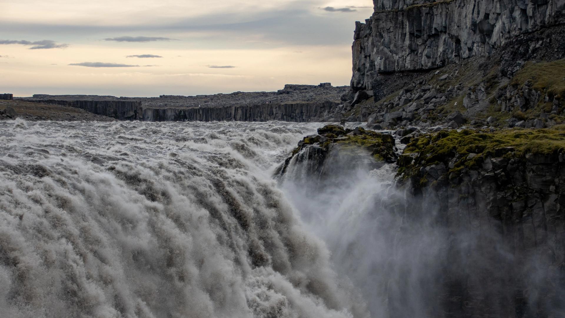
From Egilsstaðir it's about 140 km to the Diamond Circle, the north's answer to the Golden Circle. First stop, off Route 1 down road 862, is Dettifoss — Europe's most powerful waterfall by volume, 100 m wide and thunderous; the paved west bank is the easy access. A short walk downriver is Selfoss, wider and gentler. Then Ásbyrgi, a horseshoe canyon the sagas credit to Odin's horse, with easy forest trails. Loop back to the coast for Húsavík, Iceland's whale-watching capital — boats run mostly April to October, and sightings of humpbacks in Skjálfandi bay are near-routine in summer. On the way toward Akureyri, don't skip Goðafoss, the wide "waterfall of the gods" right beside Route 1. Sleep in Húsavík or push on toward Mývatn (the full day is roughly 250–300 km, 5–6 h of driving with stops).


You feel Dettifoss before you see it: near the viewpoints the ground carries a faint vibration, and the spray column rises out of the canyon like smoke. The gorge below was carved by catastrophic glacial floods, and the grey, sediment-heavy water is Vatnajökull melting in real time. If the scene looks familiar, Ridley Scott shot the opening of Prometheus here.
Day 5 — Lake Mývatn and geothermal North Iceland
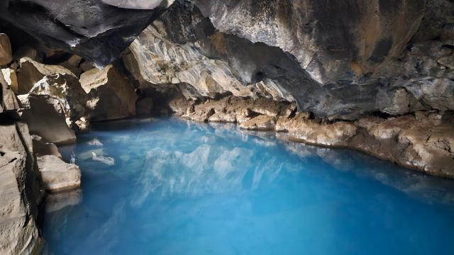
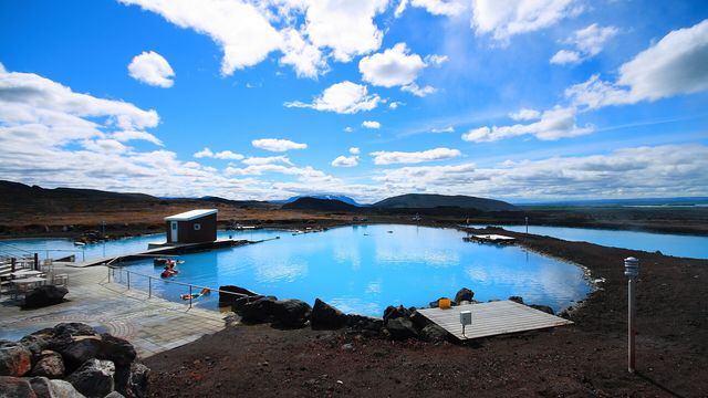
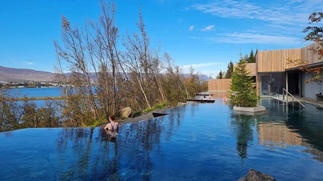
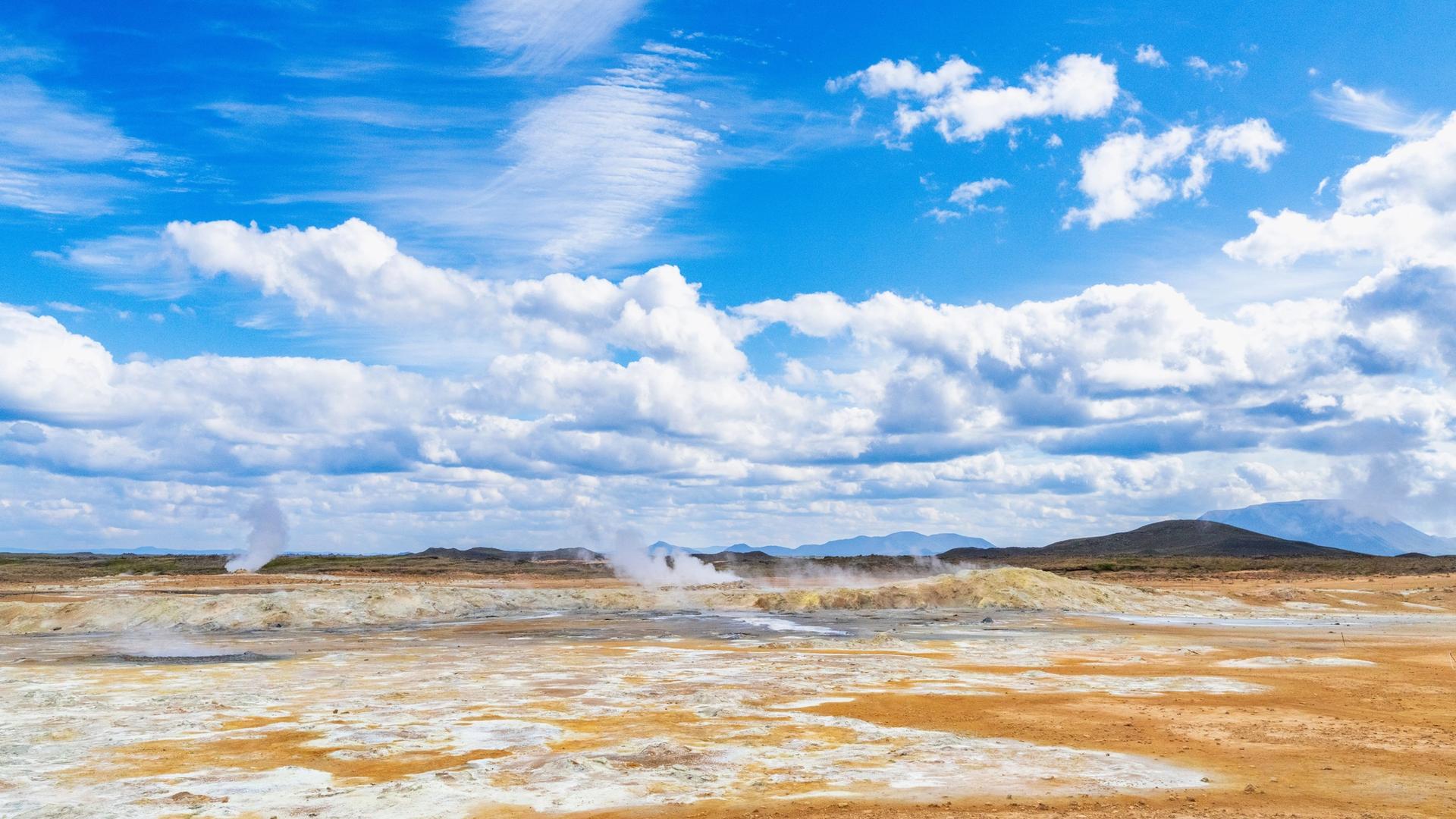
Mývatn is where Iceland shows off its volcanic plumbing, and it rewards a slow day. Circle the lake: Skútustaðagígar are grassy pseudo-craters with a flat loop path; Hverfjall is a near-perfect black tephra ring you can climb in 20–30 minutes for a crater-rim view; and Grjótagjá is a small lava cave with a hot spring inside (look, don't bathe — it's too hot and on private land). Just east over the pass, Hverir is a Martian field of hissing mud pots and yellow sulphur — the smell is part of the experience. Serious hikers can add Leirhnjúkur, the still-steaming lava from the 1975–84 Krafla eruptions. Then unwind at the Mývatn Nature Baths, the north's quieter, cheaper answer to the Blue Lagoon — it's also on our guide to Iceland's hot springs and geothermal pools if you want to work a soak into the rest of the loop too. Sleep at Mývatn, or drive the ~100 km on to Akureyri; if you overnight there, the Forest Lagoon on the fjord's edge is a lovely evening soak.



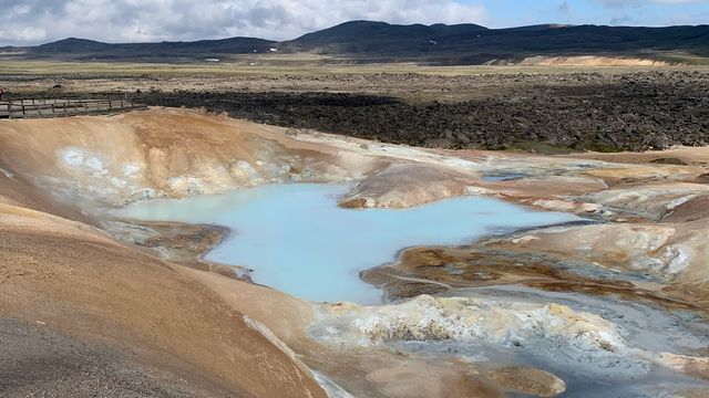
Hverir is the loudest of these stops — it's often called the Devil's Kitchen. Steam from the deep vents comes out at up to 200°C, minerals dye the ground orange, red and grey, and the acidity kills anything that tries to grow. Stay on the marked paths: the crust between the mud pots is thin, and what sits underneath is boiling.
Day 6 — Akureyri across the north to Borgarfjörður
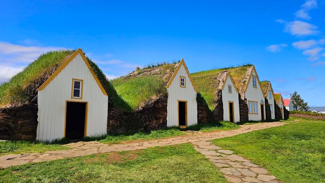
This is the longest single driving day — roughly 440 km west toward the Borgarnes area — so pick two or three stops and keep moving. Off Route 1 in the northwest, Hvítserkur is a 15 m basalt sea stack that looks like a drinking dragon (or a rhino), best at low tide. Glaumbær, a preserved turf farm near Varmahlíð, is one of Iceland's best-kept living-history sites if you want to understand how people survived here. Further south, Grábrók is a 170 m volcanic crater with a stepped path to the rim in about 20 minutes, right by the road. If you have daylight, the twin falls Hraunfossar seep out of a lava field over a wide stretch — a quick and unusual stop. Sleep around Borgarnes or Reykholt; you're now roughly 90 minutes from Reykjavík, which sets up an easy final day.
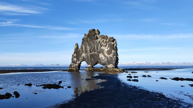


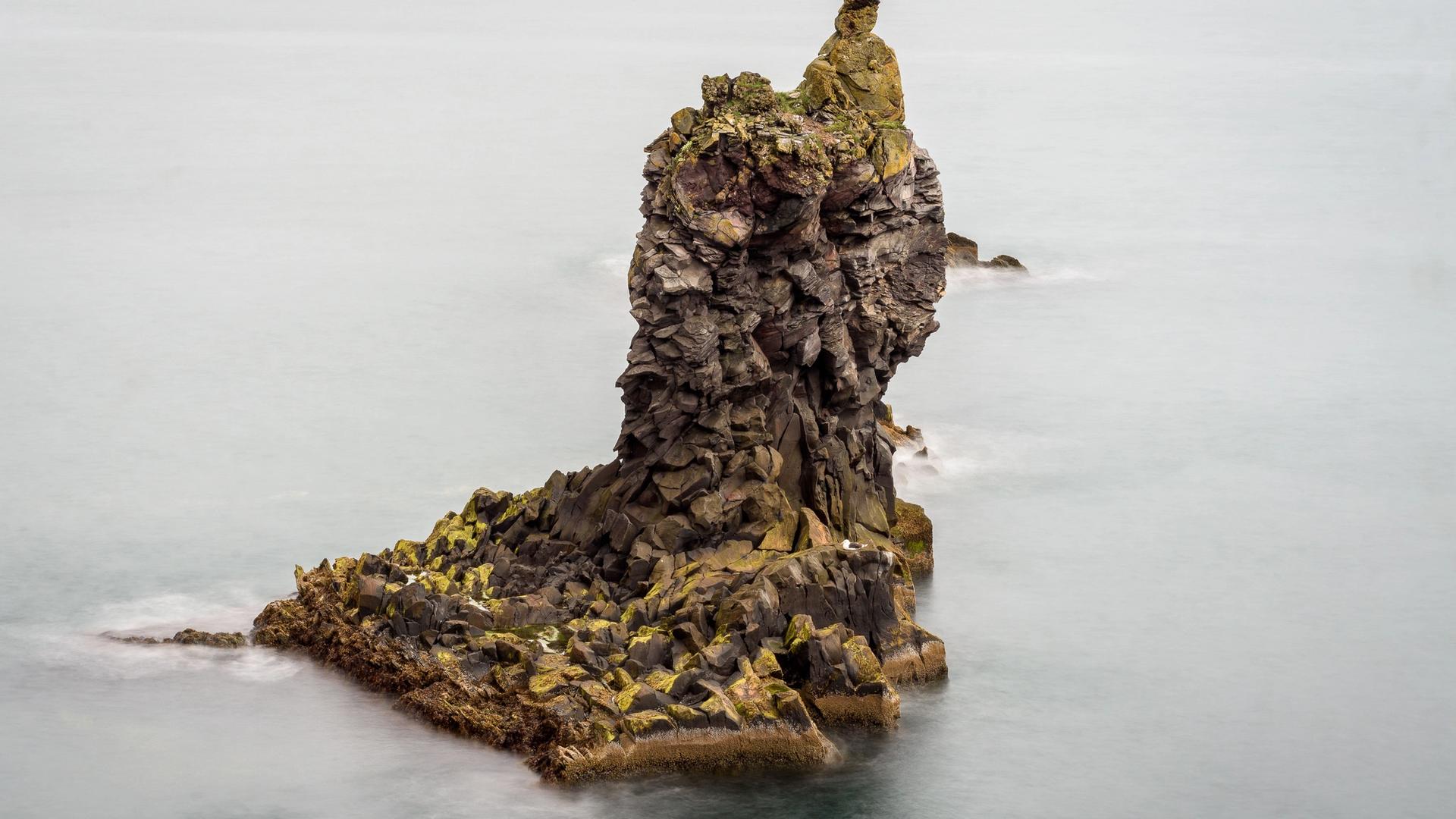
Hvítserkur repays the gravel detour along road 711 up the Vatnsnes peninsula. The name means "white shirt" — the streaks are guano from the seabirds nesting on the stack — though folklore prefers a troll caught out by the sunrise; more prosaically, the base has been reinforced with concrete so the tide doesn't finish the job. Come at low tide and you can walk across the dark sand right up to it.
Day 7 — the Golden Circle back to Reykjavík
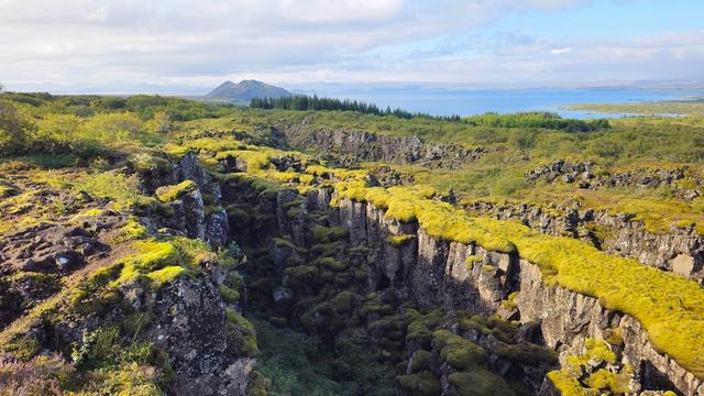
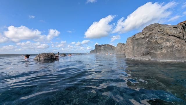
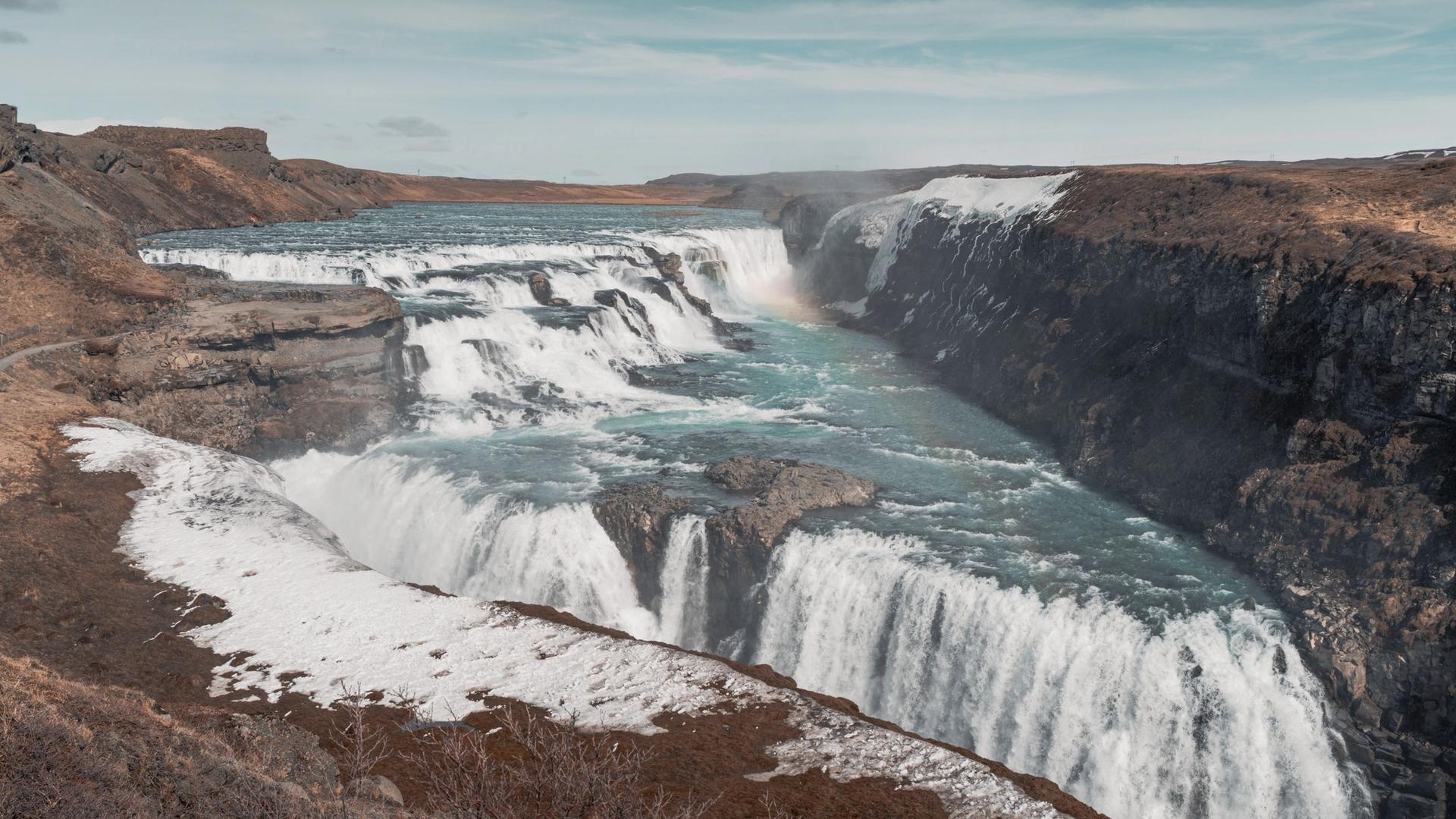
Close the loop with the Golden Circle, a ~230 km detour you can do in 6–8 hours with stops. Þingvellir National Park sits in the rift where the North American and Eurasian plates pull apart — walk the Almannagjá gorge between two continents; it's also where Iceland's parliament met from 930 AD. Next, Geysir, the geothermal field that gave the world the word: neighbouring Strokkur erupts every 5–10 minutes, reliably. Then Gullfoss, a two-tier waterfall dropping into a canyon. Add Kerið, a crater around 3,000–6,500 years old (geologists disagree), with a vivid blue-green lake, on the way back. From here it's under an hour to Reykjavík; if you have time before the flight, the Sky Lagoon on the edge of the city has an infinity edge over the Atlantic — a fitting last soak.

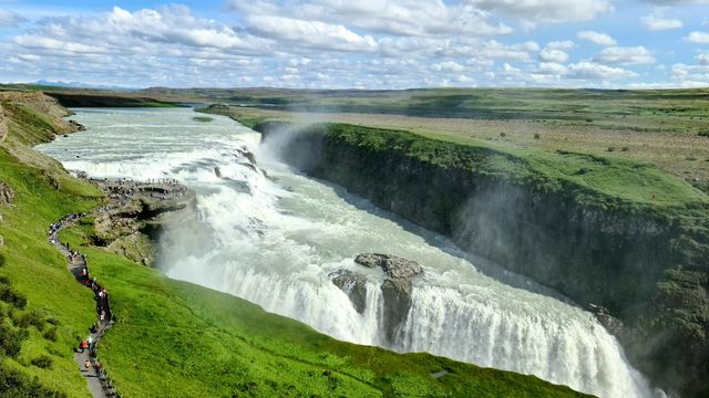

Gullfoss earns its billing as the circle's centrepiece: the Hvítá river drops in two angled tiers — 11 m, then 21 m — into a gorge so narrow the lower fall seems to vanish into the earth, and on a bright day the spray keeps a rainbow parked over the rim. That it still flows undammed owes much to Sigríður Tómasdóttir, the farmer's daughter who fought early-20th-century plans for a hydroelectric plant here; her memorial stands above the falls.
That's the loop closed. Add the detours to Route 1's 1,332 km and the week comes out at roughly 1,500 km — and the counter-clockwise order saves the easiest leg for last: from Kerið it's under an hour to Reykjavík and about 45 minutes more to Keflavík airport, so returning the car is no race against the clock.
Seven days covers the loop but leaves little slack — one storm day or one long photo stop and you're driving in the dark. If you can add days, spend them in the north (Mývatn deserves two nights) or add the Snæfellsnes peninsula between the northwest and Reykjavík. Book accommodation ahead in summer; Vík, Höfn, Egilsstaðir and Akureyri fill up. And whatever the forecast promises, check road.is and safetravel.is before each leg — Iceland's weather decides the itinerary more than any plan does.