Reynisfjara is a black sand beach in South Iceland, near the town of Vík í Mýrdal and inside the Katla UNESCO Global Geopark. Columnar basalt cliffs and Hálsanefshellir Cave mark the eastern end, the Reynisdrangar sea stacks stand offshore, and the Dyrhólaey promontory closes the beach to the west. The land is privately owned. Visitors come year-round for the geology, and the sea here is genuinely dangerous: sneaker waves have caused six deaths since 2007, and a warning-light system now signals conditions on the shore.
Reynisfjara Black Sand Beach
Local name: Reynisfjara

Between 2007 and 2024 sneaker waves here caused at least twelve serious emergency rescues and five deaths; a sixth death followed in August 2025.
- Entrance
- Free. A nominal entrance fee has been proposed to fund safety measures, but none is charged.
- Parking
- Charged. Two car parks lie about 1.2 km and 1.3 km from the mapped point of the beach; the second, Reynisfjara Parking, has a gravel surface. No price is given in the sources.
- Transport
- No bus to the beach. Nearest stop: Vík í Mýrdal, about 3.8 km away.
- Address
- Reynisfjara Beach, 871 Vík
What makes it special
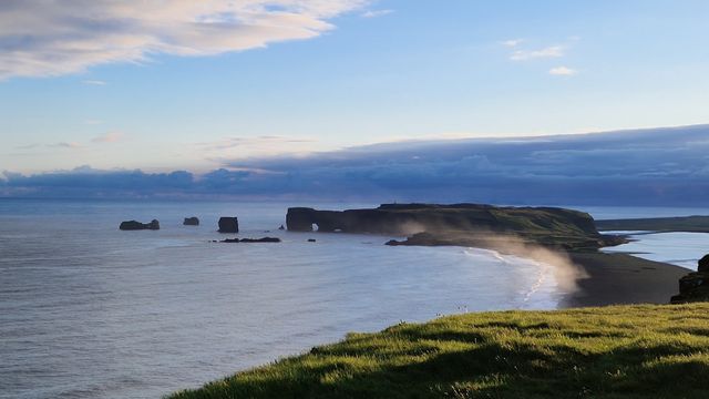
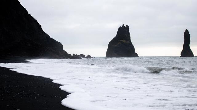
The beach is bookended by rock. At the eastern end stands Hálsanefshellir Cave, framed by columnar basalt so regular it looks cut rather than cooled. Offshore rise the Reynisdrangar sea stacks. To the west the Dyrhólaey promontory closes the view, and Eyjafjallajökull is visible inland. Reynisfjara lies inside the Katla UNESCO Global Geopark, on privately owned land.
The ground itself is not fixed. Storms in February 2026 brought down part of the basalt columns and stripped much of the beach; by July the shore read as black pebbles more than as sand. Waves run in and vanish under the stones. The rocks are tumbled smooth and skip well.
Good to know
- Crowds thin westwards: the further you walk towards Dyrhólaey, the fewer people you meet.
- No facilities: no toilets, drinking water or information point is mapped within 5 km of the beach.
- Check the tide chart: at low tide the sea pulls back far enough to reach Hálsanefshellir Cave and the basalt columns.
- Warning lights: yellow means moderate hazard. Under a red warning the cave and the basalt columns are closed.
- Weather turns fast: in rain and fog, Dyrhólaey at the far end of the beach is not visible.
Getting there
No bus serves the beach. Almost everyone arrives by car, or on a south coast tour. The drive ends at one of two car parks near the beach; the signed one, Reynisfjara Parking, has a gravel surface. From there you finish on foot, across black sand and loose pebbles. In July the car park fills up.
Best time to visit
Best: low tide, when the water is far enough out that Hálsanefshellir Cave and the basalt columns can be approached.
Avoid: July, and any day the beach is under a red warning.
Conditions change quickly here. In rain and fog the black shore still works, but visibility drops and Dyrhólaey at the far end of the beach disappears. In July the car park is full and the beach is busy.
Access & restrictions
Reynisfjara is privately owned land inside the Katla UNESCO Global Geopark. The beach carries a warning system installed after fatal accidents: warning lights, safety zones that shift with conditions, and multilingual signs with pictograms. A real-time wave forecast feeds the lights. Following a death in August 2025, Hálsanefshellir Cave and the basalt columns are closed during red warnings at the beach.
Sun & daylight
Nearby Places



Similar Places


Featured in our guides
Reynisfjara Black Sand Beach on the map
The hazard here is sneaker waves. Swell trains converge over a submerged offshore ledge and send water far inland with no warning. Six people have died since 2007 and at least twelve have needed emergency rescue. Three of the deaths happened at Hálsanefshellir Cave. Never turn your back on the sea, stay well up the beach, and treat the warning lights as instructions rather than advice. Help is not close: after the August 2025 accident the Coast Guard reached the scene 30 to 40 minutes later.
Get directions

Your whole travel map in one place
Get inspired by new places around the world and find the ones worth the journey
Frequently asked questions
Is Reynisfjara dangerous?
Yes. Sneaker waves surge far up the beach without warning and have killed six people since 2007. The beach has warning lights and marked safety zones; under a red warning Hálsanefshellir Cave and the basalt columns are closed.Can you get there by public transport?
No bus serves the beach. The nearest stop is in Vík í Mýrdal, about 3.8 km away. Visitors come by car or on a south coast tour.Is there an entrance fee?
No. Entry is free, though the car parks are charged. A nominal entrance fee to fund safety infrastructure has been proposed, along with a daily cap on visitor numbers.Why is the beach pebbly rather than sandy?
Weeks of strong waves and easterly winds in February 2026 eroded the beach and brought down part of the basalt columns. Westerly winds were expected to restore the familiar look from March.What can you see from the beach?
The Reynisdrangar sea stacks offshore, columnar basalt cliffs and Hálsanefshellir Cave to the east, the Dyrhólaey promontory to the west, and Eyjafjallajökull inland.