Thingvellir is a national park in South Iceland, about 40 km northeast of Reykjavík. The Althing, Iceland's parliament, assembled here every summer from 930 until 1798, and the site became the country's first national park in 1930. The valley lies on the crest of the Mid-Atlantic Ridge, where the North American and Eurasian plates pull apart, and the faults are visible on the ground. It was designated a UNESCO World Heritage Site in 2004 and is one of the three main stops on the Golden Circle.
Thingvellir
Local name: Þingvellir
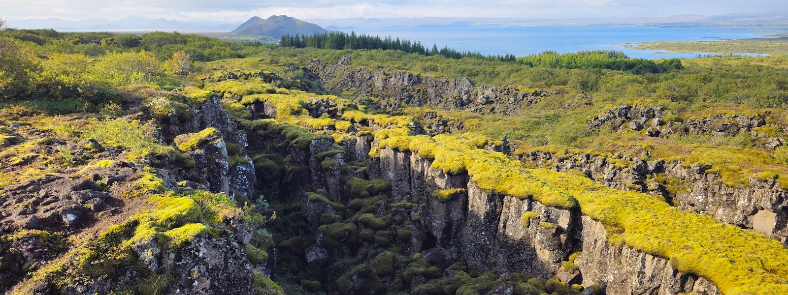
Iceland's parliament, the Althing, met in the open air here every summer from 930 until 1798.
- Entrance
- Free to enter; parking is paid
- Accessibility
- Wheelchair-accessible car park, entrance, toilets and seating.
- Parking
- Paid car parks; roadside parking is charged too. Cards and contactless are accepted. The car parks are spread along the park, not gathered at one entrance.
- Difficulty
- Walking, not climbing: the sites are reached on foot from the car parks. Longer marked routes lead out of the park, among them the Execution Trail and Leggjabrjótur.
- Transport
- Self-drive (Route 36) or day-bus from Reykjavík
- Advance booking
- Diving and snorkelling in the Silfra fissure are arranged in advance through tour operators.
- Hours
- Open 24 hours, every day of the week.
- Address
- Þingvellir National Park, 806 Selfoss
What makes it special
The rift and the parliament site are the same ground here. Faults cross the valley floor, and the largest of them, Almannagjá, is a canyon. The Law Rock (Lögberg) was the focal point of the assembly and a natural platform for speeches. Before the law was written down, the Lawspeaker recited it there from memory. The assembly ran for two weeks each summer, and people camped in booths with turf and rock walls; apart from a farm and, later, two churches, nothing here was permanent. The river Öxará crosses the park and falls over the canyon wall as Öxarárfoss. One water-filled fissure was bridged in 1907 for the visit of King Frederik VIII of Denmark. Visitors began throwing coins from the bridge, and it is now known as Peningagjá, the coin fissure. On the lake shore, Silfra is a well-known diving and snorkelling site.
Good to know
- Allow a couple of hours. The historic sites, the rift path and the waterfall sit at different points and are linked on foot.
- One car park is not the park. Cars can move between car parks along the road; a single coach stop covers one viewpoint.
- Bring a windproof layer. The valley floor is open ground and it gets cold.
- There is a visitor centre, with an interpretation of the park's history and nature, and toilets on site.
- Dogs are allowed and the park suits children.
Getting there
Thingvellir lies about 40 km northeast of Reykjavík, and people arrive by car. The car parks are spread along the park rather than gathered at one entrance, so the one you pick decides what is close by. From the car park it is a walk to the monument, not a drive-up view. Stopping at more than one car park is what covers the historic sites, the path between the plates and the waterfall.
Best time to visit
Better: with your own car and a couple of hours to spend, moving between car parks.
Avoid: a single coach stop, which takes in one viewpoint and moves on.
Thingvellir is one of the busiest sights in Iceland and a fixed stop on the Golden Circle. What separates seeing it from passing through it is time, not luck.
Sun & daylight
Nearby Places


Similar Places

Featured in our guides
Thingvellir on the map
Cliff edges along Almannagjá and the water-filled fissures are unfenced in places, and the paved paths and boardwalks turn icy in winter — keep back from the edges, mind children, and wear grips from about November to March.
Get directions

Your whole travel map in one place
Get inspired by new places around the world and find the ones worth the journey
Frequently asked questions
Is Thingvellir part of the Golden Circle?
Yes. It is one of the three main stops, together with the waterfall Gullfoss and the geysers of Haukadalur.Can you see the boundary between the tectonic plates?
The park lies in a rift valley on the crest of the Mid-Atlantic Ridge, at the boundary between the North American and Eurasian plates. The drift shows in the faults that cross the area, the largest being the canyon Almannagjá, and it causes measurable earthquakes here.Can you dive or snorkel at Silfra?
Yes. The Silfra fissure is on the northern shore of Þingvallavatn, and the drift between the plates opened it wide enough for divers. The water is exceptionally clear.How far is Thingvellir from Reykjavík?
About 40 km (25 miles) to the northeast. The park sits on the northern shore of Þingvallavatn, the largest natural lake in Iceland.Why are there coins in one of the fissures?
The fissure was bridged in 1907 for the visit of King Frederik VIII of Denmark. Visitors began throwing coins from the bridge, the bottom filled with them, and the rift became known as Peningagjá, the coin fissure.