Kerlingarfjöll is a volcanic massif in the Icelandic highlands, in the south of the country, near the Kjölur road. It rises to 1,477 metres and is about 20–30 km across. Red rhyolite, tholeiite basalt and numerous hot springs mark its volcanic origin, and minerals from the springs colour the ground yellow, red and green. A summer ski resort ran here until 2000; since then the site has operated as a highland resort with accommodation and food. In 2017, 367 km² around the mountains were placed under state protection. Visitors come for the hiking and the geothermal valleys.
Kerlingarfjöll
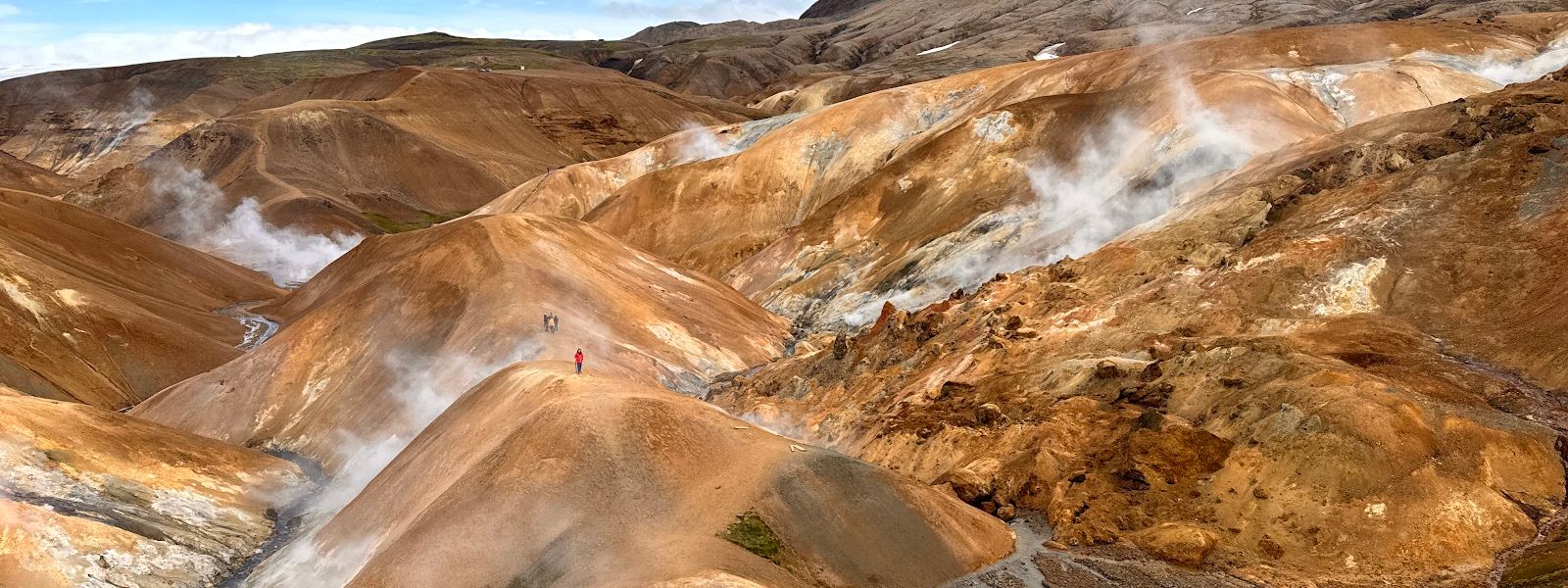
The hot springs here run at 140 °C — hot enough that a geothermal power plant on the site has been considered.
- Entrance
- Free to hike
- Accessibility
- Limited — steep, uneven mountain trails, no step-free access
- Parking
- Car parks at the Highland Base and the Hveradalir trailhead
- Difficulty
- Half-day and one-day trails, plus multi-day routes. Ground is muddy and slippery in places, with stairs on some sections and no steps on others. A loop from the base camp runs to about 8.5 miles (14 km) with a hard climb.
- Transport
- 4x4 only — F35 (Kjölur) then the mountain spur; summer bus in season
What makes it special
The colour comes out of the rock. Rhyolite turns the slopes red and orange, and minerals carried up by the hot springs stain the ground yellow, red and green. The centre of it is Hveradalir, a geothermal valley of boiling mud pots and sulphur vents that steam next to patches of snow. The air smells of sulphur. The ground hisses and rumbles underfoot.
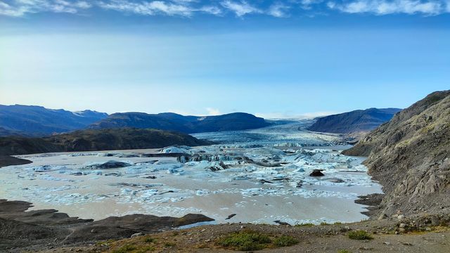
Above the valley the massif rises to 1,477 metres, and the higher paths look out over glaciers. Some loops cross a snowcap before dropping into the coloured valley. The rock is between 68,000 and 350,000 years old — older than much of the Hofsjökull volcanic system it belongs to. Wind, cold rain and a swing from warm air to cold are all part of a day here.
Good to know
- Vehicle: a 4x4 is required. The highland F-roads are rough and can include river crossings.
- Footwear: the trails get very muddy, and some sections are slippery with no steps at all. Wear hiking boots.
- Weather: it shifts fast — fierce wind, cold rain, warm air turning cold. Carry a waterproof jacket and waterproof trousers.
- Season: the area is snow-free and the trails are open from late June to early September.
- Base: the highland resort in the area has accommodation, meals and natural hot spring baths.
Getting there
Kerlingarfjöll sits off the Kjölur highland road, in the interior of Iceland. A 4x4 is required to reach it: the F-roads are rough and can include river crossings. Once in the area you can drive further up, which is the easier way in to the geothermal valley. The alternative is to walk from the base camp — one loop from there runs to roughly 8.5 miles (14 km), with a hard climb and a lot of stairs to go up and back down.
Best time to visit
Better: late June to early September, when the area is snow-free and the trails are open.
Avoid: the rest of the year, when snow lies over the trails.
The usable season is short, and the weather inside it still turns quickly: wind and cold rain arrive with little warning, and the temperature can drop within minutes. Plan the walk around the forecast rather than the date.
Sun & daylight
Nearby Places



Similar Places

Kerlingarfjöll on the map
The trails get very muddy, and some sections are slippery with no steps at all. The mud pots and vents in the geothermal valleys are boiling: keep to the marked trails and off the crusted ground. Weather changes within minutes, from warm air to fierce wind and cold rain. On the way in, the F-roads can include river crossings, which need a 4x4 and judgement about the water level.
Get directions

Your whole travel map in one place
Get inspired by new places around the world and find the ones worth the journey
Frequently asked questions
Do you need a 4x4 to get to Kerlingarfjöll?
Yes. The highland F-roads leading in are rough and can include river crossings.When is the area snow-free?
From late June to early September. That is the window when the trails are open.How long are the hikes?
There are half-day and one-day trails, and multi-day routes as well. Short walks are possible; one loop from the base camp runs to about 8.5 miles (14 km) with a heavy climb.Is there anywhere to stay or eat?
Yes. A highland resort has operated here since 2000, with accommodation, food and natural hot spring baths.What is Hveradalir?
The geothermal zone in the massif: boiling mud pots and sulphur vents steaming beside snow patches, with the ground stained red, yellow and green.