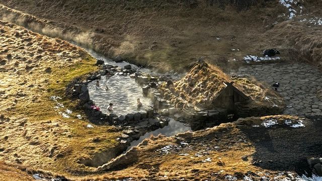
Hveravellir is a geothermal field in the Icelandic interior, on the Kjölur mountain route between the glaciers Langjökull and Hofsjökull. It lies at 600 m above sea level, at the northern edge of the Kjalhraun lava shield, and belongs to the Oddnýjarhnjúkur-Langjökull volcanic system. The site is a small nature reserve and a declared natural monument. A pool fed by dammed hot water is open for bathing. Travellers have broken their journeys here since the settlement age, and refuge huts have stood on the spot from the start.
Hveravellir Hot Springs
Local name: Hveravellir
At Breiðimelur, north of the main thermal area, people baked black rye bread straight in the hot ground beside the steam vents.
- Entrance
- Free — the outdoor pool has no ticket.
- Parking
- Two car parks, roughly 540 m and 830 m from the springs.
- Difficulty
- Walk of 15–30 minutes each way between the car park and the pool.
- Transport
- No public transport; access is by car.
- Address
- Kerlingarfjöll, 846 Flúðir
What makes it special
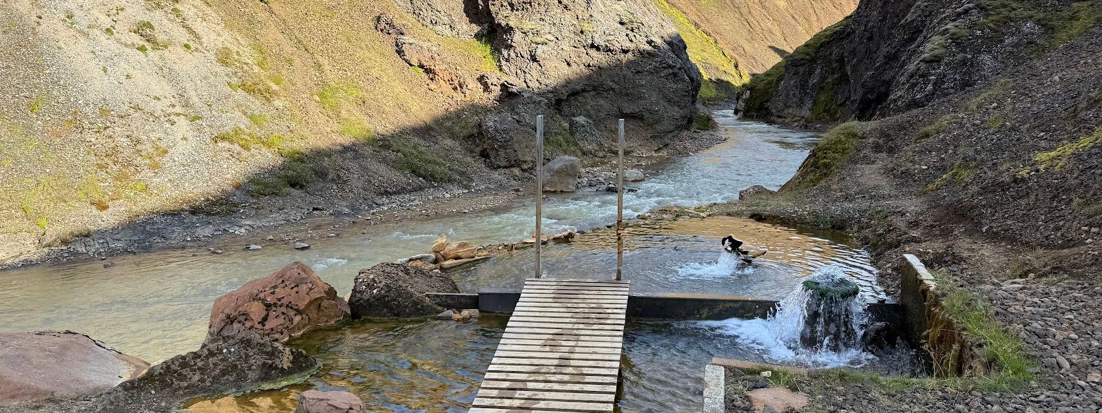
The pool is what most people come for, but the ground around it does more. Hot water was dammed in 1950 to fill the bathing pool, and it still fills the same way.
The main thermal area covers about 2.5 km² and runs through the full range of geothermal forms: geysers, fumaroles, solfataras, boiling pits and springs that are only warm. The geysers still going erupt small and at irregular intervals, so do not plan a visit around watching one go off. Sinter and geyserite have built low, wide domes over the vents, live and extinct alike. The thermal ground carries on for several kilometres to the north, where more hot springs break out.
Good to know
- No changing rooms. There are none at the pool. Put a swimsuit on under your clothes before you set out.
- No toilets and no drinking water at the springs. Bring what you need with you.
- A cold stream runs beside the pool. You can cool off in it after a long soak.
- The pool sits at 600 m in the highlands. Pack warm layers for the walk back.
Getting there
No bus reaches Hveravellir, so visitors arrive by car. Two car parks serve the site, and the pool is reached on foot from either. The walk takes 15 to 30 minutes. Yellow signs mark the route to the pool. An information point stands within a few hundred metres of the springs.
Sun & daylight
Nearby Places


Similar Places

Hveravellir Hot Springs on the map
Boiling pits and active geysers lie inside the geothermal field, and the water in them is scalding. Keep to the marked route. The pool water is sulphurous, and a long soak can leave you light-headed on the walk back — break off every 15 minutes.
Get directions

Your whole travel map in one place
Get inspired by new places around the world and find the ones worth the journey
Frequently asked questions
What geothermal features are there at Hveravellir?
Geysers, fumaroles, solfataras, boiling pits and warm springs of lower temperature, across roughly 2.5 km². The active geysers produce only small, irregular eruptions. Sinter and geyserite form low, wide domes around active and extinct centres.When was the bathing pool made?
In 1950, by damming the hot water stream. The pool it created is still the place people bathe.How long have people been stopping here?
Hveravellir has been a resting place on highland journeys since the settlement age, 1100 to 1200 years ago, and it turns up often in the old sagas, annals and folklore. The oldest written description dates from 1752, by the Icelandic travellers Eggert Ólafsson and Bjarni Pálsson.Is the site protected?
Yes. Hveravellir is a small nature reserve and a declared natural monument.